Sakarçäge: Difference between revisions
Appearance
Content deleted Content added
Dr. Blofeld (talk | contribs) ←Created page with '{{Infobox Settlement <!--See the Table at Infobox Settlement for all fields and descriptions of usage--> <!-- Basic info ----------------> |official_name …' |
No edit summary |
||
| (11 intermediate revisions by 8 users not shown) | |||
| Line 1: | Line 1: | ||
{{Infobox |
{{Infobox settlement |
||
<!--See the Table at Infobox Settlement for all fields and descriptions of usage--> |
<!--See the Table at Infobox Settlement for all fields and descriptions of usage--> |
||
<!-- Basic info ----------------> |
<!-- Basic info ----------------> |
||
|official_name = Sakarçäge |
|official_name = Sakarçäge |
||
|other_name = |
|other_name = Çetili |
||
|native_name = <!-- for cities whose native name is not in English --> |
|native_name = <!-- for cities whose native name is not in English --> |
||
|nickname = |
|nickname = |
||
|settlement_type = |
|settlement_type = City |
||
|motto = |
|motto = |
||
<!-- images and maps -----------> |
<!-- images and maps -----------> |
||
| Line 31: | Line 31: | ||
|dot_map_caption = |
|dot_map_caption = |
||
|dot_x = |dot_y = |
|dot_x = |dot_y = |
||
|pushpin_map = <!-- the name of a location map as per http://en.wikipedia.org/wiki/Template:Location_map --> |
|pushpin_map = Turkmenistan<!-- the name of a location map as per http://en.wikipedia.org/wiki/Template:Location_map --> |
||
|pushpin_label_position =bottom |
|pushpin_label_position =bottom |
||
|pushpin_mapsize = 300 |
|pushpin_mapsize = 300 |
||
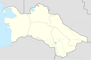
|pushpin_map_caption =Location in Turkmenistan |
|pushpin_map_caption =Location in Turkmenistan |
||
|coordinates = {{coord|37|39|46.44|N|61|39|15.12|E|source:rowiki_region:TM_type:city|display=it}} |
|||
<!-- Location ------------------> |
|||
|subdivision_type = Country |
|subdivision_type = Country |
||
|subdivision_name = {{flag|Turkmenistan}} |
|subdivision_name = {{flag|Turkmenistan}} |
||
|subdivision_type1 = [[Provinces of Turkmenistan| |
|subdivision_type1 = [[Provinces of Turkmenistan|Region]] |
||
|subdivision_name1 = [[Mary |
|subdivision_name1 = [[Mary Region]] |
||
|subdivision_type2 = [[Districts of Turkmenistan|District]] |
|subdivision_type2 = [[Districts of Turkmenistan|District]] |
||
|subdivision_name2 = [[Sakarçäge District]] |
|subdivision_name2 = [[Sakarçäge District]] |
||
| Line 67: | Line 67: | ||
<!-- Area ---------------------> |
<!-- Area ---------------------> |
||
|area_magnitude = |
|area_magnitude = |
||
|unit_pref = |
|unit_pref =metric |
||
|area_footnotes = |
|area_footnotes = |
||
|area_total_km2 = <!-- ALL fields dealing with a measurements are subject to automatic unit conversion--> |
|area_total_km2 = <!-- ALL fields dealing with a measurements are subject to automatic unit conversion--> |
||
| Line 103: | Line 103: | ||
|population_density_blank1_sq_mi = |
|population_density_blank1_sq_mi = |
||
<!-- General information ---------------> |
<!-- General information ---------------> |
||
|timezone = |
|timezone = |
||
|utc_offset = +5 |
|utc_offset = +5 |
||
|timezone_DST = |
|timezone_DST = |
||
|utc_offset_DST = |
|utc_offset_DST = |
||
|latd= |latm=|lats= |latNS=N |
|||
|longd=|longm=|longs=|longEW=E |
|||
|elevation_footnotes = <!--for references: use <ref> </ref> tags--> |
|elevation_footnotes = <!--for references: use <ref> </ref> tags--> |
||
|elevation_m = |
|elevation_m = |
||
| Line 123: | Line 121: | ||
|footnotes = |
|footnotes = |
||
}} |
}} |
||
''' |
'''Sakarçäge''' is a [[city]] and capital of [[Sakarçäge District]], [[Mary Region]], [[Turkmenistan]].<ref name=osm>{{cite web|url=https://wiki.openstreetmap.org/wiki/Districts_in_Turkmenistan |title=OpenStreetMap / Districts of Turkmenistan | access-date=29 April 2021}}</ref> |
||
==Etymology== |
|||
Atanyyazow states that the name is related to the Sakar people, a minor Turkmen tribe. The word ''çäge'' means sand. The settlement was previously called Çetili (Chetili).<ref name=atanyyazov>{{cite book|title= Түркменистаның Географик Атларының Дүшүндиришли Сөзлүги|trans-title= Explanatory Dictionary of Geographic Names in Turkmenistan |page=244-245 |publisher=Ылым |date=1980 |place=Ashgabat |first=Soltanşa |last=Atanyýazow|url=https://www.twirpx.com/file/2683178/ }}</ref> |
|||
==References== |
|||
{{reflist}} |
|||
{{DEFAULTSORT:Sakarcage}} |
|||
[[Category:Populated places in Mary Region]] |
|||
{{Turkmenistan-geo-stub}} |
{{Turkmenistan-geo-stub}} |
||
{{ |
{{Cities of Turkmenistan}} |
||
[[Category:Cities, towns and villages in Turkmenistan]] |
|||
[[Category:Mary Province]] |
|||
Latest revision as of 20:56, 29 April 2021
Sakarçäge
Çetili | |
|---|---|
City | |
| Coordinates: 37°39′46.44″N 61°39′15.12″E / 37.6629000°N 61.6542000°E | |
| Country | |
| Region | Mary Region |
| District | Sakarçäge District |
| Time zone | UTC+5 |
Sakarçäge is a city and capital of Sakarçäge District, Mary Region, Turkmenistan.[1]
Etymology
[edit]Atanyyazow states that the name is related to the Sakar people, a minor Turkmen tribe. The word çäge means sand. The settlement was previously called Çetili (Chetili).[2]
References
[edit]- ^ "OpenStreetMap / Districts of Turkmenistan". Retrieved 29 April 2021.
- ^ Atanyýazow, Soltanşa (1980). Түркменистаның Географик Атларының Дүшүндиришли Сөзлүги [Explanatory Dictionary of Geographic Names in Turkmenistan]. Ashgabat: Ылым. p. 244-245.

