Kapedo sub-county: Difference between revisions
Appearance
Content deleted Content added
Zackmann08 (talk | contribs) Converting to use Template:Infobox settlement |
Added content Tags: Visual edit Mobile edit Mobile web edit |
||
| (One intermediate revision by the same user not shown) | |||
| Line 1: | Line 1: | ||
{{Unreferenced|date=September 2013}} |
{{Unreferenced|date=September 2013}} |
||
{{Infobox settlement |
{{Infobox settlement |
||
| name = Kapedo sub-county |
| name = Kapedo sub-county |
||
| native_name = |
| native_name = |
||
| other_name = |
| other_name = |
||
| settlement_type = |
| settlement_type = <!-- images, nickname, motto --> |
||
| ⚫ | |||
<!-- images, nickname, motto --> |
|||
| |
| image_caption = |
||
| |
| image_flag = |
||
| |
| image_shield = |
||
| |
| motto = |
||
| |
| nickname = |
||
| |
| etymology = from the administrative center, [[Kapedo, Uganda|Kapedo]] |
||
<!-- location -->| subdivision_type = Country |
|||
| etymology = from the administrative center, [[Kapedo, Uganda|Kapedo]] |
|||
| ⚫ | |||
<!-- location --> |
|||
| |
| subdivision_type1 = |
||
| |
| subdivision_name1 = |
||
| |
| subdivision_type2 = Region |
||
| |
| subdivision_name2 = Karamoja |
||
| |
| subdivision_type3 = District |
||
| |
| subdivision_name3 = Karenga District |
||
| |
| subdivision_type4 = |
||
| ⚫ | |||
| subdivision_name3 = Kaabong District |
|||
| |
| image_map = |
||
| |
| map_caption = |
||
| ⚫ | |||
| ⚫ | |||
| |
| pushpin_relief = |
||
| |
| pushpin_map_caption = |
||
| ⚫ | |||
| ⚫ | |||
| |
| coordinates_footnotes = <!-- established --> |
||
| |
| established_title = |
||
| ⚫ | |||
| ⚫ | |||
| ⚫ | |||
| coordinates_footnotes = |
|||
| ⚫ | |||
<!-- established --> |
|||
| |
| area_total_sq_mi = |
||
| |
| area_land_sq_mi = |
||
| area_water_sq_mi = <!-- elevation --> |
|||
<!-- area --> |
|||
| |
| elevation_footnotes = |
||
| |
| elevation_m = |
||
| |
| elevation_ft = <!-- population --> |
||
| |
| population_as_of = 2010 |
||
| |
| population_footnotes = |
||
| ⚫ | |||
<!-- elevation --> |
|||
| |
| population_density_km2 = auto |
||
| |
| population_density_sq_mi = |
||
| |
| population_demonym = <!-- time zone(s) --> |
||
| ⚫ | |||
<!-- population --> |
|||
| |
| utc_offset1 = |
||
| |
| timezone1_DST = |
||
| ⚫ | |||
| ⚫ | |||
| ⚫ | |||
| population_density_km2 = auto |
|||
| postal_code = |
|||
| population_density_sq_mi= |
|||
| |
| area_code_type = |
||
| area_code = |
|||
<!-- time zone(s) --> |
|||
| |
| geocode = |
||
| |
| iso_code = <!-- website, footnotes --> |
||
| |
| website = |
||
| |
| footnotes = |
||
| ⚫ | |||
| ⚫ | |||
| ⚫ | |||
| area_code_type = |
|||
| ⚫ | |||
| ⚫ | |||
| ⚫ | |||
<!-- website, footnotes --> |
|||
| ⚫ | |||
| ⚫ | |||
}} |
}} |
||
'''Kapedo sub-county''' is a subdivision of [[Dodoth County]] in |
'''Kapedo sub-county''' is a subdivision of [[Dodoth West County]] in Karenga District of northern [[Uganda]]. |
||
==Location== |
==Location== |
||
Latest revision as of 05:27, 23 May 2021
Kapedo sub-county | |
|---|---|
| Etymology: from the administrative center, Kapedo | |
| Coordinates: 3°41′20″N 33°56′42″E / 3.68889°N 33.94500°E | |
| Country | Uganda |
| Region | Karamoja |
| District | Karenga District |
| Population (2010) | |
• Total | 39,665 |
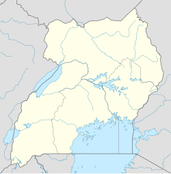
Kapedo sub-county is a subdivision of Dodoth West County in Karenga District of northern Uganda.
Location
[edit]This section is empty. You can help by adding to it. (February 2013) |
References
[edit]


