Brančić: Difference between revisions
Appearance
Content deleted Content added
Correct HPBot error in expand translation link, plus general fixes using AWB (7916) |
|||
| (13 intermediate revisions by 13 users not shown) | |||
| Line 5: | Line 5: | ||
|native_name = |
|native_name = |
||
|nickname = |
|nickname = |
||
|settlement_type = Village |
|settlement_type = [[List of populated places in Serbia|Village]] ([[village#Slavic countries|Selo]]) |
||
|motto = |
|motto = |
||
|image_skyline = |
|image_skyline = Brančić, Ulica, 06.jpg |
||
|imagesize = |
|imagesize = |
||
|image_caption = |
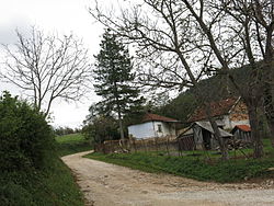
|image_caption = Brančić, Street |
||
|image_flag = |
|image_flag = |
||
|flag_size = |
|flag_size = |
||
| Line 24: | Line 24: | ||
|subdivision_name ={{flag|Serbia}} |
|subdivision_name ={{flag|Serbia}} |
||
|subdivision_type1 = [[Districts of Serbia|District]] |
|subdivision_type1 = [[Districts of Serbia|District]] |
||
|subdivision_name1 = |
|subdivision_name1 = [[Kolubara District|Kolubara]] |
||
|subdivision_type2 =[[Municipalities of Serbia|Municipality]] |
|subdivision_type2 =[[Municipalities of Serbia|Municipality]] |
||
|subdivision_name2 = [[Ljig]] |
|subdivision_name2 = [[Ljig]] |
||
| Line 49: | Line 49: | ||
|timezone_DST = [[Central European Summer Time|CEST]] |
|timezone_DST = [[Central European Summer Time|CEST]] |
||
|utc_offset_DST = +2 |
|utc_offset_DST = +2 |
||
|coordinates = |
|||
|latd=|latm= |lats= |latNS=N |
|||
|longd=|longm=|longs=|longEW=E |
|||
|elevation_footnotes = |
|elevation_footnotes = |
||
|elevation_m = |
|elevation_m = |
||
| Line 62: | Line 61: | ||
|footnotes = |
|footnotes = |
||
}} |
}} |
||
'''Brančić''' is a village |
'''Brančić''' is a village situated in [[Ljig]] municipality, [[Kolubara District]] in [[Serbia]].<ref>{{Cite web |url=http://www.ined.fr/fr/pop_chiffres/pays_developpes/base_pays_developpes/ |title=Institut national d'études démographique (INED) |access-date=2011-09-24 |archive-url=https://web.archive.org/web/20140702194706/http://www.ined.fr/fr/pop_chiffres/pays_developpes/base_pays_developpes/ |archive-date=2014-07-02 |url-status=dead }}</ref> |
||
==References== |
==References== |
||
{{reflist}} |
{{reflist}} |
||
{{Kolubara District}} |
|||
{{coord missing|Serbia}} |
|||
{{coord|44|12|27|N|20|15|43|E|type:city_source:frwiki|display=title}} |
|||
| ⚫ | |||
{{DEFAULTSORT:Brancic}} |
|||
| ⚫ | |||
| ⚫ | |||
| ⚫ | |||
[[fr:Brančić]] |
|||
[[sl:Brančić]] |
|||
[[sr:Бранчић]] |
|||
Latest revision as of 17:24, 17 September 2021
You can help expand this article with text translated from the corresponding article in Serbian. (September 2011) Click [show] for important translation instructions.
|
Brančić | |
|---|---|
 Brančić, Street | |
 | |
| Country | |
| District | Kolubara |
| Municipality | Ljig |
| Time zone | UTC+1 (CET) |
| • Summer (DST) | UTC+2 (CEST) |
Brančić is a village situated in Ljig municipality, Kolubara District in Serbia.[1]
References
[edit]- ^ "Institut national d'études démographique (INED)". Archived from the original on 2014-07-02. Retrieved 2011-09-24.
