Moramanga District: Difference between revisions
No edit summary |
m Removed link(s) to title (CW Error #48) (via Bandersnatch) |
||
| Line 44: | Line 44: | ||
|subdivision_name1 = [[Alaotra-Mangoro]] |
|subdivision_name1 = [[Alaotra-Mangoro]] |
||
|subdivision_type2 = [[Districts of Madagascar|District]] |
|subdivision_type2 = [[Districts of Madagascar|District]] |
||
|subdivision_name2 = |
|subdivision_name2 = Moramanga |
||
<!-- Smaller parts (e.g. boroughs of a city) and seat of government --> |
<!-- Smaller parts (e.g. boroughs of a city) and seat of government --> |
||
|seat_type = |
|seat_type = |
||
Latest revision as of 17:27, 29 September 2021
Moramanga | |
|---|---|
 Moramanga market | |
| Coordinates: 18°56′49″S 48°13′49″E / 18.94694°S 48.23028°E | |
| Country | |
| Region | Alaotra-Mangoro |
| District | Moramanga |
| Area | |
| • Land | 9,396 km2 (3,628 sq mi) |
| Elevation | 980 m (3,220 ft) |
| Population (2018) | |
• Total | 350,724 |
| Climate | Cwa |

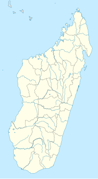
Moramanga District is a district in the Alaotra-Mangoro region in Madagascar. Its capital is Moramanga.
It is situated between the capital Antananarivo and the east coast on the crossroad of RN 2 and RN 44. The name of Moranmanga originates from the slave trade. To differ them from other social classes, they were dressed in blue or manga. As they were among the cheapest (mora) in Africa, it became Moramanga.[1]
People
[edit]Moramanga is also the capital city of the Bezanozano people (one of the eighteen Ethnic groups of Madagascar).
Communes
[edit]The district is further divided into 22 communes:
- Ambatovola
- Amboasary Gara
- Ambohidronono
- Ampasipotsy Gare
- Ampasipotsy Mandialaza
- Andaingo
- Andasibe
- Anosibe Ifody
- Antanandava
- Antaniditra
- Beforona
- Belavabary
- Beparasy
- Fierenana
- Lakato
- Mandialaza
- Moramanga
- Moramanga Suburbaine
- Morarano Gare
- Sabotsy Anjiro
- Vodiriana
Transports
[edit]The national road RN 2 connects the city with Antananarivo (115 km) and Toamasina (254 km), the Route nationale 44 to Ambatondrazaka (157 km), Imerimandroso and Amboavory.
The city is at the TCE (Tananarive-Côte Est) and the south end of the MLA (Moramanga-Lac Alaotra) railways, so it's the only railway junction in Madagascar (except for the capital).
Economy
[edit]The nickel and cobalt mine of Ambatovy is situated near this town.
Wildlife
[edit]Protected areas near Moramanga are:
- Analamazoatra Reserve 31 km (19 mi) east along NR2
- Andasibe-Mantadia National Park 43 km (27 mi) northeast
The Peyrieras Reptile Reserve (a butterfly farm and reptile center) is at Marozevo, 40 km (25 mi) west of Moramanga on National Route NR2.
See also
[edit]References
[edit]


