Anajpur: Difference between revisions
Appearance
Content deleted Content added
No edit summary |
Citation bot (talk | contribs) Add: title. Changed bare reference to CS1/2. | Use this bot. Report bugs. | Suggested by BrownHairedGirl | Linked from User:BrownHairedGirl/Articles_with_bare_links | #UCB_webform_linked 490/2199 |
||
| (33 intermediate revisions by 23 users not shown) | |||
| Line 1: | Line 1: | ||
{{Use dmy dates|date=January 2019}} |
|||
{{Infobox Indian Jurisdiction |
|||
{{Use Indian English|date=January 2019}} |
|||
| native_name = Anajpur<br>అనాజ్పూర్ |
|||
{{Infobox settlement |
|||
| type = Village |
|||
| name = Anajpur |
|||
| state_name = Andhra Pradesh |
|||
| native_name_lang = Telangaana |
|||
| leader_title = |
|||
| other_name = |
|||
| leader_name = |
|||
| nickname = |
|||
| altitude = |
|||
| settlement_type = Village |
|||
|latd=17 |latm=16 |lats=15.38 |longd=78 |longm=41 |longs=35.8 |
|||
| image_skyline = |
|||
| ⚫ | |||
| image_alt = |
|||
| ⚫ | |||
| image_caption = |
|||
| population_density = |
|||
| pushpin_map = India Telangana#India |
|||
| area_magnitude= |
|||
| pushpin_label_position = |
|||
| area_total = |
|||
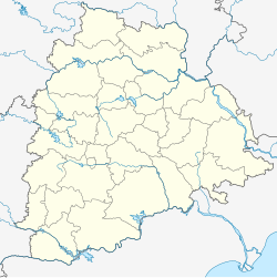
| pushpin_map_alt = Location in Telangana, India |
|||
| area_telephone = 040 |
|||
| pushpin_map_caption = Location in Telangana, India |
|||
| ⚫ | |||
| coordinates = {{coord|17|16|15.38|N|78|41|35.8|E|display=inline,title}} |
|||
| vehicle_code_range = AP 26 X XXXX |
|||
| subdivision_type = Country |
|||
| sex_ratio = |
|||
| subdivision_name = {{flag|India}} |
|||
| unlocode = |
|||
| subdivision_type1 = [[States and territories of India|State]] |
|||
| website = |
|||
| subdivision_name1 = [[Telangana]] |
|||
| ⚫ | |||
| established_title = <!-- Established --> |
|||
| established_date = |
|||
| founder = |
|||
| named_for = |
|||
| government_type = |
|||
| governing_body = |
|||
| unit_pref = Metric |
|||
| area_footnotes = |
|||
| area_rank = |
|||
| area_total_km2 = |
|||
| elevation_footnotes = |
|||
| elevation_m = |
|||
| ⚫ | |||
| ⚫ | |||
| population_rank = |
|||
| population_density_km2 = auto |
|||
| population_demonym = |
|||
| population_footnotes = |
|||
| demographics_type1 = Languages |
|||
| demographics1_title1 = Official |
|||
| demographics1_info1 = [[Telugu language|Telugu]] |
|||
| timezone1 = [[Indian Standard Time|IST]] |
|||
| utc_offset1 = +5:30 |
|||
| postal_code_type = <!-- [[Postal Index Number|PIN]] --> |
|||
| ⚫ | |||
| area_code_type = 08415 |
|||
| area_code = |
|||
| registration_plate =TS |
|||
| website = {{URL|telangana.gov.in}} |
|||
| ⚫ | |||
}} |
}} |
||
'''Anajpur''' |
'''Anajpur''' is a village in [[Rangareddy district]] in [[Telangana]], India.<ref>{{Cite web|url=http://anajpur.pincodez.co.in/pincode/ap/rangareddi/anajpur|title = ANAJPUR Pincode (AP)}}</ref> It falls under [[Hayathnagar]] mandal and is close to the [[Outer Ring Road, Hyderabad]]. Anajpur village is home to [[Ramoji Film City]], the world's largest film production facility.<ref>{{Cite web|url=http://www.eenaduinfo.com/about_ram.htm|title=About Ramoji Groups}}</ref> |
||
==References== |
==References== |
||
{{reflist}} |
{{reflist}} |
||
| ⚫ | |||
[[Category:Villages in Ranga Reddy district]] |
[[Category:Villages in Ranga Reddy district]] |
||
| ⚫ | |||
Latest revision as of 23:17, 4 October 2021
Anajpur | |
|---|---|
Village | |
| Coordinates: 17°16′15.38″N 78°41′35.8″E / 17.2709389°N 78.693278°E | |
| Country | |
| State | Telangana |
| Languages | |
| • Official | Telugu |
| Time zone | UTC+5:30 (IST) |
| Vehicle registration | TS |
| Website | telangana |
Anajpur is a village in Rangareddy district in Telangana, India.[1] It falls under Hayathnagar mandal and is close to the Outer Ring Road, Hyderabad. Anajpur village is home to Ramoji Film City, the world's largest film production facility.[2]
References
[edit]


