Kusmishera: Difference between revisions
Appearance
Content deleted Content added
The sage JAIMINI Place |
→top: Added Gandaki Province Map |
||
| (9 intermediate revisions by 7 users not shown) | |||
| Line 16: | Line 16: | ||
|mapsize = |
|mapsize = |
||
|map_caption = |
|map_caption = |
||
|pushpin_map = Nepal |
| pushpin_map = Nepal Gandaki Province#Nepal |
||
|pushpin_label_position = bottom |
|pushpin_label_position = bottom |
||
|pushpin_mapsize = 300 |
|pushpin_mapsize = 300 |
||
| Line 49: | Line 49: | ||
|population_blank1_title = Ethnicities |
|population_blank1_title = Ethnicities |
||
|population_blank2_title = Religions |
|population_blank2_title = Religions |
||
|population_blank2 =[[Hindu]] |
|population_blank2 =[[Hindu]] [[Buddhism]] [[Animism]] [[Shamanism]] |
||
<!-- General information --> |
<!-- General information --> |
||
|timezone = [[Nepal Time]] |
|timezone = [[Nepal Time]] |
||
| Line 67: | Line 67: | ||
|footnotes = |
|footnotes = |
||
}} |
}} |
||
'''Kushmishera''' is a [[Village development committee (Nepal)|village development committee]] in [[Baglung District]] in the [[Dhawalagiri Zone|Dhaulagiri Zone]] of central [[Nepal]]. At the time of the [[1991 Nepal census]] it had a population of 2,944 and had 570 houses in the town |
'''Kushmishera''' is a [[Village development committee (Nepal)|village development committee]] in the [[Baglung District]] in the [[Dhawalagiri Zone|Dhaulagiri Zone]] of central [[Nepal]]. At the time of the [[1991 Nepal census]] it had a population of 2,944 and had 570 houses in the town.<ref>By Bibek Raj Paudel & Bhuban Chapagain {{Cite web|url=http://www.digitalhimalaya.com/collections/nepalcensus/form.php?selection=1 |title=Nepal Census 2001 |work=Nepal's Village Development Committees |publisher=[[Digital Himalaya]] |accessdate=2008-08-23 |url-status=dead |archiveurl=https://web.archive.org/web/20081012163506/http://www.digitalhimalaya.com/collections/nepalcensus/form.php?selection=1 |archivedate=2008-10-12 }}</ref> |
||
==References== |
==References== |
||
| Line 73: | Line 73: | ||
{{Baglung District}} |
{{Baglung District}} |
||
[[Category:Populated places in Baglung District]] |
[[Category:Populated places in Baglung District]] |
||
{{ |
{{Baglung-geo-stub}} |
||
Latest revision as of 18:09, 30 November 2021
Kushmishera
कुश्मीशेरा,JAIMINI GUFA,JAIMINI TOPSTHAN. | |
|---|---|
 | |
| Coordinates: 28°12′N 83°37′E / 28.20°N 83.62°E | |
| Country | |
| Zone | Dhaulagiri Zone |
| District | Baglung District |
| Population (1991) | |
• Total | 2,944 |
| • Religions | Hindu Buddhism Animism Shamanism |
| Time zone | UTC+5:45 (Nepal Time) |
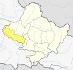
Kushmishera is a village development committee in the Baglung District in the Dhaulagiri Zone of central Nepal. At the time of the 1991 Nepal census it had a population of 2,944 and had 570 houses in the town.[1]
References
[edit]- ^ By Bibek Raj Paudel & Bhuban Chapagain "Nepal Census 2001". Nepal's Village Development Committees. Digital Himalaya. Archived from the original on 2008-10-12. Retrieved 2008-08-23.


