Kiçikoba: Difference between revisions
Appearance
Content deleted Content added
renaming, ref |
m →top: Fixed CS1 errors: extra text: volume and general fixes |
||
| (22 intermediate revisions by 20 users not shown) | |||
| Line 1: | Line 1: | ||
| ⚫ | |||
{{coor title dms|39|23|24|N|45|32|42|E}} |
|||
| ⚫ | |||
|name =Kiçikoba |
|name =Kiçikoba |
||
|settlement_type=Municipality |
|settlement_type=Municipality |
||
| Line 9: | Line 8: | ||
|subdivision_name = {{flag|Azerbaijan}} |
|subdivision_name = {{flag|Azerbaijan}} |
||
|subdivision_type1 = [[Administrative divisions of Azerbaijan|Autonomous republic]] |
|subdivision_type1 = [[Administrative divisions of Azerbaijan|Autonomous republic]] |
||
|subdivision_name1 =[[Nakhchivan|Nakhchivan]] |
|subdivision_name1 =[[Nakhchivan Autonomous Republic|Nakhchivan]] |
||
|subdivision_type2 = [[Administrative divisions of Azerbaijan| |
|subdivision_type2 = [[Administrative divisions of Azerbaijan|District]] |
||
|subdivision_name2 =[[ |
|subdivision_name2 =[[Shahbuz District|Shahbuz]] |
||
|leader_title = |
|leader_title = |
||
|leader_name = |
|leader_name = |
||
| Line 18: | Line 17: | ||
|area_total_km2 = |
|area_total_km2 = |
||
|area_footnotes = |
|area_footnotes = |
||
|population_as_of = |
|population_as_of = 2005 |
||
|population_total = |
|population_total =176 |
||
|population_footnotes = |
|population_footnotes ={{citation needed|date=October 2010}} |
||
|population_density_km2 = |
|population_density_km2 = |
||
|timezone =[[Azerbaijan Time|AZT]] |
|timezone =[[Azerbaijan Time|AZT]] |
||
|utc_offset = +4 |
|utc_offset = +4 |
||
|timezone_DST = |
|timezone_DST = |
||
|utc_offset_DST = |
|utc_offset_DST = |
||
|coordinates = {{Coord|39|23|24|N|45|32|42|E|region:AZ|display=inline,title}} |
|||
|latd=39 |latm=23 |lats=24 |latNS=N |
|||
|longd=45|longm=32 |longs=42 |longEW=E |
|||
|elevation_m = |
|elevation_m = |
||
|area_code = |
|area_code = |
||
|website = |
|website = |
||
}} |
}} |
||
'''Kiçikoba''' (until |
'''Kiçikoba''' (until 2003,<ref>[http://www.meclis.gov.az/?/az/legislation/view/580 Azerbaijan Parliament renaming law]</ref> '''Yenikənd''' and '''Yenikend''') is a village and municipality in the [[Shahbuz District]] of [[Nakhchivan Autonomous Republic|Nakhchivan]], [[Azerbaijan]]. It is located 4 km in the south-west from the district center, on the bank of the Nakhchivanchay River. Its population is busy with gardening and animal husbandry. There are primary school in the village. It has a population of 176.<ref name="ANAS">{{cite book| last=ANAS| first=Azerbaijan National Academy of Sciences| author-link=Azerbaijan National Academy of Sciences| title= Nakhchivan Encyclopedia| publisher= ANAS| location=Baku| year=2005| volume=I| page=296| isbn=5-8066-1468-9}}</ref> Until 1936, it was called '''Sicanlı'''. Since 2003, officially registered in the name of Kicikoba.<ref>''Encyclopedic dictionary of Azerbaijan toponyms''. In two volumes. Volume I. p. 304. Baku: "East-West". 2007. {{ISBN|978-9952-34-155-3}}.</ref> |
||
== References == |
== References == |
||
{{ |
{{Reflist}} |
||
*{{GEOnet2|32FA8852FFD93774E0440003BA962ED3|Kiçikoba (as Yenikənd)}} |
|||
*[[GEOnet Names Server]] |
|||
{{Shahbuz District}} |
|||
[[Category:Cities, towns and villages in Azerbaijan]] |
|||
[[Category:Shakhbuz Rayon]] |
|||
{{DEFAULTSORT:Kicikoba}} |
|||
[[Category:Populated places in Shahbuz District]] |
|||
Latest revision as of 15:21, 27 January 2022
Kiçikoba | |
|---|---|
Municipality | |
| Coordinates: 39°23′24″N 45°32′42″E / 39.39000°N 45.54500°E | |
| Country | |
| Autonomous republic | Nakhchivan |
| District | Shahbuz |
| Population (2005)[citation needed] | |
• Total | 176 |
| Time zone | UTC+4 (AZT) |
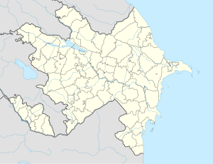
Kiçikoba (until 2003,[1] Yenikənd and Yenikend) is a village and municipality in the Shahbuz District of Nakhchivan, Azerbaijan. It is located 4 km in the south-west from the district center, on the bank of the Nakhchivanchay River. Its population is busy with gardening and animal husbandry. There are primary school in the village. It has a population of 176.[2] Until 1936, it was called Sicanlı. Since 2003, officially registered in the name of Kicikoba.[3]
References
[edit]- ^ Azerbaijan Parliament renaming law
- ^ ANAS, Azerbaijan National Academy of Sciences (2005). Nakhchivan Encyclopedia. Vol. I. Baku: ANAS. p. 296. ISBN 5-8066-1468-9.
- ^ Encyclopedic dictionary of Azerbaijan toponyms. In two volumes. Volume I. p. 304. Baku: "East-West". 2007. ISBN 978-9952-34-155-3.


