Burlestone: Difference between revisions
Appearance
Content deleted Content added
m rm overlink, cleanup using AWB |
Adding custom short description: "Village in Devon, England" (Shortdesc helper) |
||
| (7 intermediate revisions by 6 users not shown) | |||
| Line 1: | Line 1: | ||
{{Short description|Village in Devon, England}} |
|||
{{Unreferenced|date=July 2013}}{{infobox UK place| |
|||
{{Use dmy dates|date=October 2019}} |
|||
{{Infobox UK place |
|||
|country = England |
|country = England |
||
|static_image = |
|static_image = Lower Burlestone (geograph 3104423).jpg |
||
|static_image_caption= |
|static_image_caption=Lower Burlestone |
||
|coordinates = {{coord|50.32|-03.65|display=inline,title}} |
|||
|latitude= 50.32 |
|||
|longitude=-03.65 |
|||
|official_name =Burlestone |
|official_name =Burlestone |
||
|population = |
|population = |
||
| Line 19: | Line 20: | ||
|os_grid_reference= SX8248 |
|os_grid_reference= SX8248 |
||
}} |
}} |
||
'''Burlestone''' is a village in [[Devon]], England. |
'''Burlestone''' is a village in [[Devon]], England.<ref name=OS202>{{cite map|title=Ordnance Survey: Landranger map sheet 202 ''Torbay & South Dartmoor (Totnes & Salcombe)''|ISBN= 9780319232880 |publisher=Ordnance Survey|date=2009}}</ref> |
||
<ref name=OSGaz50>{{cite web|url=https://www.ordnancesurvey.co.uk/opendatadownload/products.html|title=Ordnance Survey: 1:50,000 Scale Gazetteer|format=csv (download)|date= 1 January 2016|publisher=Ordnance Survey|website=www.ordnancesurvey.co.uk|accessdate=30 January 2016}}</ref> |
|||
==References== |
|||
{{reflist}} |
|||
{{authority control}} |
|||
[[Category:Villages in Devon]] |
[[Category:Villages in Devon]] |
||
Latest revision as of 19:26, 24 April 2022
| Burlestone | |
|---|---|
 Lower Burlestone | |
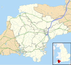
Location within Devon | |
| OS grid reference | SX8248 |
| Shire county | |
| Region | |
| Country | England |
| Sovereign state | United Kingdom |
| Police | Devon and Cornwall |
| Fire | Devon and Somerset |
| Ambulance | South Western |
Burlestone is a village in Devon, England.[1] [2]
References
[edit]- ^ Ordnance Survey: Landranger map sheet 202 Torbay & South Dartmoor (Totnes & Salcombe) (Map). Ordnance Survey. 2009. ISBN 9780319232880.
- ^ "Ordnance Survey: 1:50,000 Scale Gazetteer" (csv (download)). www.ordnancesurvey.co.uk. Ordnance Survey. 1 January 2016. Retrieved 30 January 2016.

