Leckihorn: Difference between revisions
Appearance
Content deleted Content added
add |
|||
| (15 intermediate revisions by 12 users not shown) | |||
| Line 1: | Line 1: | ||
{{short description|Mountain in Switzerland}} |
|||
{{Infobox mountain |
{{Infobox mountain |
||
| name = Leckihorn |
| name = Leckihorn |
||
| photo = |
| photo = LeckihornFromNE.JPG |
||
| photo_caption = |
| photo_caption = Gross Leckihorn seen from northeast, on the left Chli Leckihorn |
||
| elevation_m = 3068 |
| elevation_m = 3068 |
||
| elevation_ref = |
| elevation_ref = |
||
| prominence_m = 222 |
| prominence_m = 222 |
||
| prominence_ref = <ref>[[Swisstopo]] maps</ref> |
| prominence_ref = <ref>Retrieved from the [[Swisstopo]] topographic maps. The key col is the Muttenlücke (2,846 m).</ref> |
||
| parent_peak = [[Gross Muttenhorn]] |
| parent_peak = [[Gross Muttenhorn]] |
||
| map = Switzerland |
| map = Switzerland |
||
| map_caption = Location in Switzerland |
|||
| location = {{SUI}} |
|||
| location = [[Valais]]/[[Canton of Uri|Uri]], [[Switzerland]] |
|||
| range = [[Lepontine Alps]] |
| range = [[Lepontine Alps]] |
||
| coordinates = {{coord|46|32|9.2|N|8|27|50.5|E|type:mountain_region:CH_scale:100000|format=dms|display=inline,title}} |
|||
| lat_d = 46 | lat_m = 32 | lat_s = 9.2 | lat_NS = N |
|||
| range_coordinates = |
|||
| long_d = 8 | long_m = 27 | long_s = 50.5 | long_EW = E |
|||
| region = CH |
|||
| first_ascent = |
| first_ascent = |
||
| easiest_route = |
| easiest_route = |
||
| Line 25: | Line 27: | ||
==External links== |
==External links== |
||
*[http://www.summitpost.org/gross-leckihorn/291887 Gross Leckihorn on Summitpost] |
*[http://www.summitpost.org/gross-leckihorn/291887 Gross Leckihorn on Summitpost] |
||
*[http://www.hikr.org/dir/Gross_Leckihorn_6134/ Leckihorn on Hikr] |
|||
[[Category:Mountains of the Alps]] |
[[Category:Mountains of the Alps]] |
||
[[Category:Alpine |
[[Category:Alpine three-thousanders]] |
||
[[Category:Mountains of Switzerland]] |
[[Category:Mountains of Switzerland]] |
||
[[Category:Mountains of Valais]] |
|||
[[Category:Mountains of the canton of Uri]] |
|||
[[Category:Uri–Valais border]] |
|||
[[Category:Lepontine Alps]] |
|||
{{ |
{{Uri-mountain-stub}} |
||
{{Valais-mountain-stub}} |
|||
[[it:Leckihorn]] |
|||
Latest revision as of 16:15, 15 May 2022
| Leckihorn | |
|---|---|
 Gross Leckihorn seen from northeast, on the left Chli Leckihorn | |
| Highest point | |
| Elevation | 3,068 m (10,066 ft) |
| Prominence | 222 m (728 ft)[1] |
| Parent peak | Gross Muttenhorn |
| Coordinates | 46°32′9.2″N 8°27′50.5″E / 46.535889°N 8.464028°E |
| Geography | |
| Location | Valais/Uri, Switzerland |
| Parent range | Lepontine Alps |
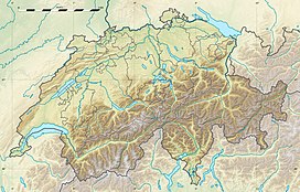
The Leckihorn is a mountain in the Lepontine Alps, located on the border between the cantons of Valais and Uri. Its summit is also named Gross Leckihorn (3,068 metres) to distinguish it from a lower summit (3,023 metres) named Chli Leckihorn.
References
[edit]External links
[edit]

