Sturefors: Difference between revisions
Appearance
Content deleted Content added
+bg |
GreenC bot (talk | contribs) Rescued 1 archive link. Wayback Medic 2.5 |
||
| (14 intermediate revisions by 13 users not shown) | |||
| Line 1: | Line 1: | ||
{{Infobox |
{{Infobox settlement |
||
|official_name = Sturefors |
|official_name = Sturefors |
||
|image_skyline = |
|image_skyline = Sturefors slott 2011.jpg |
||
|image_caption = |
|image_caption = |
||
|pushpin_map = Sweden |
|pushpin_map = Sweden Östergötland#Sweden |
||
|pushpin_label_position = |
|pushpin_label_position = |
||
|subdivision_type = [[Country]] |
|subdivision_type = [[Country]] |
||
| Line 13: | Line 13: | ||
|subdivision_type1 = [[Provinces of Sweden|Province]] |
|subdivision_type1 = [[Provinces of Sweden|Province]] |
||
|subdivision_name1 = [[Östergötland]] |
|subdivision_name1 = [[Östergötland]] |
||
|area_footnotes = <ref name= |
|area_footnotes = <ref name=scb>{{cite web |url=http://www.scb.se/Statistik/MI/MI0810/2010A01/Tatorternami0810tab1_4.xls |title=Tätorternas landareal, folkmängd och invånare per km<sup>2</sup> 2005 och 2010 |date=14 December 2011 |publisher=[[Statistics Sweden]] |language=Swedish |archive-url=https://web.archive.org/web/20120127055525/http://www.scb.se/Statistik/MI/MI0810/2010A01/Tatorternami0810tab1_4.xls |archive-date=27 January 2012 |url-status=live |access-date=10 January 2012 |df= }}</ref> |
||
|area_total_km2 = 1. |
|area_total_km2 = 1.05 |
||
|population_as_of = |
|population_as_of = 31 December 2010 |
||
|population_footnotes = <ref name= |
|population_footnotes = <ref name=scb /> |
||
|population_total = 2, |
|population_total = 2,229 <!-- This is the official figure from Statistics Sweden (Statistiska centralbyrån). --> |
||
|population_density_km2 = |
|population_density_km2 = 2123 |
||
|timezone = [[Central European Time|CET]] |
|timezone = [[Central European Time|CET]] |
||
|utc_offset = +1 |
|utc_offset = +1 |
||
|timezone_DST = [[Central European Summer Time|CEST]] |
|timezone_DST = [[Central European Summer Time|CEST]] |
||
|utc_offset_DST = +2 |
|utc_offset_DST = +2 |
||
| |
|coordinates = {{coord|58|20|N|15|44|E|region:SE|display=inline,title}} |
||
|latd=58 |latm=20 |lats= |latNS=N |
|||
|longd=15 |longm=44 |longs= |longEW=E |
|||
|website = |
|website = |
||
}} |
}} |
||
'''Sturefors''' is a [[urban areas of Sweden|locality]] situated in [[Linköping Municipality]], [[Östergötland County]], [[Sweden]] with 2, |
'''Sturefors''' is a [[urban areas of Sweden|locality]] situated in [[Linköping Municipality]], [[Östergötland County]], [[Sweden]] with 2,229 inhabitants in 2010.<ref name=scb /> |
||
== History == |
|||
Sturefors was called Husby till 1940. Husby was named Sturefors after Sturefors station and railway station. Sturefors, located in the valley of Stångån between Linköping-Åtvidaberg-Västervik and Linköping-Kisa-Vimmerby-Kalmar railway lines.<ref>{{Citation|title=Ekonomisk karta|date=2018-09-27|url=https://sv.wikipedia.org/enwiki/w/index.php?title=Ekonomisk_karta&oldid=43628559|work=Wikipedia|language=sv|access-date=2019-09-25}}</ref> |
|||
== References == |
== References == |
||
{{Reflist}} |
{{Reflist}} |
||
== External links == |
|||
| ⚫ | |||
{{Commons category-inline}} |
|||
{{Localities in Linköping Municipality}} |
{{Localities in Linköping Municipality}} |
||
{{authority control}} |
|||
[[Category: |
[[Category:Populated places in Östergötland County]] |
||
[[Category:Populated places in Linköping Municipality]] |
|||
[[bg:Стюрефорш]] |
|||
| ⚫ | |||
[[et:Sturefors]] |
|||
[[fr:Sturefors]] |
|||
[[nl:Sturefors]] |
|||
[[no:Sturefors]] |
|||
[[sv:Sturefors]] |
|||
Latest revision as of 10:52, 21 June 2022
Sturefors | |
|---|---|
 | |
| Coordinates: 58°20′N 15°44′E / 58.333°N 15.733°E | |
| Country | Sweden |
| Province | Östergötland |
| County | Östergötland County |
| Municipality | Linköping Municipality |
| Area | |
• Total | 1.05 km2 (0.41 sq mi) |
| Population (31 December 2010)[1] | |
• Total | 2,229 |
| • Density | 2,123/km2 (5,500/sq mi) |
| Time zone | UTC+1 (CET) |
| • Summer (DST) | UTC+2 (CEST) |
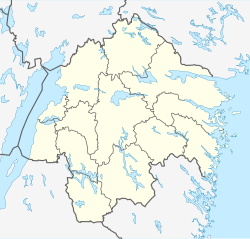
Sturefors is a locality situated in Linköping Municipality, Östergötland County, Sweden with 2,229 inhabitants in 2010.[1]
History
[edit]Sturefors was called Husby till 1940. Husby was named Sturefors after Sturefors station and railway station. Sturefors, located in the valley of Stångån between Linköping-Åtvidaberg-Västervik and Linköping-Kisa-Vimmerby-Kalmar railway lines.[2]
References
[edit]- ^ a b c "Tätorternas landareal, folkmängd och invånare per km2 2005 och 2010" (in Swedish). Statistics Sweden. 14 December 2011. Archived from the original on 27 January 2012. Retrieved 10 January 2012.
- ^ "Ekonomisk karta", Wikipedia (in Swedish), 2018-09-27, retrieved 2019-09-25
External links
[edit]![]() Media related to Sturefors at Wikimedia Commons
Media related to Sturefors at Wikimedia Commons


