Kuchuma: Difference between revisions
Appearance
Content deleted Content added
m fmt |
Added Syunik Province location map to infobox |
||
| (13 intermediate revisions by 12 users not shown) | |||
| Line 1: | Line 1: | ||
{{about|the town in Armenia|the mountain in the Southwest United States|Kuchamaa}} |
|||
{{Infobox |
{{Infobox settlement |
||
|official_name = Kuchuma |
|official_name = Kuchuma |
||
|native_name = |
|native_name = |
||
| Line 9: | Line 10: | ||
|image_map = |
|image_map = |
||
|map_caption = |
|map_caption = |
||
|pushpin_map = Armenia |
|pushpin_map = Armenia#Syunik |
||
|pushpin_label_position =bottom |
|pushpin_label_position =bottom |
||
|pushpin_mapsize = 300 |
|pushpin_mapsize = 300 |
||
| Line 15: | Line 16: | ||
|subdivision_type = [[Countries of the world|Country]] |
|subdivision_type = [[Countries of the world|Country]] |
||
|subdivision_type1 = [[Provinces of Armenia|Province]] |
|subdivision_type1 = [[Provinces of Armenia|Province]] |
||
|subdivision_name = |
|subdivision_name = {{flag|Armenia}} |
||
|subdivision_name1 = [[Syunik]] |
|subdivision_name1 = [[Syunik Province|Syunik]] |
||
|subdivision_type2 = |
|subdivision_type2 = |
||
|subdivision_name2 = |
|subdivision_name2 = |
||
| Line 24: | Line 25: | ||
|leader_title = |
|leader_title = |
||
|leader_name = |
|leader_name = |
||
|area_magnitude = |
|||
|area_total_sq_mi = |
|area_total_sq_mi = |
||
|area_total_km2 = |
|area_total_km2 = |
||
| Line 30: | Line 30: | ||
|area_land_km2 = |
|area_land_km2 = |
||
|area_urban_sq_mi = |
|area_urban_sq_mi = |
||
|area_urban_km2 = |
|||
|area_metro_km2 = |
|||
|area_metro_sq_mi = |
|area_metro_sq_mi = |
||
|population_as_of= |
|population_as_of= |
||
| Line 44: | Line 42: | ||
|timezone_DST = |
|timezone_DST = |
||
|utc_offset_DST = |
|utc_offset_DST = |
||
| ⚫ | |||
|latd=39|latm=12|lats=|latNS=N |
|||
|longd=46|longm=16|longs=|longEW=E |
|||
|elevation_footnotes= |
|elevation_footnotes= |
||
|elevation_m = 1725 |
|elevation_m = 1725 |
||
| Line 55: | Line 52: | ||
|footnotes = |
|footnotes = |
||
}} |
}} |
||
| ⚫ | |||
| ⚫ | |||
| ⚫ | |||
| ⚫ | |||
| ⚫ | |||
== See also == |
|||
* [[Lernadzor]] |
|||
* [[Syunik Province]] |
|||
==References== |
==References== |
||
*{{GEOnet2|32FA881E6DB53774E0440003BA962ED3}} |
*{{GEOnet2|32FA881E6DB53774E0440003BA962ED3}} |
||
[[Category:Populated places in Syunik Province]] |
|||
==External links== |
|||
*[http://www.maplandia.com/armenia/armenia-x-yerevan/kuchuma/ Satellite map at Maplandia.com] |
|||
*[http://encarta.msn.com/encnet/features/mapcenter/map.aspx?TextLatitude=39.1660569536897&TextLongitude=46.2660377948227&TextAltitude=9&TextSelectedEntity=7675668&MapStyle=Comprehensive&MapSize=Large&MapStyleSelectedIndex=0&searchTextMap=Kuchuma&MapStylesList=Comprehensive&ZoomOnMapClickCheck=on Location on MSN encarta map] |
|||
[[Category:Cities, towns and villages in Armenia]] |
|||
[[Category:Syunik]] |
|||
{{Syunik-geo-stub}} |
{{Syunik-geo-stub}} |
||
Latest revision as of 01:53, 17 August 2022
Kuchuma | |
|---|---|
| Coordinates: 39°12′N 46°16′E / 39.200°N 46.267°E | |
| Country | |
| Province | Syunik |
| Elevation | 1,725 m (5,659 ft) |
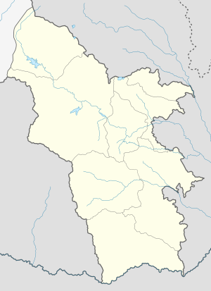
Kuchuma is a town in south-eastern Armenia. It is located in Syunik Province. It is located about 4 km north of Adzhilu.
Other nearby towns and villages include Kavchut (1.3 miles), Nerkin Giratagh (1.2 miles), Musallam (0.9 miles) and Ajylu (2.5 miles)
See also
[edit]References
[edit]


