Amselflue: Difference between revisions
Appearance
Content deleted Content added
m removed duplicated coordinates data in infobox using AWB |
LilianaUwU (talk | contribs) Reverted 1 edit by 129.2.181.175 (talk) to last revision by Ser Amantio di Nicolao |
||
| (14 intermediate revisions by 14 users not shown) | |||
| Line 1: | Line 1: | ||
{{short description|Mountain in Switzerland}} |
|||
{{Infobox mountain |
{{Infobox mountain |
||
| name = Amselflue |
| name = Amselflue |
||
| photo = |
| photo = Amselflue.jpg |
||
| photo_caption = |
| photo_caption = Amselflue |
||
| elevation_m = |
| elevation_m = 2781 |
||
| elevation_ref = |
| elevation_ref = |
||
| |
| prominence_m = 290 |
||
| prominence_ref= <ref>[[Swisstopo]] map</ref> |
|||
| ⚫ | |||
| parent_peak = [[Aroser Rothorn]] |
|||
| location = {{SUI}} |
|||
| |
| location = [[Graubünden]], [[Switzerland]] |
||
| ⚫ | |||
| lat_d = 46 | lat_m = 45 | lat_s = 49.8 | lat_NS = N |
|||
| map_caption = Location in Switzerland |
|||
| long_d = 9 | long_m = 43 | long_s = 44.5 | long_EW = E |
|||
| range = [[Plessur Alps]] |
|||
| region = CH |
|||
| coordinates = {{coord|46|45|49.8|N|9|43|44.5|E|type:mountain_region:CH_scale:100000|format=dms|display=inline,title}} |
|||
| range_coordinates = |
|||
| first_ascent = |
| first_ascent = |
||
| easiest_route = |
| easiest_route = |
||
}} |
}} |
||
'''Amselflue''' is a [[mountain]] |
The '''Amselflue''' is a [[mountain]] of the [[Plessur Alps]], overlooking [[Arosa]] in the canton of [[Graubünden]]. The main summit has an elevation of 2,781 metres, while the eastern summit, located directly above the Maienfelder Furgga, is 2,768 metre high. |
||
==References== |
|||
{{reflist}} |
|||
==External links== |
==External links== |
||
* [http://www.hikr.org/dir/Amselflue_Westgipfel_33808/ Amselflue on Hikr] |
|||
* [http://www.jo-albis.ch/index.php?menu_id=7 List of mountains above 2000 m in Switzerland with coordinates] |
|||
[[Category:Mountains of the Alps]] |
[[Category:Mountains of the Alps]] |
||
[[Category:Mountains of Switzerland]] |
|||
[[Category:Mountains of Graubünden]] |
[[Category:Mountains of Graubünden]] |
||
[[Category:Two-thousanders of Switzerland]] |
|||
{{ |
{{Graubünden-geo-stub}} |
||
Latest revision as of 06:02, 29 September 2022
| Amselflue | |
|---|---|
 Amselflue | |
| Highest point | |
| Elevation | 2,781 m (9,124 ft) |
| Prominence | 290 m (950 ft)[1] |
| Parent peak | Aroser Rothorn |
| Coordinates | 46°45′49.8″N 9°43′44.5″E / 46.763833°N 9.729028°E |
| Geography | |
| Location | Graubünden, Switzerland |
| Parent range | Plessur Alps |
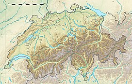
The Amselflue is a mountain of the Plessur Alps, overlooking Arosa in the canton of Graubünden. The main summit has an elevation of 2,781 metres, while the eastern summit, located directly above the Maienfelder Furgga, is 2,768 metre high.
References
[edit]External links
[edit]

