Väse: Difference between revisions
Appearance
Content deleted Content added
m Bot: Migrating 4 interwiki links, now provided by Wikidata on d:q3251047 (Report Errors) |
Undid revision 1070952434 by 2600:1700:A805:A300:99CD:B056:6EBB:6F23 (talk) - appears to have been a grief edit made by a burner account, made my own account to fix this after I noticed it while researching the Old Norse names of places in Scandinavia. Apologies if I'm acting out of line, here, correct me if I have acted wrongly. |
||
| (10 intermediate revisions by 9 users not shown) | |||
| Line 5: | Line 5: | ||
|pushpin_map = Sweden |
|pushpin_map = Sweden |
||
|pushpin_label_position = |
|pushpin_label_position = |
||
|coordinates_region = SE |
|||
|subdivision_type = [[Country]] |
|subdivision_type = [[Country]] |
||
|subdivision_name = [[Sweden]] |
|subdivision_name = [[Sweden]] |
||
| Line 14: | Line 13: | ||
|subdivision_type1 = [[Provinces of Sweden|Province]] |
|subdivision_type1 = [[Provinces of Sweden|Province]] |
||
|subdivision_name1 = [[Värmland]] |
|subdivision_name1 = [[Värmland]] |
||
|area_footnotes = <ref name=scb>{{cite web |url=http://www.scb.se/Statistik/MI/MI0810/2010A01/Tatorternami0810tab1_4.xls |title=Tätorternas landareal, folkmängd och invånare per km<sup>2</sup> 2005 och 2010 |date=14 December 2011 |publisher=[[Statistics Sweden]] |language= |
|area_footnotes = <ref name=scb>{{cite web |url=http://www.scb.se/Statistik/MI/MI0810/2010A01/Tatorternami0810tab1_4.xls |title=Tätorternas landareal, folkmängd och invånare per km<sup>2</sup> 2005 och 2010 |date=14 December 2011 |publisher=[[Statistics Sweden]] |language=sv |archive-url=https://web.archive.org/web/20120127055525/http://www.scb.se/Statistik/MI/MI0810/2010A01/Tatorternami0810tab1_4.xls |archive-date=27 January 2012 |url-status=live |access-date=10 January 2012 }}</ref> |
||
|area_total_km2 = 0.69 |
|area_total_km2 = 0.69 |
||
|population_as_of = 31 December 2010 |
|population_as_of = 31 December 2010 |
||
| Line 24: | Line 23: | ||
|timezone_DST = [[Central European Summer Time|CEST]] |
|timezone_DST = [[Central European Summer Time|CEST]] |
||
|utc_offset_DST = +2 |
|utc_offset_DST = +2 |
||
| |
|coordinates = {{coord|59|23|N|13|50|E|region:SE|display=inline,title}} |
||
|latd=59 |latm=23 |lats= |latNS=N |
|||
|longd=13 |longm=50 |longs= |longEW=E |
|||
|website = |
|website = |
||
}} |
}} |
||
'''Väse''' is a [[Urban areas in Sweden|locality]] situated in [[Karlstad Municipality]], [[Värmland County]], [[Sweden]] with 494 inhabitants in 2010.<ref name=scb /> |
'''Väse''' is a [[Urban areas in Sweden|locality]] situated in [[Karlstad Municipality]], [[Värmland County]], [[Sweden]] with 494 inhabitants in 2010.<ref name=scb /> |
||
Väse är en liten by utanför Karlstad, Värmland. Även fast den är liten så är den stor till sättet. Trots dens lilla storlek så finns det många små affärer, t.ex Då och Nu, och Design rummet, som är de populäraste. |
|||
I Väse finns det en kommunal skola för F-6 och två dagis. |
|||
== References == |
== References == |
||
| Line 39: | Line 32: | ||
{{Localities in Karlstad Municipality}} |
{{Localities in Karlstad Municipality}} |
||
{{authority control}} |
|||
{{DEFAULTSORT:Vase}} |
{{DEFAULTSORT:Vase}} |
||
[[Category:Populated places in Värmland County]] |
[[Category:Populated places in Värmland County]] |
||
[[Category:Populated places in Karlstad Municipality]] |
|||
{{Värmland-geo-stub}} |
{{Värmland-geo-stub}} |
||
Latest revision as of 11:59, 10 October 2022
Väse | |
|---|---|
| Coordinates: 59°23′N 13°50′E / 59.383°N 13.833°E | |
| Country | Sweden |
| Province | Värmland |
| County | Värmland County |
| Municipality | Karlstad Municipality |
| Area | |
• Total | 0.69 km2 (0.27 sq mi) |
| Population (31 December 2010)[1] | |
• Total | 494 |
| • Density | 715/km2 (1,850/sq mi) |
| Time zone | UTC+1 (CET) |
| • Summer (DST) | UTC+2 (CEST) |
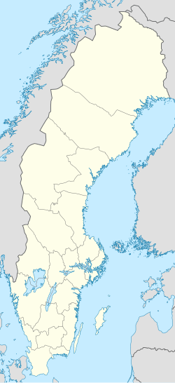
Väse is a locality situated in Karlstad Municipality, Värmland County, Sweden with 494 inhabitants in 2010.[1]
References
[edit]- ^ a b c "Tätorternas landareal, folkmängd och invånare per km2 2005 och 2010" (in Swedish). Statistics Sweden. 14 December 2011. Archived from the original on 27 January 2012. Retrieved 10 January 2012.

