Kakamega Airport: Difference between revisions
→External links: new ext. link |
m Robot: fixing links to disambiguation page Asphalt |
||
| (38 intermediate revisions by 25 users not shown) | |||
| Line 1: | Line 1: | ||
{{Short description|Airport in Kakamega, Kenya}} |
|||
{{inuse}} |
|||
{{EngvarB|date=March 2014}} |
|||
{{Use dmy dates|date=March 2014}} |
|||
{{Infobox |
{{Infobox airport |
||
| name = Kakamega Airport |
| name = Kakamega Airport |
||
| nativename = |
| nativename = |
||
| Line 9: | Line 10: | ||
| image-width = |
| image-width = |
||
| caption = |
| caption = |
||
| IATA = |
| IATA = GGM |
||
| ICAO = HKKG |
| ICAO = HKKG |
||
| pushpin_map = Kenya |
|||
<center>{{Location map|Kenya|width=200|float=center|caption= |
|||
| ⚫ | |||
|mark=Airplane silhouette.svg|marksize=10|label=HKKG|position=inline |
|||
| pushpin_label = HKKG |
|||
|lat_deg=00|lat_min=34|lat_sec=35|lat_dir=N|lon_deg=035|lon_min=33|lon_sec=05|lon_dir=E |
|||
| pushpin_label_position = inline |
|||
| ⚫ | |||
| website = |
| website = |
||
| type = [[Public]], |
| type = [[Public airport|Public]], Civilian |
||
| owner = [[Kenya Airports Authority]] |
| owner = [[Kenya Airports Authority]] |
||
| operator = |
| operator = |
||
| city-served = Kakamega, Kenya |
| city-served = Kakamega, Kenya |
||
| location = [[Kakamega]], {{ |
| location = [[Kakamega]], {{flagu|Kenya}} |
||
| elevation-f = |
| elevation-f = 5,020 |
||
| elevation-m = 1, |
| elevation-m = 1,530 |
||
| coordinates = {{Coord|00| |
| coordinates = {{Coord|00|16|12|N|34|47|00|E|type:airport_region:KE|display=inline|name=Bungoma Airport}} |
||
| metric-elev = |
| metric-elev = |
||
| metric-rwy = |
| metric-rwy = |
||
| r1-number = |
| r1-number = 08-26 |
||
| r1-length-f = |
| r1-length-f = 4,200 |
||
| r1-length-m = |
| r1-length-m = 1,280 |
||
| r1-surface = [[Asphalt]] |
| r1-surface = [[Asphalt concrete|Asphalt]] ({{convert|49|ft|m|abbr=on|disp=or}} wide) |
||
| stat-year = |
| stat-year = |
||
| stat1-header = |
| stat1-header = |
||
| Line 38: | Line 39: | ||
}} |
}} |
||
| ⚫ | '''Kakamega Airport''' is a small [[airport]] in [[Kenya]]. It serves the town of [[Kakamega]]. At {{convert|1530|m|ft}} above sea level,<ref>{{Cite web|url=http://www.wolframalpha.com/input/?i=Kakamega+Airport+elevation&lk=1&a=ClashPrefs_*Airport.HKKG.AirportProperty.Elevation|title=Wolfram{{!}}Alpha: Making the world's knowledge computable|website=www.wolframalpha.com|language=en-us|access-date=2018-08-21}}</ref> the airport has a single [[Asphalt concrete|asphalt]] [[runway]] which measures {{convert|4200|ft|m}} in length and {{convert|49|ft|m}} in width.<ref>{{Cite web|url=http://www.privatejetscharter.net/airports/western-province/kakamega/kakamega-airport/ap3207/|title=Kakamega Airport :: Private Jet ::|website=www.privatejetscharter.net|access-date=2018-08-21}}</ref> |
||
'''Kakamega Airport''' is an airport in [[Kenya]]. |
|||
==Location== |
==Location== |
||
Kakamega Airport {{airport codes| |
Kakamega Airport {{airport codes|GGM|HKKG}} is in [[Kakamega County]] in the town of [[Kakamega]], in western [[Kenya]], close to the international border with the [[Republic of Uganda]]. |
||
It is approximately {{convert|301|km|mi}}, by air, northwest of [[Nairobi International Airport]], the country's largest civilian airport.<ref>{{Cite web|url=http://distancecalculator.globefeed.com/Kenya_Distance_Result.asp?fromplace=Kakamega%20(Western)%20&toplace=Jomo%20Kenyatta%20Airport%20Nairobi%20(Nairobi%20Area)&fromlat=0.2833333&tolat=-1.3166667&fromlng=34.75&tolng=36.9333333|title=Distance between Kakamega (Western) and Jomo Kenyatta Airport Nairobi (Nairobi Area) (Kenya)|website=distancecalculator.globefeed.com|language=en-US|access-date=2018-08-21}}</ref> The geographic coordinates of this airport are 0° 16' 12.00"N, 34° 47' 0.00"E (Latitude: 0.270000; Longitude: 34.783332). |
|||
The airport currently receives weekly flights by SkyWard Express from Wilson airport (Nairobi). |
|||
==Overview== |
|||
| ⚫ | Kakamega Airport is a small airport |
||
==Airlines and destinations== |
|||
None at the moment. |
|||
| ⚫ | |||
| ⚫ | |||
| ⚫ | |||
| ⚫ | |||
==See also== |
==See also== |
||
* [[Kakamega]] |
|||
* [[Kakamega District]] |
|||
* [[Western Province (Kenya)]] |
|||
* [[Kenya Airports Authority]] |
* [[Kenya Airports Authority]] |
||
* [[Kenya Civil Aviation Authority]] |
* [[Kenya Civil Aviation Authority]] |
||
| Line 65: | Line 54: | ||
==References== |
==References== |
||
{{ |
{{Reflist}} |
||
| ⚫ | |||
| ⚫ | |||
| ⚫ | |||
| ⚫ | |||
{{Airports in Kenya}} |
|||
| ⚫ | |||
{{Authority control}} |
|||
| ⚫ | |||
[[Category:Airports in Kenya]] |
[[Category:Airports in Kenya]] |
||
[[Category:Kakamega |
[[Category:Kakamega County]] |
||
[[Category:Western Province (Kenya)]] |
|||
Latest revision as of 18:51, 15 January 2023
Kakamega Airport | |||||||||||
|---|---|---|---|---|---|---|---|---|---|---|---|
| Summary | |||||||||||
| Airport type | Public, Civilian | ||||||||||
| Owner | Kenya Airports Authority | ||||||||||
| Serves | Kakamega, Kenya | ||||||||||
| Location | Kakamega, | ||||||||||
| Elevation AMSL | 5,020 ft / 1,530 m | ||||||||||
| Coordinates | 00°16′12″N 34°47′00″E / 0.27000°N 34.78333°E | ||||||||||
| Map | |||||||||||
 | |||||||||||
| Runways | |||||||||||
| |||||||||||
Kakamega Airport is a small airport in Kenya. It serves the town of Kakamega. At 1,530 metres (5,020 ft) above sea level,[1] the airport has a single asphalt runway which measures 4,200 feet (1,300 m) in length and 49 feet (15 m) in width.[2]
Location
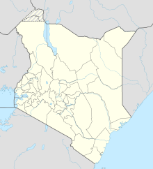
[edit]Kakamega Airport (IATA: GGM, ICAO: HKKG) is in Kakamega County in the town of Kakamega, in western Kenya, close to the international border with the Republic of Uganda.
It is approximately 301 kilometres (187 mi), by air, northwest of Nairobi International Airport, the country's largest civilian airport.[3] The geographic coordinates of this airport are 0° 16' 12.00"N, 34° 47' 0.00"E (Latitude: 0.270000; Longitude: 34.783332).
The airport currently receives weekly flights by SkyWard Express from Wilson airport (Nairobi).
See also
[edit]References
[edit]- ^ "Wolfram|Alpha: Making the world's knowledge computable". www.wolframalpha.com. Retrieved 21 August 2018.
- ^ "Kakamega Airport :: Private Jet ::". www.privatejetscharter.net. Retrieved 21 August 2018.
- ^ "Distance between Kakamega (Western) and Jomo Kenyatta Airport Nairobi (Nairobi Area) (Kenya)". distancecalculator.globefeed.com. Retrieved 21 August 2018.

