Amaozara: Difference between revisions
Appearance
Content deleted Content added
m WP:CHECKWIKI error fixes + genfixes using AWB (7242) |
→top: add {{Use Nigerian English}} |
||
| (9 intermediate revisions by 6 users not shown) | |||
| Line 1: | Line 1: | ||
{{Use Nigerian English|date=January 2023}} |
|||
{{multiple issues|expand=October 2008|unreferenced=October 2008|orphan =February 2009}} |
|||
{{Infobox settlement |
|||
|official_name =Amaozara |
|||
|other_name = |
|||
|native_name = |
|||
|nickname = |
|||
|settlement_type = village |
|||
|motto = |
|||
|image_skyline = |
|||
|imagesize = |
|||
|image_caption = |
|||
|image_flag = |
|||
|flag_size = |
|||
|image_seal = |
|||
|seal_size = |
|||
|image_map = |
|||
|mapsize = |
|||
|map_caption = |
|||
|pushpin_map =Nigeria |
|||
|pushpin_label_position = |
|||
|pushpin_mapsize=250 |
|||
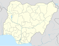
|pushpin_map_caption =Location in Nigeria |
|||
|subdivision_type = Country |
|||
|subdivision_name ={{flag|Nigeria}} |
|||
|subdivision_type1 = [[States of Nigeria|State]] |
|||
|subdivision_name1 = [[Abia State]] |
|||
|subdivision_type2 = [[Local government areas of Nigeria|Local Government Area]] |
|||
|subdivision_name2 = [[Bende, Abia|Bende]] |
|||
|subdivision_type3 = |
|||
|subdivision_name3 = |
|||
|government_footnotes = |
|||
|government_type = |
|||
|leader_title = |
|||
|leader_name = |
|||
|established_title = |
|||
|established_date = |
|||
<!-- Area ---------------------> |
|||
'''Amaozara''' is a [[village]] located in [[Afikpo]] in [[Ebonyi state]], [[Nigeria]]. It is made up of four compounds: Ezi Ukwu, Ezi Egwu, Ezi Okoro and Ezi Uhu. |
|||
|area_magnitude = |
|||
|unit_pref =Metric |
|||
|area_footnotes = |
|||
|area_total_km2 = |
|||
|area_land_km2 = <!--See table @ Template:Infobox Settlement for details on automatic unit conversion--> |
|||
<!-- Population -----------------------> |
|||
|population_as_of = |
|||
|population_footnotes = |
|||
|population_note = |
|||
|population_total = |
|||
|population_density_km2 = |
|||
|population_density_urban_sq_mi = |
|||
|population_blank1_title = Ethnicities |
|||
|population_blank1 = |
|||
|population_blank2_title = Religions |
|||
|population_blank2 = |
|||
|population_density_blank1_km2 = |
|||
|population_density_blank1_sq_mi = |
|||
<!-- General information ---------------> |
|||
||timezone =[[West Africa Time|WAT]] |
|||
|utc_offset = +1 |
|||
|timezone_DST = |
|||
|utc_offset_DST = |
|||
|coordinates = {{coord|5|43|48|N|7|37|10|E|type:city_region:NG|display=inline,title}} |
|||
|elevation_footnotes = |
|||
|elevation_m = |
|||
|elevation_ft = |
|||
<!-- Area/postal codes & others --------> |
|||
|postal_code_type = |
|||
|postal_code = |
|||
|area_code = |
|||
|iso_code = |
|||
|website = |
|||
|footnotes = |
|||
}} |
|||
'''Amaozara''' is a [[village]] located in [[Bende, Abia|Bende Local Government Area]] in [[Abia State]], [[Nigeria]].<ref>{{Cite web|url=http://www.geonames.org/7075506/amaozara.html|title=GeoNames.org|website=www.geonames.org|language=en|access-date=2017-02-15}}</ref> <!-- The article claimed Amaozara is in Ebonyi State however GPS coords from the NGA gazetteer pretty clearly show it in Abia State. --> It is made up of four compounds: Ezi Ukwu, Ezi Egwu, Ezi Okoro and Ezi Uhu.{{Citation needed|date=February 2017}} |
|||
==Geography== |
==Geography== |
||
Most of the inhabitants are farmers, traders, civil servants and bricklayers. The village has [[spring water]] and stream water. The [[geography]] of the land is very diverse, with hills, lakes, forests, and ponds. |
|||
==Culture and Economy== |
==Culture and Economy== |
||
Most of the [[Indigenous peoples|indigenous]] are [[ |
Most of the [[Indigenous peoples|indigenous people]] are [[Christianity|Christians]] and few are traditional worshippers.{{Citation needed|date=February 2017}} The village has a primary school. The village has its own [[calendar]] and market days (Eke, Orie, Afor, Nkwo).{{Citation needed|date=February 2017}} |
||
== References == |
|||
{{coord missing|Nigeria}} |
|||
{{Reflist}} |
|||
{{GEOnet2|71F767273E1EB37BE040D6A413F769AC}} |
|||
[[Category:Populated places in |
[[Category:Populated places in Abia State]] |
||
Latest revision as of 22:12, 28 January 2023
Amaozara | |
|---|---|
village | |
| Coordinates: 5°43′48″N 7°37′10″E / 5.73000°N 7.61944°E | |
| Country | |
| State | Abia State |
| Local Government Area | Bende |
| Time zone | UTC+1 (WAT) |
Amaozara is a village located in Bende Local Government Area in Abia State, Nigeria.[1] It is made up of four compounds: Ezi Ukwu, Ezi Egwu, Ezi Okoro and Ezi Uhu.[citation needed]
Geography
[edit]Most of the inhabitants are farmers, traders, civil servants and bricklayers. The village has spring water and stream water. The geography of the land is very diverse, with hills, lakes, forests, and ponds.
Culture and Economy
[edit]Most of the indigenous people are Christians and few are traditional worshippers.[citation needed] The village has a primary school. The village has its own calendar and market days (Eke, Orie, Afor, Nkwo).[citation needed]
References
[edit]- ^ "GeoNames.org". www.geonames.org. Retrieved 2017-02-15.

