Lomas de Solymar: Difference between revisions
Appearance
Content deleted Content added
rename/create Location section using AWB |
Tags: Mobile edit Mobile web edit |
||
| (9 intermediate revisions by 8 users not shown) | |||
| Line 9: | Line 9: | ||
|mapsize = |
|mapsize = |
||
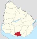
|map_caption = Location of Lomas de Solymar in Ciudad de la Costa |
|map_caption = Location of Lomas de Solymar in Ciudad de la Costa |
||
|coordinates_display = inline,title |
|||
|coordinates_region = UY-CA |
|||
|subdivision_type = Country |
|subdivision_type = Country |
||
|subdivision_name = [[Image:Flag of Uruguay.svg|25px]] [[Uruguay]] |
|subdivision_name = [[Image:Flag of Uruguay.svg|25px]] [[Uruguay]] |
||
| Line 20: | Line 18: | ||
|population_density_km2 = |
|population_density_km2 = |
||
|timezone = [[UTC]] -3 |
|timezone = [[UTC]] -3 |
||
|coordinates = {{coord|34|48|47|S|55|56|25|W|region:UY-CA|display=inline,title}} |
|||
|latd=34|latm=48|lats=47|latNS=S |
|||
|longd=55|longm=56|longs=25|longEW=W |
|||
|elevation_m = |
|elevation_m = |
||
|postal_code_type = Postal code |
|postal_code_type = Postal code |
||
| Line 29: | Line 26: | ||
|website = |
|website = |
||
}} |
}} |
||
'''Lomas de Solymar''', which also contains the area '''Médanos de Solymar''', is a residential neighbourhood and a resort of [[Ciudad de la Costa]] in [[Canelones Department|Canelones]], [[Uruguay]]. |
'''Lomas de Solymar''', which also contains the area '''Médanos de Solymar''', is a residential neighbourhood and a resort of [[Ciudad de la Costa]] in [[Canelones Department|Canelones]], [[Uruguay]]. |
||
== |
==Geography== |
||
This resort is located on the [[Ruta Interbalnearia]] between [[Solymar, Uruguay|Solymar]] to the west and [[El Pinar, Uruguay|El Pinar]] to the east. |
This resort is located on the [[Ruta Interbalnearia]] between [[Solymar, Uruguay|Solymar]] to the west and [[El Pinar, Uruguay|El Pinar]] to the east. |
||
==Population== |
==Population== |
||
In 2011 Lomas de Solymar had a population of 19,124.<ref>{{cite web |
In 2011 Lomas de Solymar had a population of 19,124.<ref>{{cite web|url=http://www.ine.gub.uy/censos2011/resultadosfinales/cuadros/NIVEL%20DEPARTAMENTAL/Canelones/P_3_CAN.xls |title=Censos 2011 Cuadros Canelones |format=XLS |date=2012 |publisher=INE |accessdate=25 August 2012 |url-status=dead |archiveurl=https://web.archive.org/web/20121010041513/http://www.ine.gub.uy/censos2011/resultadosfinales/cuadros/NIVEL%20DEPARTAMENTAL/Canelones/P_3_CAN.xls |archivedate=10 October 2012 }}</ref><ref>{{cite web|url=http://www.ine.gub.uy/censos2011/resultadosfinales/canelones.html |title=Censos 2011 Canelones (flash plugin needed) |date=2012 |publisher=INE |accessdate=25 August 2012 |url-status=dead |archiveurl=https://web.archive.org/web/20120907041709/http://www.ine.gub.uy/censos2011/resultadosfinales/canelones.html |archivedate=7 September 2012 }}</ref> |
||
{| class="wikitable" |
{| class="wikitable" |
||
! Year || Population |
! Year || Population |
||
| Line 51: | Line 48: | ||
| 2011 || 19,124 |
| 2011 || 19,124 |
||
|} |
|} |
||
Source: ''Instituto Nacional de Estadística de Uruguay''<ref>{{cite web |
Source: ''Instituto Nacional de Estadística de Uruguay''<ref>{{cite web|url=http://www.ine.gub.uy/biblioteca/toponimico/TOPOletraL.doc |title=1963–1996 Statistics / L |publisher=Instituto Nacional de Estadística de Uruguay |date=2004 |format=DOC |accessdate=3 July 2011 |url-status=dead |archiveurl=https://web.archive.org/web/20111129075121/http://www.ine.gub.uy/biblioteca/toponimico/TOPOletraL.doc |archivedate=29 November 2011 }}</ref> |
||
==Street map== |
==Street map== |
||
[[File:Map of Lomas de Solymar.png|thumb|260px|left|Street map of Lomas de Solymar]] |
[[File:Map of Lomas de Solymar.png|thumb|260px|left|Street map of Lomas de Solymar]] |
||
{{clear|left}} |
|||
==References== |
==References== |
||
{{reflist}} |
{{reflist}} |
||
==External links== |
==External links== |
||
*[http://www.ine.gub.uy/mapas/censos2011/para%20colgar%20en%20web/pdf/03_UYCA/Localidades/A1H_03732_953_987%20Solymar%20y%20otras.pdf INE map of Solymar, Lomas de Solymar and Colinas de Solymar] |
*[https://web.archive.org/web/20121010043713/http://www.ine.gub.uy/mapas/censos2011/para%20colgar%20en%20web/pdf/03_UYCA/Localidades/A1H_03732_953_987%20Solymar%20y%20otras.pdf INE map of Solymar, Lomas de Solymar and Colinas de Solymar] |
||
{{Ciudad de la Costa}} |
{{Ciudad de la Costa}} |
||
{{Canelones Department}} |
{{Canelones Department}} |
||
| ⚫ | |||
[[Category:Ciudad de la Costa]] |
[[Category:Ciudad de la Costa]] |
||
| ⚫ | |||
Latest revision as of 14:18, 29 January 2023
Lomas de Solymar
Lomas y Médanos de Solymar | |
|---|---|
Resort of Ciudad de la Costa | |
 Location of Lomas de Solymar in Ciudad de la Costa | |
| Coordinates: 34°48′47″S 55°56′25″W / 34.81306°S 55.94028°W | |
| Country | |
| Department | Canelones Department |
| Population (2011) | |
• Total | 19,124 |
| Time zone | UTC -3 |
| Postal code | 15006 & 15007 |
| Dial plan | +598 2 (+7 digits) |
Lomas de Solymar, which also contains the area Médanos de Solymar, is a residential neighbourhood and a resort of Ciudad de la Costa in Canelones, Uruguay.
Geography
[edit]This resort is located on the Ruta Interbalnearia between Solymar to the west and El Pinar to the east.
Population
[edit]In 2011 Lomas de Solymar had a population of 19,124.[1][2]
| Year | Population |
|---|---|
| 1963 | 135 |
| 1975 | 1,266 |
| 1985 | 3,974 |
| 1996 | 10,843 |
| 2004 | 16,018 |
| 2011 | 19,124 |
Source: Instituto Nacional de Estadística de Uruguay[3]
Street map
[edit]
References
[edit]- ^ "Censos 2011 Cuadros Canelones". INE. 2012. Archived from the original (XLS) on 10 October 2012. Retrieved 25 August 2012.
- ^ "Censos 2011 Canelones (flash plugin needed)". INE. 2012. Archived from the original on 7 September 2012. Retrieved 25 August 2012.
- ^ "1963–1996 Statistics / L". Instituto Nacional de Estadística de Uruguay. 2004. Archived from the original (DOC) on 29 November 2011. Retrieved 3 July 2011.
External links
[edit]

