Plácido Rosas: Difference between revisions
Appearance
Content deleted Content added
m r2.7.2) (Robot: Adding ca:Plácido Rosas, es:Plácido Rosas |
Tags: Mobile edit Mobile web edit |
||
| (14 intermediate revisions by 10 users not shown) | |||
| Line 3: | Line 3: | ||
|other_name = |
|other_name = |
||
|settlement_type = Village |
|settlement_type = Village |
||
|image_skyline = |
|image_skyline = Cartel de Plácido Rosas, Uruguay.jpg |
||
|imagesize = |
|imagesize = |
||
|image_caption = |
|image_caption = |
||
| Line 9: | Line 9: | ||
|pushpin_label_position = left |
|pushpin_label_position = left |
||
|pushpin_map_caption = Location in Uruguay |
|pushpin_map_caption = Location in Uruguay |
||
|coordinates_display = inline,title |
|||
|coordinates_region = UY-CL |
|||
|subdivision_type = Country |
|subdivision_type = Country |
||
|subdivision_name = {{flag|Uruguay}} |
|subdivision_name = {{flag|Uruguay}} |
||
| Line 20: | Line 18: | ||
|established_date = |
|established_date = |
||
|area_total_km2 = |
|area_total_km2 = |
||
|population_as_of = |
|population_as_of = 2011 |
||
|population_total = |
|population_total = 415 |
||
|population_density_km2 = |
|population_density_km2 = |
||
|timezone = [[UTC]] -3 |
|timezone = [[UTC]] -3 |
||
|coordinates = {{coord|32|45|0|S|53|43|0|W|region:UY-CL|display=inline,title}} |
|||
|latd=32|latm=45|lats=0|latNS=S |
|||
|longd=53|longm=43|longs=0|longEW=W |
|||
|elevation_m = |
|elevation_m = |
||
|postal_code_type = Postal code |
|postal_code_type = Postal code |
||
|postal_code = 37101 |
|postal_code = 37101 |
||
| |
|area_code_type = [[Telephone numbers in Uruguay|Dial plan]] |
||
|area_code = +598 4675 (+4 digits) |
|||
|website = |
|website = |
||
}} |
}} |
||
'''Plácido Rosas''' is a village or populated centre in the [[Cerro Largo Department]] of eastern [[Uruguay]]. |
'''Plácido Rosas''' is a village or populated centre in the [[Cerro Largo Department]] of eastern [[Uruguay]]. |
||
==Geography== |
|||
It is located on the north bank of [[Río Tacuarí]], near the bridge Paso del Dragóneast, over which Route 18 crosses the river. The railroad track Montevideo - Nico Pérez - Río Branco passes through the village. |
|||
==Population== |
==Population== |
||
In |
In 2011 Plácido Rosas had a population of 415.<ref>{{cite web |url=http://www.ine.gub.uy/censos2011/resultadosfinales/cerro%20largo.html |title=Censos 2011 Cerro Largo (needs flash plugin) |date=2012 |publisher=INE |accessdate=25 August 2012 |url-status=dead |archiveurl=https://web.archive.org/web/20130606130307/http://www.ine.gub.uy/censos2011/resultadosfinales/cerro%20largo.html |archivedate=6 June 2013 }}</ref> |
||
{| class="wikitable" |
{| class="wikitable" style="line-height:1.1em;" |
||
! Year || Population |
! Year || Population |
||
|- align="right" |
|- align="right" |
||
| Line 48: | Line 49: | ||
|- align="right" |
|- align="right" |
||
| 2004 || 459 |
| 2004 || 459 |
||
|- align="right" |
|||
| 2011 || 415 |
|||
|} |
|} |
||
Source: ''Instituto Nacional de Estadística de Uruguay''<ref>{{cite web |url=http://www.ine.gub.uy/biblioteca/toponimico/TOPOletraP.doc |title=1963–1996 Statistics / P |publisher= |
Source: ''Instituto Nacional de Estadística de Uruguay''<ref>{{cite web |url=http://www.ine.gub.uy/biblioteca/toponimico/TOPOletraP.doc |title=1963–1996 Statistics / P |publisher=Instituto Nacional de Estadística de Uruguay |date=2004 |format=DOC |accessdate=7 July 2011}}</ref> |
||
==References== |
==References== |
||
| Line 55: | Line 58: | ||
==External links== |
==External links== |
||
*[http://www.ine.gub.uy/mapas/ |
*[https://web.archive.org/web/20130309063937/http://www.ine.gub.uy/mapas/censos2011/para%20colgar%20en%20web/pdf/04_UYCL/Localidades/A3H_04827%20Pl%C3%A1cido%20Rosas.pdf INE map of Plácido Rosas] |
||
{{Cerro Largo Department}} |
{{Cerro Largo Department}} |
||
| ⚫ | |||
{{DEFAULTSORT:Placido Rosas}} |
{{DEFAULTSORT:Placido Rosas}} |
||
[[Category:Populated places in the Cerro Largo Department]] |
[[Category:Populated places in the Cerro Largo Department]] |
||
[[ca:Plácido Rosas]] |
|||
| ⚫ | |||
[[de:Plácido Rosas]] |
|||
[[es:Plácido Rosas]] |
|||
Latest revision as of 05:38, 2 February 2023
Plácido Rosas | |
|---|---|
Village | |
 | |
| Coordinates: 32°45′0″S 53°43′0″W / 32.75000°S 53.71667°W | |
| Country | |
| Department | Cerro Largo Department |
| Population (2011) | |
• Total | 415 |
| Time zone | UTC -3 |
| Postal code | 37101 |
| Dial plan | +598 4675 (+4 digits) |
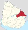
Plácido Rosas is a village or populated centre in the Cerro Largo Department of eastern Uruguay.
Geography
[edit]It is located on the north bank of Río Tacuarí, near the bridge Paso del Dragóneast, over which Route 18 crosses the river. The railroad track Montevideo - Nico Pérez - Río Branco passes through the village.
Population
[edit]In 2011 Plácido Rosas had a population of 415.[1]
| Year | Population |
|---|---|
| 1963 | 379 |
| 1975 | 428 |
| 1985 | 387 |
| 1996 | 402 |
| 2004 | 459 |
| 2011 | 415 |
Source: Instituto Nacional de Estadística de Uruguay[2]
References
[edit]- ^ "Censos 2011 Cerro Largo (needs flash plugin)". INE. 2012. Archived from the original on 6 June 2013. Retrieved 25 August 2012.
- ^ "1963–1996 Statistics / P" (DOC). Instituto Nacional de Estadística de Uruguay. 2004. Retrieved 7 July 2011.
External links
[edit]


