Isla Pitahaya, Baja California Sur: Difference between revisions
Appearance
Content deleted Content added
Farwestern (talk | contribs) No edit summary |
Remove Category:Islands of Mexico, already in subcategories, WP:CATSPECIFIC |
||
| (22 intermediate revisions by 17 users not shown) | |||
| Line 1: | Line 1: | ||
{{Infobox islands |
|||
| ⚫ | '''Isla Pitahaya''' is an island in [[Bahía Concepción, Baja California Sur|Bahía Concepción]] near Playa Santispac. The island's name is derived from the fact that the island has many tall |
||
| name = Isla Pitahaya |
|||
| image_name = Isla_Pitahaya_-_Playa_Santispac_-_Bahia_Conception_Island_360_pano.jpg |
|||
| image_size = 300px |
|||
| image_caption = View from atop the lighthouse of Isla Pitahaya in [[Bahía Concepción, Baja California Sur]]. |
|||
| ⚫ | |||
| map = Mexico |
|||
| map_caption = |
|||
| location = [[Gulf of California]] |
|||
| country = {{Flag|Mexico}} |
|||
}} |
|||
| ⚫ | '''Isla Pitahaya''' is an island in [[Bahía Concepción, Baja California Sur|Bahía Concepción]] near Playa Santispac, in [[Baja California Sur]]. The island's name is derived from the fact that the island has many tall [[Pitaya|pitahaya cacti]] that are clearly observable from afar. Isla Pitahaya also has a lighthouse.<ref name=ftgy>{{cite web|url=http://www.pramhus.com/MEXICO/bahia_concepcion.htm|title=Bahia Concepcion|accessdate=2009-12-25|archive-url=https://web.archive.org/web/20110715111420/http://www.pramhus.com/MEXICO/bahia_concepcion.htm|archive-date=2011-07-15|url-status=dead}}</ref> The southwest shore has a small white, sandy beach while the rest of the island is rocky. The island is about {{convert|1.5|mi}} from Playa Santispac and {{convert|0.5|mi}} from the nearest mainland shore. |
||
| ⚫ | |||
{{Panorama|image=Image:Isla_Pitahaya_-_Playa_Santispac_-_Bahia_Conception_Island_360_pano.jpg |fullwidth=24932 |fullheight=3429 |caption=360° Panorama from atop the lighthouse of Isla Pitahaya in [[Bahía Concepción, Baja California Sur]]. Several islands are visible in the bay: (left to right) Isla Coyote, Isla Blanca and Isla San Ramon. In the center is Playa Concepcion with its associated developments visible above island cacti. On the far right appears the eastern peninsula sandwiched between the eastern shores of Bahía Concepción and the [[Sea of Cortez]].|height=300}} |
|||
{{Portal|Islands}} |
|||
| ⚫ | |||
| ⚫ | |||
| ⚫ | |||
[[Category:Nature reserves in Mexico]] |
|||
[[Category:Islands of the Gulf of California]] |
|||
[[Category:Uninhabited islands of Mexico]] |
|||
| ⚫ | |||
| ⚫ | |||
{{BajaCaliforniaSur-geo-stub}} |
|||
| ⚫ | |||
Latest revision as of 21:31, 10 March 2023
View from atop the lighthouse of Isla Pitahaya in Bahía Concepción, Baja California Sur. | |
| Geography | |
|---|---|
| Location | Gulf of California |
| Coordinates | 26°45′06″N 111°52′20″W / 26.75161°N 111.872284°W |
| Administration | |
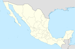
Isla Pitahaya is an island in Bahía Concepción near Playa Santispac, in Baja California Sur. The island's name is derived from the fact that the island has many tall pitahaya cacti that are clearly observable from afar. Isla Pitahaya also has a lighthouse.[1] The southwest shore has a small white, sandy beach while the rest of the island is rocky. The island is about 1.5 miles (2.4 km) from Playa Santispac and 0.5 miles (0.80 km) from the nearest mainland shore.
References
[edit]- ^ "Bahia Concepcion". Archived from the original on 2011-07-15. Retrieved 2009-12-25.

