Sutton-under-Brailes: Difference between revisions
Appearance
Content deleted Content added
Header changes per WP:UKVILLAGES / Fix WL / Ce / |
|||
| (8 intermediate revisions by 3 users not shown) | |||
| Line 1: | Line 1: | ||
{{Use dmy dates|date=April 2022}} |
|||
{{Infobox UK place |
{{Infobox UK place |
||
| official_name= Sutton-under-Brailes |
| official_name= Sutton-under-Brailes |
||
| Line 17: | Line 18: | ||
| area_total_km2=4.48 |
| area_total_km2=4.48 |
||
|static_image=Tower of Sutton under Brailes church - geograph.org.uk - 508147.jpg |
|static_image=Tower of Sutton under Brailes church - geograph.org.uk - 508147.jpg |
||
|static_image_caption= |
|static_image_caption=Church of St Thomas a Becket |
||
|website= |
|website= |
||
}} |
}} |
||
'''Sutton-under-Brailes''' is a village and [[civil parish]] {{convert|17|mi|km}} south of [[Warwick]],<ref>{{cite web|url=https://www.genuki.org.uk/gazetteer/howfar?from=128377&to=128441|title=Distance from Sutton under Brailes [52.032852, 1.564693]|publisher=[[GENUKI]]|accessdate=15 November 2020}}</ref> in the [[Stratford-on-Avon District|Stratford-on-Avon]] district of [[Warwickshire]], England. Adjacent |
'''Sutton-under-Brailes''' is a village and [[civil parish]] {{convert|17|mi|km}} south of [[Warwick]],<ref>{{cite web|url=https://www.genuki.org.uk/gazetteer/howfar?from=128377&to=128441|title=Distance from Sutton under Brailes [52.032852, 1.564693]|publisher=[[GENUKI]]|accessdate=15 November 2020}}</ref> in the [[Stratford-on-Avon District|Stratford-on-Avon]] district of [[Warwickshire]], [[England]]. Adjacent [[parish]]es are [[Barcheston]], [[Brailes]], [[Cherington, Warwickshire|Cherington]], [[Stourton, Warwickshire|Stourton]] and [[Whichford]].<ref>{{cite web|url=http://data.ordnancesurvey.co.uk/doc/7000000000009962|title=Sutton-under-Brailes|publisher=[[Ordnance Survey]]|accessdate=15 November 2020}}</ref> In 2001 the parish had a population of 89.<ref>[http://www.neighbourhood.statistics.gov.uk/dissemination/viewFullDataset.do?instanceSelection=03070&productId=779&$ph=60_61&datasetInstanceId=3070&startColumn=1&numberOfColumns=4&containerAreaId=790540 Neighbourhood Statistics]</ref> |
||
In 2001 the parish had a population of 89.<ref>[http://www.neighbourhood.statistics.gov.uk/dissemination/viewFullDataset.do?instanceSelection=03070&productId=779&$ph=60_61&datasetInstanceId=3070&startColumn=1&numberOfColumns=4&containerAreaId=790540 Neighbourhood Statistics]</ref> |
|||
== History == |
== History == |
||
The name "Sutton" means 'South farm/settlement', the "Brailes" part referring to being 2 miles south of Brailes.<ref>{{cite web|url=http://kepn.nottingham.ac.uk/map/place/Warwickshire/Sutton%20under%20Brailes|title=Sutton under Brailes Key to English Place-names|publisher=The University of Nottingham|accessdate=15 November 2020}}</ref> Sutton-under-Brailes was recorded in the [[Domesday Book]] as ''Sudtune''.<ref>{{cite web|url=http://www.domesdaybook.co.uk/warwickshire3.html#suttonunderbrailes|title=Warwickshire Q-Z|publisher=The Domesday Book Online|accessdate=15 November 2020}}</ref> Sutton under Brailes was formerly a detached parish of [[Gloucestershire]], in the 1840s it was transferred to Warwickshire.<ref>1844 according to{{cite web|url=https://www.genuki.org.uk/big/eng/WAR/SuttonunderBrailes|title=Sutton under Brailes|publisher=GENUKI|accessdate=15 November 2020}}</ref><ref> |
The name "Sutton" means 'South farm/settlement', the "[[Brailes]]" part referring to being 2 miles south of Brailes.<ref>{{cite web|url=http://kepn.nottingham.ac.uk/map/place/Warwickshire/Sutton%20under%20Brailes|title=Sutton under Brailes Key to English Place-names|publisher=The University of Nottingham|accessdate=15 November 2020}}</ref> Sutton-under-Brailes was recorded in the [[Domesday Book]] as ''Sudtune''.<ref>{{cite web|url=http://www.domesdaybook.co.uk/warwickshire3.html#suttonunderbrailes|title=Warwickshire Q-Z|publisher=The Domesday Book Online|accessdate=15 November 2020}}</ref> Sutton under Brailes was formerly a detached [[parish]] of [[Gloucestershire]], in the 1840s it was transferred to [[Warwickshire]].<ref>1844 according to {{cite web|url=https://www.genuki.org.uk/big/eng/WAR/SuttonunderBrailes|title=Sutton under Brailes|publisher=[[GENUKI]]|accessdate=15 November 2020}}</ref><ref> 1840 according to {{cite web|url=https://www.british-history.ac.uk/vch/warks/vol5/pp157-159|title=Parishes: Sutton-under-Brailes|publisher=[[British History Online]]|accessdate=15 November 2020}}</ref> |
||
== Landmarks == |
== Landmarks == |
||
There are 17 [[listed building]]s in Sutton-under-Brailes.<ref>{{cite web|url=https://britishlistedbuildings.co.uk/england/sutton-under-brailes-stratford-on-avon-warwickshire|title=Listed Buildings in Sutton-under-Brailes, Stratford-on-Avon, Warwickshire|publisher=British Listed Buildings|accessdate=15 November 2020}}</ref> |
There are 17 [[listed building]]s in Sutton-under-Brailes.<ref>{{cite web|url=https://britishlistedbuildings.co.uk/england/sutton-under-brailes-stratford-on-avon-warwickshire|title=Listed Buildings in Sutton-under-Brailes, Stratford-on-Avon, Warwickshire|publisher=British Listed Buildings|accessdate=15 November 2020}}</ref> The [[Church of England parish church|parish church]] is dedicated to [[Thomas Becket|St Thomas a Becket]].<ref>{{cite web|url=https://southfeldongroup.org/sutton.html|title=St Thomas a Becket church Sutton under Brailes|publisher=South Feldon Group|accessdate=15 November 2020}}</ref> |
||
== References == |
== References == |
||
{{Reflist}} |
{{Reflist}} |
||
==Source== |
|||
{{refbegin}} |
|||
* {{cite web|url=https://www.citypopulation.de/en/uk/westmidlands/admin/stratford_on_avon/E04009789__sutton_under_brailes/|title=Sutton-under-Brailes|publisher=City Population De.|accessdate=15 November 2020}} |
* {{cite web|url=https://www.citypopulation.de/en/uk/westmidlands/admin/stratford_on_avon/E04009789__sutton_under_brailes/|title=Sutton-under-Brailes|publisher=City Population De.|accessdate=15 November 2020}} |
||
{{refend}} |
|||
{{Commons cat|Sutton-under-Brailes}} |
{{Commons cat|Sutton-under-Brailes}} |
||
| ⚫ | |||
[[Category:Villages in Warwickshire]] |
[[Category:Villages in Warwickshire]] |
||
[[Category:Civil parishes in Warwickshire]] |
[[Category:Civil parishes in Warwickshire]] |
||
[[Category:Stratford-on-Avon District]] |
[[Category:Stratford-on-Avon District]] |
||
[[Category:English churches dedicated to St Thomas Becket]] |
|||
| ⚫ | |||
{{Warwickshire-geo-stub}} |
{{Warwickshire-geo-stub}} |
||
Latest revision as of 15:13, 27 March 2023
| Sutton-under-Brailes | |
|---|---|
 Church of St Thomas a Becket | |
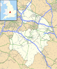
Location within Warwickshire | |
| Area | 4.48 km2 (1.73 sq mi) |
| Population | 89 (2001 census) |
| • Density | 20/km2 (52/sq mi) |
| Civil parish |
|
| District | |
| Shire county | |
| Region | |
| Country | England |
| Sovereign state | United Kingdom |
Sutton-under-Brailes is a village and civil parish 17 miles (27 km) south of Warwick,[1] in the Stratford-on-Avon district of Warwickshire, England. Adjacent parishes are Barcheston, Brailes, Cherington, Stourton and Whichford.[2] In 2001 the parish had a population of 89.[3]
History
[edit]The name "Sutton" means 'South farm/settlement', the "Brailes" part referring to being 2 miles south of Brailes.[4] Sutton-under-Brailes was recorded in the Domesday Book as Sudtune.[5] Sutton under Brailes was formerly a detached parish of Gloucestershire, in the 1840s it was transferred to Warwickshire.[6][7]
Landmarks
[edit]There are 17 listed buildings in Sutton-under-Brailes.[8] The parish church is dedicated to St Thomas a Becket.[9]
References
[edit]- ^ "Distance from Sutton under Brailes [52.032852, 1.564693]". GENUKI. Retrieved 15 November 2020.
- ^ "Sutton-under-Brailes". Ordnance Survey. Retrieved 15 November 2020.
- ^ Neighbourhood Statistics
- ^ "Sutton under Brailes Key to English Place-names". The University of Nottingham. Retrieved 15 November 2020.
- ^ "Warwickshire Q-Z". The Domesday Book Online. Retrieved 15 November 2020.
- ^ 1844 according to "Sutton under Brailes". GENUKI. Retrieved 15 November 2020.
- ^ 1840 according to "Parishes: Sutton-under-Brailes". British History Online. Retrieved 15 November 2020.
- ^ "Listed Buildings in Sutton-under-Brailes, Stratford-on-Avon, Warwickshire". British Listed Buildings. Retrieved 15 November 2020.
- ^ "St Thomas a Becket church Sutton under Brailes". South Feldon Group. Retrieved 15 November 2020.
Source
[edit]- "Sutton-under-Brailes". City Population De. Retrieved 15 November 2020.
Wikimedia Commons has media related to Sutton-under-Brailes.


