Zamora Municipality, Aragua: Difference between revisions
named for, d unnecessary see also |
Fix Linter errors. (wikilink inside external link) |
||
| (36 intermediate revisions by 28 users not shown) | |||
| Line 1: | Line 1: | ||
{{Other uses|Zamora (disambiguation){{!}}Zamora}} |
|||
{{Infobox Venezuelan municipality |
|||
{{Infobox settlement |
|||
|name= Zamora |
|||
| name = Zamora Municipality |
|||
|image_map= Zamora-aragua.PNG |
|||
| official_name = |
|||
| ⚫ | |||
| other_name = |
|||
|shiretown= [[Villa de Cura]] |
|||
| native_name = Municipio Zamora |
|||
|latd = 10|latm = 02|lats = |latNS = N |
|||
| native_name_lang = es |
|||
|longd = 67|longm = 29|longs = |longEW = W |
|||
| nickname = |
|||
|coordinates_type = source:svwiki_region:VE_type:city |
|||
| settlement_type = [[Municipalities of Venezuela|Municipality]] |
|||
|coordinates_display = title |
|||
| image_skyline = |
|||
|area_total_km2= 649 |
|||
| image_caption = |
|||
| ⚫ | |||
| image_flag = {{#property:P41}} |
|||
| ⚫ | |||
| flag_size = 100px |
|||
|population_density= auto |
|||
| image_seal = {{#property:P94}} |
|||
|mayor= Aldo Lovera |
|||
| seal_size = 100px |
|||
| ⚫ | |||
| image_map = {{#property:P242}} |
|||
| ⚫ | |||
| mapsize = 300px |
|||
|website= http://zamora-aragua.gob.ve/portal-alcaldias/ |
|||
| map_caption = Location in [[Aragua (state)|Aragua]] |
|||
| pushpin_map = Venezuela |
|||
| pushpin_label_position = |
|||
| pushpin_map_alt = Map showing the location of Zamora Municipality within Venezuela |
|||
| pushpin_mapsize = 300px |
|||
| pushpin_map_caption = Location in Venezuela |
|||
| coordinates = {{coord|nosave=1|format=dms|display=inline,title}} |
|||
| subdivision_type = Country |
|||
| subdivision_name = {{flag|Venezuela}} |
|||
| subdivision_type1 = [[States of Venezuela|State]] |
|||
| ⚫ | |||
| seat_type = [[Municipal seat]] |
|||
| seat = {{#invoke:Wikidata|getValue|P36|FETCH_WIKIDATA}} |
|||
| leader_title = [[Mayor]] |
|||
| leader_name = Aldo Lovera |
|||
| ⚫ | |||
| elevation_m = |
|||
| area_total_km2 = {{#invoke:String|replace|{{#invoke:String|replace|{{#invoke:String|replace|{{#property:P2046}}|±0 |replace=}}|square kilometre|replace=}}|pattern=,|replace=}} |
|||
| ⚫ | |||
| population_note = |
|||
| ⚫ | |||
| population_footnotes = |
|||
| population_density_km2 = auto |
|||
| established_title = Founded |
|||
| established_date = |
|||
| established_title1 = Established |
|||
| established_date1 = |
|||
| established_title2 = Incorporated |
|||
| established_date2 = |
|||
| timezone = [[Venezuelan Standard Time Zone|VET]] |
|||
| utc_offset = −4 |
|||
| area_code_type = [[Telephone numbers in Venezuela|Area code(s)]] |
|||
| ⚫ | |||
| postal_code_type = [[Postal code]](s) |
|||
| postal_code = |
|||
| website = |
|||
| footnotes = {{main other|{{EditOnWikidata}}}} |
|||
}} |
}} |
||
'''Zamora Municipality''' is one of the 18 [[Municipalities of Venezuela|municipalities]] ([[municipio]]s) that makes up the [[Venezuela]]n state of [[Aragua (state)|Aragua]] and, according to the 2011 census by the National Institute of Statistics of Venezuela, the municipality has a population of 144,759.<ref>http://www.geohive.com/cntry/venezuela_ext.aspx {{Dead link|date=August 2022}}</ref> The town of [[Villa de Cura]] is the [[municipal seat]] of the Zamora Municipality.<ref name=autogenerated1>http://www.ine.gob.ve/secciones/division/Aragua.zip {{dead link|date=July 2016 |bot=InternetArchiveBot |fix-attempted=yes }}</ref> |
|||
==Name== |
|||
The municipality is one of several named "[[Zamora Municipality (disambiguation)|Zamora Municipality]]" for the 19th century Venezuelan soldier [[Ezequiel Zamora]]. |
|||
==History== |
==History== |
||
| Line 24: | Line 64: | ||
==Demographics== |
==Demographics== |
||
The Zamora Municipality, according to a 2007 population estimate by the National Institute of Statistics of Venezuela, has a population of 145,742 (up from 127,595 in 2000). This amounts to 8.8% of the state's population.<ref>http://www.ine.gob.ve/sintesisestadistica/estados/aragua/cuadros/Poblacion5.xls</ref> The municipality's population density is {{convert|224.56|PD/sqkm}}.<ref>http://www.ine.gob.ve/sintesisestadistica/estados/aragua/cuadros/Poblacion4.xls</ref> |
The Zamora Municipality, according to a 2007 population estimate by the National Institute of Statistics of Venezuela, has a population of 145,742 (up from 127,595 in 2000). This amounts to 8.8% of the state's population.<ref>http://www.ine.gob.ve/sintesisestadistica/estados/aragua/cuadros/Poblacion5.xls {{dead link|date=July 2016 |bot=InternetArchiveBot |fix-attempted=yes }}</ref> The municipality's population density is {{convert|224.56|PD/sqkm}}.<ref>http://www.ine.gob.ve/sintesisestadistica/estados/aragua/cuadros/Poblacion4.xls {{dead link|date=July 2016 |bot=InternetArchiveBot |fix-attempted=yes }}</ref> |
||
==Government== |
==Government== |
||
The mayor of the Zamora Municipality is Aldo Lovera, elected on November 23, 2008 with 55% of the vote.<ref>http://www.cne.gob.ve/divulgacion_regionales_2008/index.php?e=04&m=00&p=00&c=00&t=00&ca=00&v=02</ref> He replaced Stefano Mangione shortly after the elections. The municipality is divided into five [[ |
The mayor of the Zamora Municipality is Aldo Lovera, elected on November 23, 2008, with 55% of the vote.<ref>{{cite web | url=http://www.cne.gob.ve/divulgacion_regionales_2008/index.php?e=04&m=00&p=00&c=00&t=00&ca=00&v=02 | title=Divulgación Elecciones Regionales - 23 de Noviembre de 2008 }}</ref> He replaced Stefano Mangione shortly after the elections. The municipality is divided into five [[parish]]es; Capital Zamora, Magdaleno, [[:es:San Francisco de Asís (Venezuela)|San Francisco de Asís]], Valles de Tucutunemo, and Augusto Mijares (separated from San Francisco de Asís parish effective 16/12/97).<ref name=autogenerated1 /> |
||
==References== |
==References== |
||
{{ |
{{Reflist|2}} |
||
==External links== |
==External links== |
||
*[http://zamora-aragua.gob.ve/portal-alcaldias/ zamora-aragua.gob.ve] {{ |
*[http://zamora-aragua.gob.ve/portal-alcaldias/ zamora-aragua.gob.ve] {{Dead link|date=September 2018 |bot=InternetArchiveBot |fix-attempted=yes }} {{in lang|es}} |
||
{{Authority control}} |
|||
| ⚫ | |||
{{DEFAULTSORT:Zamora Municipality}} |
{{DEFAULTSORT:Zamora Municipality}} |
||
[[Category:Municipalities of Aragua]] |
[[Category:Municipalities of Aragua]] |
||
[[an:Monezipio Zamora (Aragua)]] |
|||
| ⚫ | |||
[[es:Municipio Zamora (Aragua)]] |
|||
[[nl:Zamora (Aragua)]] |
|||
[[pt:Zamora (Aragua)]] |
|||
[[sv:Villa de Cura]] |
|||
Latest revision as of 17:42, 8 June 2023
Zamora Municipality
Municipio Zamora | |
|---|---|
 Location in Aragua | |
| Coordinates: 10°03′05″N 67°29′11″W / 10.0514°N 67.4864°W | |
| Country | |
| State | Aragua |
| Municipal seat | Villa de Cura |
| Government | |
| • Mayor | Aldo Lovera (PSUV) |
| Area | |
• Total | 689.3 km2 (266.1 sq mi) |
| Population (2011) | |
• Total | 144,759 |
| • Density | 210/km2 (540/sq mi) |
| Time zone | UTC−4 (VET) |
| Area code(s) | 0244 |
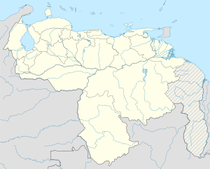
Zamora Municipality is one of the 18 municipalities (municipios) that makes up the Venezuelan state of Aragua and, according to the 2011 census by the National Institute of Statistics of Venezuela, the municipality has a population of 144,759.[1] The town of Villa de Cura is the municipal seat of the Zamora Municipality.[2]
Name
[edit]The municipality is one of several named "Zamora Municipality" for the 19th century Venezuelan soldier Ezequiel Zamora.
History
[edit]The city of Villa de Cura was founded on May 25, 1722.
Demographics
[edit]The Zamora Municipality, according to a 2007 population estimate by the National Institute of Statistics of Venezuela, has a population of 145,742 (up from 127,595 in 2000). This amounts to 8.8% of the state's population.[3] The municipality's population density is 224.56 inhabitants per square kilometre (581.6/sq mi).[4]
Government
[edit]The mayor of the Zamora Municipality is Aldo Lovera, elected on November 23, 2008, with 55% of the vote.[5] He replaced Stefano Mangione shortly after the elections. The municipality is divided into five parishes; Capital Zamora, Magdaleno, San Francisco de Asís, Valles de Tucutunemo, and Augusto Mijares (separated from San Francisco de Asís parish effective 16/12/97).[2]
References
[edit]- ^ http://www.geohive.com/cntry/venezuela_ext.aspx [dead link]
- ^ a b http://www.ine.gob.ve/secciones/division/Aragua.zip [permanent dead link]
- ^ http://www.ine.gob.ve/sintesisestadistica/estados/aragua/cuadros/Poblacion5.xls [permanent dead link]
- ^ http://www.ine.gob.ve/sintesisestadistica/estados/aragua/cuadros/Poblacion4.xls [permanent dead link]
- ^ "Divulgación Elecciones Regionales - 23 de Noviembre de 2008".
External links
[edit]- zamora-aragua.gob.ve [permanent dead link] (in Spanish)


