Shaley: Difference between revisions
Appearance
Content deleted Content added
m hyphen bypass, replaced: National Geospatial Intelligence Agency → National Geospatial-Intelligence Agency |
|||
| (One intermediate revision by one other user not shown) | |||
| Line 122: | Line 122: | ||
|footnotes = |
|footnotes = |
||
}} |
}} |
||
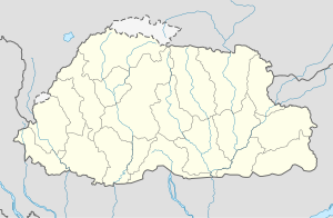
'''Shaley Vally''' is a village in [[Wangdue Phodrang District]] in central [[Bhutan]].<ref>{{cite web|url=http://geonames.nga.mil/ggmagaz/geonames4.asp |title=NGA GeoName Database |publisher=[[National Geospatial |
'''Shaley Vally''' is a village in [[Wangdue Phodrang District]] in central [[Bhutan]].<ref>{{cite web|url=http://geonames.nga.mil/ggmagaz/geonames4.asp |title=NGA GeoName Database |publisher=[[National Geospatial-Intelligence Agency]] |accessdate=2008-07-05 |archiveurl=https://web.archive.org/web/20080608190852/http://geonames.nga.mil/ggmagaz/geonames4.asp |archivedate=2008-06-08 |url-status=dead }}</ref> |
||
==References== |
==References== |
||
| Line 131: | Line 131: | ||
[[Category:Populated places in Bhutan]] |
[[Category:Populated places in Bhutan]] |
||
{{Bhutan-geo-stub}} |
{{Bhutan-geo-stub}} |
||
Latest revision as of 02:41, 16 June 2023
Shaley | |
|---|---|
| Coordinates: 27°22′N 89°58′E / 27.367°N 89.967°E | |
| Country | |
| District | Wangdue Phodrang District |
| Time zone | UTC+6 (BTT) |
Shaley Vally is a village in Wangdue Phodrang District in central Bhutan.[1]
References
[edit]- ^ "NGA GeoName Database". National Geospatial-Intelligence Agency. Archived from the original on 2008-06-08. Retrieved 2008-07-05.
External links
[edit]

