Kewabania: Difference between revisions
Appearance
Content deleted Content added
m Robot - Moving category Cities, towns and villages in Barguna District to Populated places in Barguna District per CFD at Wikipedia:Categories for discussion/Log/2010 May 28. |
m →top: hyphen bypass, replaced: National Geospatial Intelligence Agency → National Geospatial-Intelligence Agency |
||
| (7 intermediate revisions by 6 users not shown) | |||
| Line 1: | Line 1: | ||
| ⚫ | |||
{{Orphan|date=February 2009}} |
|||
| ⚫ | |||
<!--See the Table at Infobox Settlement for all fields and descriptions of usage--> |
<!--See the Table at Infobox Settlement for all fields and descriptions of usage--> |
||
<!-- Basic info ----------------> |
<!-- Basic info ----------------> |
||
| Line 15: | Line 14: | ||
|image_flag = |
|image_flag = |
||
|flag_size = |
|flag_size = |
||
|image_seal = |
|||
|seal_size = |
|||
|image_shield = |
|||
|shield_size = |
|||
|image_blank_emblem = |
|||
|blank_emblem_type = |
|||
|blank_emblem_size = |
|||
|image_map = |
|image_map = |
||
|mapsize = |
|mapsize = |
||
| Line 67: | Line 59: | ||
|established_date3 = |
|established_date3 = |
||
<!-- Area ---------------------> |
<!-- Area ---------------------> |
||
|area_magnitude = |
|||
|unit_pref =Imperial <!--Enter: Imperial, if Imperial (metric) is desired--> |
|||
|area_footnotes = |
|area_footnotes = |
||
|area_total_km2 = <!-- ALL fields dealing with a measurements are subject to automatic unit conversion--> |
|area_total_km2 = <!-- ALL fields dealing with a measurements are subject to automatic unit conversion--> |
||
|area_land_km2 = <!--See table @ Template:Infobox Settlement for details on automatic unit conversion--> |
|||
|area_water_km2 = |
|||
|area_total_sq_mi = |
|||
|area_land_sq_mi = |
|||
|area_water_sq_mi = |
|||
|area_water_percent = |
|||
|area_urban_km2 = |
|||
|area_urban_sq_mi = |
|||
|area_metro_km2 = |
|area_metro_km2 = |
||
|area_metro_sq_mi = |
|||
|area_blank1_title = |
|||
|area_blank1_km2 = |
|||
|area_blank1_sq_mi = |
|||
<!-- Population -----------------------> |
<!-- Population -----------------------> |
||
|population_as_of = |
|population_as_of = |
||
|population_footnotes = |
|population_footnotes = |
||
|population_note = |
|||
|population_total = |
|population_total = |
||
|population_density_km2 = |
|population_density_km2 = |
||
|population_density_sq_mi = |
|||
|population_metro = |
|||
|population_density_metro_km2 = |
|||
|population_density_metro_sq_mi = |
|||
|population_urban = |
|||
|population_density_urban_km2 = |
|||
|population_density_urban_sq_mi = |
|||
|population_blank1_title =Ethnicities |
|||
|population_blank1 = |
|||
|population_blank2_title =Religions |
|||
|population_blank2 = |
|||
|population_density_blank1_km2 = |
|||
|population_density_blank1_sq_mi = |
|||
<!-- General information ---------------> |
<!-- General information ---------------> |
||
|timezone = [[Bangladesh Standard Time|Bangladesh Time]] |
|timezone = [[Bangladesh Standard Time|Bangladesh Time]] |
||
|utc_offset = +6 |
|utc_offset = +6 |
||
|coordinates = {{coord|22|16|N|90|16|E|region:BD|display=inline,title}} |
|||
|timezone_DST = |
|||
|utc_offset_DST = |
|||
|latd=22 |latm=16|lats= |latNS=N |
|||
|longd=90|longm=16|longs=|longEW=E |
|||
|elevation_footnotes = <!--for references: use <ref> </ref> tags--> |
|elevation_footnotes = <!--for references: use <ref> </ref> tags--> |
||
|elevation_m = |
|elevation_m = |
||
| Line 116: | Line 77: | ||
|postal_code_type = <!-- enter ZIP code, Postcode, Post code, Postal code... --> |
|postal_code_type = <!-- enter ZIP code, Postcode, Post code, Postal code... --> |
||
|postal_code = |
|postal_code = |
||
|area_code = |
|||
|blank_name = |
|||
|blank_info = |
|||
|blank1_name = |
|||
|blank1_info = |
|||
|website = |
|website = |
||
|footnotes = |
|footnotes = |
||
}} |
}} |
||
''' Kewabania''' is a |
''' Kewabania''' is a village in [[Barguna District]] in the [[Barisal Division]] of southern-central [[Bangladesh]].<ref>{{cite web|url=http://geonames.nga.mil/ggmagaz/geonames4.asp |title=NGA GeoName Database |publisher=[[National Geospatial-Intelligence Agency]] |accessdate=2008-07-14 |url-status=dead |archiveurl=https://web.archive.org/web/20080608190852/http://geonames.nga.mil/ggmagaz/geonames4.asp |archivedate=2008-06-08 }}</ref> |
||
==References== |
==References== |
||
| Line 131: | Line 86: | ||
==External links== |
==External links== |
||
*[http://www.maplandia.com/bangladesh/barisal-div/barguna-zl/kewabania/ Satellite map at Maplandia.com] |
* [http://www.maplandia.com/bangladesh/barisal-div/barguna-zl/kewabania/ Satellite map at Maplandia.com] |
||
| ⚫ | |||
| ⚫ | |||
| ⚫ | |||
| ⚫ | |||
Latest revision as of 02:59, 16 June 2023
Kewabania | |
|---|---|
| Coordinates: 22°16′N 90°16′E / 22.267°N 90.267°E | |
| Country | |
| Division | Barisal Division |
| District | Barguna District |
| Time zone | UTC+6 (Bangladesh Time) |
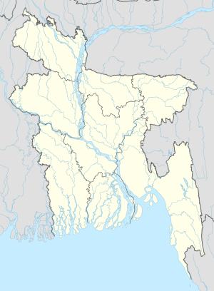
Kewabania is a village in Barguna District in the Barisal Division of southern-central Bangladesh.[1]
References
[edit]- ^ "NGA GeoName Database". National Geospatial-Intelligence Agency. Archived from the original on 2008-06-08. Retrieved 2008-07-14.
External links
[edit]

