Ambohimahamasina: Difference between revisions
Appearance
Content deleted Content added
Sadalmelik (talk | contribs) cat |
elevation |
||
| (22 intermediate revisions by 17 users not shown) | |||
| Line 1: | Line 1: | ||
{{Orphan|date=July 2006}} |
|||
'''Ambohimahamasina''' is a town in central [[Fianarantsoa Province]] in central [[Madagascar]]. |
|||
{{Infobox settlement |
|||
{{coor title dm|21|56|S|47|11|E|region:MG_type:city}} |
|||
<!--See Template:Infobox Settlement for additional fields that may be available--> |
|||
[[Category:Cities in Madagascar]] |
|||
<!--See the Table at Infobox Settlement for all fields and descriptions of usage--> |
|||
[[Category:Fianarantsoa Province]] |
|||
<!-- Basic info ----------------> |
|||
|name = <!-- at least one of the first two fields must be filled in --> |
|||
|official_name = Ambohimahamasina |
|||
|other_name = |
|||
|native_name = <!-- if different from the English name --> |
|||
|nickname = |
|||
|settlement_type = <!-- e.g. Town, Village, City, etc.--> |
|||
|total_type = <!-- to set a non-standard label for total area and population rows --> |
|||
|motto = |
|||
<!-- images and maps -----------> |
|||
|image_skyline = Pont à l'entrée de la commune d'Ambohimahamasina.JPG |
|||
|imagesize = 300px |
|||
|image_caption = Bridge entering Ambohimahamasina |
|||
|image_flag = |
|||
|flag_size = |
|||
|image_seal = |
|||
|seal_size = |
|||
|image_shield = |
|||
|shield_size = 100px |
|||
|image_blank_emblem = |
|||
|blank_emblem_type = |
|||
|blank_emblem_size = |
|||
|image_map = |
|||
|mapsize = |
|||
|map_caption = |
|||
|image_map1 = |
|||
|mapsize1 = |
|||
|map_caption1 = |
|||
|pushpin_map = Madagascar <!-- the name of a location map as per http://en.wikipedia.org/wiki/Template:Location_map --> |
|||
|pushpin_label_position = <!-- the position of the pushpin label: left, right, top, bottom, none --> |
|||
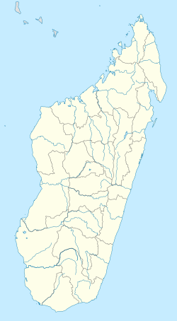
|pushpin_map_caption = Location in Madagascar |
|||
|pushpin_mapsize = |
|||
<!-- Location ------------------> |
|||
|subdivision_type = Country |
|||
|subdivision_name = {{MAD}} |
|||
|subdivision_type1 = Region |
|||
|subdivision_name1 = [[Haute Matsiatra]] |
|||
|subdivision_type2 = District |
|||
|subdivision_name2 = [[Ambalavao District]] |
|||
<!-- Politics -----------------> |
|||
|government_footnotes = |
|||
|government_type = |
|||
|leader_title = |
|||
|leader_name = |
|||
|leader_title1 = <!-- for places with, say, both a mayor and a city manager --> |
|||
|leader_name1 = |
|||
|established_title = <!-- Settled --> |
|||
|established_date = |
|||
<!-- Area ---------------------> |
|||
|area_magnitude = |
|||
|unit_pref = <!--Enter: Imperial, to display imperial before metric--> |
|||
|area_footnotes = |
|||
|area_total_km2 = <!-- ALL fields with measurements are subject to automatic unit conversion--> |
|||
|area_land_km2 = <!--See table @ Template:Infobox Settlement for details on unit conversion--> |
|||
|area_water_km2 = |
|||
|area_total_sq_mi = |
|||
|area_land_sq_mi = |
|||
|area_water_sq_mi = |
|||
|area_water_percent = |
|||
<!-- Elevation --------------------------> |
|||
|elevation_footnotes = <!--for references: use <ref> </ref> tags--> |
|||
|elevation_m = 1009 |
|||
|elevation_ft = |
|||
|elevation_max_m = |
|||
|elevation_max_ft = |
|||
|elevation_min_m = |
|||
|elevation_min_ft = |
|||
<!-- Population -----------------------> |
|||
|population_as_of =2018 |
|||
|population_footnotes = Census |
|||
|population_note = |
|||
|population_total = 23949 |
|||
|population_density_km2 = <!--For automatic calculation, any density field may contain: auto --> |
|||
|population_density_sq_mi = |
|||
|population_blank1_title = Ethnicities |
|||
|population_blank1 = |
|||
<!-- General information ---------------> |
|||
|timezone = |
|||
|utc_offset = |
|||
|timezone_DST = |
|||
|utc_offset_DST = |
|||
|coor_type = <!-- can be used to specify what the coordinates refer to --> |
|||
|coordinates = {{Coord|21|56|S|47|11|E|region:MG_type:city|display=title}} |
|||
|blank1_name_sec2 = Climate |
|||
|blank1_info_sec2 = |
|||
<!-- Area/postal codes & others --------> |
|||
|postal_code_type = Postal code |
|||
|postal_code = 303 |
|||
|area_code = |
|||
|website = |
|||
|footnotes = |
|||
}} |
|||
{{Madagascar-geo-stub}} |
|||
'''Ambohimahamasina''' is a rural municipality in the [[Ambalavao District]] in [[Haute Matsiatra]] Region in central [[Madagascar]]. |
|||
It is situated near the [[Andringitra National Park]]. Ambohimahamasina can be reached by the [[RIP 201|Provincial road 201]] from [[Ambalavao]] (39 km). |
|||
==Rivers== |
|||
It is situated at the [[Mananatana]] river. |
|||
==References== |
|||
{{Reflist}} |
|||
{{Haute Matsiatra Region}} |
|||
[[Category:Populated places in Haute Matsiatra]] |
|||
{{HauteMatsiatra-geo-stub}} |
|||
Latest revision as of 03:48, 10 August 2023
Ambohimahamasina | |
|---|---|
 Bridge entering Ambohimahamasina | |
| Coordinates: 21°56′S 47°11′E / 21.933°S 47.183°E | |
| Country | |
| Region | Haute Matsiatra |
| District | Ambalavao District |
| Elevation | 1,009 m (3,310 ft) |
| Population (2018)Census | |
• Total | 23,949 |
| Postal code | 303 |
Ambohimahamasina is a rural municipality in the Ambalavao District in Haute Matsiatra Region in central Madagascar.
It is situated near the Andringitra National Park. Ambohimahamasina can be reached by the Provincial road 201 from Ambalavao (39 km).
Rivers
[edit]It is situated at the Mananatana river.
References
[edit]


