Nosara Airport: Difference between revisions
Fixed typo Tags: Mobile edit Mobile web edit |
|||
| (2 intermediate revisions by 2 users not shown) | |||
| Line 33: | Line 33: | ||
}} |
}} |
||
'''Nosara Airport''' {{airport codes|NOB|MRNS}} is an airport serving [[Nosara]], a village in the [[Guanacaste Province]] of [[Costa Rica]]. The airport is approximately 15 minutes from the beaches of Nosara, the main tourist attraction in the area. The airport is owned and |
'''Nosara Airport''' {{airport codes|NOB|MRNS}} is an airport serving [[Nosara]], a village in the [[Guanacaste Province]] of [[Costa Rica]]. The airport is approximately 15 minutes from the beaches of Nosara, the main tourist attraction in the area. The airport is owned and administered by the country's [[Dirección General de Aviación Civil (Costa Rica)|Directorate General of Civil Aviation]] (DGAC). |
||
Nosara Airport receives only domestic flights, but has daily scheduled service from the Costa Rican capital, [[Juan Santamaría International Airport|San José]]. |
Nosara Airport receives only domestic flights, but has daily scheduled service from the Costa Rican capital, [[Juan Santamaría International Airport|San José]]. |
||
| Line 41: | Line 41: | ||
==Airlines and destinations== |
==Airlines and destinations== |
||
{{Airport-dest-list |
{{Airport-dest-list |
||
| [[Sansa Airlines]] | [[ |
| [[Sansa Airlines]] | [[Daniel Oduber International Airport|Liberia]], [[Juan Santamaría International Airport|San José–Juan Santamaría]]}} |
||
==Passenger Statistics== |
==Passenger Statistics== |
||
Latest revision as of 16:31, 24 August 2023
Nosara Airport | |||||||||||
|---|---|---|---|---|---|---|---|---|---|---|---|
| Summary | |||||||||||
| Airport type | Public | ||||||||||
| Operator | DGAC | ||||||||||
| Serves | Nosara, Costa Rica | ||||||||||
| Elevation AMSL | 33 ft / 10 m | ||||||||||
| Coordinates | 9°58′35″N 85°39′10″W / 9.97639°N 85.65278°W | ||||||||||
| Map | |||||||||||
 | |||||||||||
| Runways | |||||||||||
| |||||||||||
| Statistics (2014) | |||||||||||
| |||||||||||
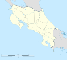
Nosara Airport (IATA: NOB, ICAO: MRNS) is an airport serving Nosara, a village in the Guanacaste Province of Costa Rica. The airport is approximately 15 minutes from the beaches of Nosara, the main tourist attraction in the area. The airport is owned and administered by the country's Directorate General of Civil Aviation (DGAC).
Nosara Airport receives only domestic flights, but has daily scheduled service from the Costa Rican capital, San José.
The airport is 3 kilometres (1.9 mi) inland from the Pacific coast. The runway length includes a 125 metres (410 ft) displaced threshold on Runway 04. There is nearby low mountainous terrain north of the airport, and also east through south.
Airlines and destinations
[edit]| Airlines | Destinations |
|---|---|
| Sansa Airlines | Liberia, San José–Juan Santamaría |
Passenger Statistics
[edit]These data show number of passengers movements into the airport, according to the DGAC Statistical Yearbooks.
| Year | 2008 | 2009 | 2010 | 2011 | 2012 | 2013 | 2014 | 2015 |
|---|---|---|---|---|---|---|---|---|
| Passengers | 6,284 | 7,392 | 7,420 | 7,417 | 6,513 | 6,679 | 7,350 | T.B.A. |
| Growth (%) | T.B.A. | |||||||
| Source: Costa Rica's Directorate General of Civil Aviation (DGAC). Statistical Yearbooks (Years 2008,[5] 2009,[6] 2010,[7] 2011,[8] 2012,[9] 2013,[10] and 2014[1]) | ||||||||
| Year | 2000 | 2001 | 2002 | 2003 | 2004 | 2005 | 2006 | 2007 |
|---|---|---|---|---|---|---|---|---|
| Passengers | 2,214 | 3,672 | 4,754 | 5,686 | 6,195 | 7,095 | 7,639 | 9,056 |
| Growth (%) | N.A. | |||||||
| Source: Costa Rica's Directorate General of Civil Aviation (DGAC). Statistical Yearbooks (Years 2000-2005,[11] 2006,[12] and 2007,[13]) | ||||||||
See also
[edit]References
[edit]- ^ a b DGAC Yearbooks 2014 Archived 2016-03-04 at the Wayback Machine
- ^ Aeronautical Information Publication (AIP) of Costa Rica, Section III (Airstrips) Archived 2016-03-04 at the Wayback Machine
- ^ Airport information for Nosara Airport at Great Circle Mapper.
- ^ SkyVector Nosara Airport
- ^ DGAC Yearbooks 2008 Archived 2016-03-04 at the Wayback Machine
- ^ DGAC Yearbooks 2009 Archived 2016-01-25 at the Wayback Machine
- ^ DGAC Yearbooks 2010 Archived 2016-03-04 at the Wayback Machine
- ^ DGAC Yearbooks 2011 Archived 2016-03-04 at the Wayback Machine
- ^ DGAC Yearbooks 2012 Archived 2016-03-04 at the Wayback Machine
- ^ DGAC Yearbooks 2013 Archived 2016-03-04 at the Wayback Machine
- ^ Oficina de Planificación, DGAC de Costa Rica
- ^ DGAC Yearbooks 2006 Archived 2016-01-25 at the Wayback Machine
- ^ DGAC Yearbooks 2007 Archived 2016-01-26 at the Wayback Machine

