Wistanswick: Difference between revisions
Appearance
Content deleted Content added
Matt r baker (talk | contribs) No edit summary |
mNo edit summary |
||
| (10 intermediate revisions by 9 users not shown) | |||
| Line 1: | Line 1: | ||
{{Use dmy dates|date=August 2019}} |
|||
{{ |
{{Infobox UK place |
||
| ⚫ | |||
| |
|country = England |
||
|official_name= Wistanswick |
|||
|label_position = left |
|||
|static_image_name = The Red Lion, Wistanswick - geograph.org.uk - 228273.jpg |
|static_image_name = The Red Lion, Wistanswick - geograph.org.uk - 228273.jpg |
||
| ⚫ | |||
|static_image_width = 240 |
|||
|coordinates = {{coord|52.856|-2.499|display=inline,title}} |
|||
| ⚫ | |||
| |
|civil_parish= [[Stoke upon Tern]] |
||
| ⚫ | |||
|longitude= -2.499068 |
|||
|population_ref = |
|||
|civil_parish= [[Stoke upon Tern]] |
|||
|unitary_england= [[Shropshire Council|Shropshire]] |
|||
| ⚫ | |||
| |
|lieutenancy_england = [[Shropshire]] |
||
| ⚫ | |||
|lieutenancy_england = [[Shropshire]] |
|||
| ⚫ | |||
|region= West Midlands |
|||
| ⚫ | |||
| ⚫ | |||
| ⚫ | |||
|postcode_district= TF9 |
|postcode_district= TF9 |
||
|postcode_area= |
|postcode_area= TF |
||
|dial_code= |
|dial_code= 01630 |
||
|os_grid_reference= |
|os_grid_reference= SJ664288 |
||
}} |
}} |
||
| ⚫ | '''Wistanswick''' is a small village, located in the parish of [[Stoke upon Tern]] in [[Shropshire]], |
||
| ⚫ | '''Wistanswick''' ({{IPAc-en|w|ɪ|s|t|ə|n|z|w|ɪ|k}} {{respell|WISS|tənz|wik}}) is a small village, located in the parish of [[Stoke upon Tern]] in [[Shropshire]], England. It is located in a rural area approximately five miles south of [[Market Drayton]] just off the [[A41 (road)|A41]]. The village contains a public house (pictured right) and a [[United Reformed Church|URC]] chapel. |
||
| ⚫ | |||
==See also== |
|||
*[[Listed buildings in Stoke upon Tern]] |
|||
{{shropshire}} |
{{shropshire}} |
||
{{authority control}} |
|||
| ⚫ | |||
{{Shropshire-geo-stub}} |
{{Shropshire-geo-stub}} |
||
Latest revision as of 21:06, 24 August 2023
| Wistanswick | |
|---|---|
 The Red Lion public house at Wistanswick | |
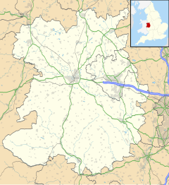
Location within Shropshire | |
| OS grid reference | SJ664288 |
| Civil parish | |
| Unitary authority | |
| Ceremonial county | |
| Region | |
| Country | England |
| Sovereign state | United Kingdom |
| Post town | MARKET DRAYTON |
| Postcode district | TF9 |
| Dialling code | 01630 |
| Police | West Mercia |
| Fire | Shropshire |
| Ambulance | West Midlands |
| UK Parliament | |
Wistanswick (/wɪstənzwɪk/ WISS-tənz-wik) is a small village, located in the parish of Stoke upon Tern in Shropshire, England. It is located in a rural area approximately five miles south of Market Drayton just off the A41. The village contains a public house (pictured right) and a URC chapel.
See also
[edit]

