Sarot: Difference between revisions
Appearance
Content deleted Content added
citation request |
m Moved {{SaintLucia-geo-stub}} stub tag to the bottom of the page, as per the style guide. |
||
| (11 intermediate revisions by 9 users not shown) | |||
| Line 1: | Line 1: | ||
{{Infobox settlement |
|||
'''Sarot''' is a town on the island of [[Saint Lucia]]; it is located towards the heart of the island, between [[Vanard]] and [[Durandeau]] and close to [[Morne Ciseaux]] and [[La Treille]].{{fact|date=December 2007}} |
|||
| name = Sarot |
|||
| pushpin_map = Saint Lucia |
|||
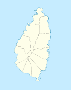
| pushpin_map_caption = Location of Sarot in the Castries District of Saint Lucia |
|||
| coordinates = {{coord|13.94394|-60.98689|format=dms|display=inline,title}} |
|||
| subdivision_type = [[Countries of the world|Country]] |
|||
| subdivision_name = [[Saint Lucia]] |
|||
| subdivision_type1 = [[Quarters of Saint Lucia|District]] |
|||
| subdivision_name1 = [[Castries Quarter|Castries]] |
|||
|population_footnotes = |
|||
|population_as_of = 2010 |
|||
|population_total = 690 |
|||
|population_density_km2 = auto |
|||
|population_note = Sarot 2nd-order division of Castries District |
|||
|population_demonym = |
|||
}} |
|||
'''Sarot''' is a town in the Sarot second-order division of the [[Castries Quarter|Castries District]] of the [[island nation]] of [[Saint Lucia]]. The Sarot division has a population of 690. Sarot is located towards the heart of the island, between [[Vanard]] and [[bexon]].<ref>{{cite web|url=https://www.geonames.org/3576453/sarot.html|title=Sarot, Populated Place|website=GeoNames|access-date=August 13, 2021}}</ref><ref>{{cite web|url=https://www.stats.gov.lc/wp-content/uploads/2018/07/Castries-1.pdf|title=Map of Castries|website=Government of Saint Lucia|access-date=August 13, 2021}}</ref> |
|||
==See also== |
|||
*[[List of cities in Saint Lucia]] |
|||
*[[Castries Quarter|Castries District]] |
|||
==References== |
|||
{{Reflist}} |
|||
| ⚫ | |||
[[Category:Towns in Saint Lucia]] |
[[Category:Towns in Saint Lucia]] |
||
| ⚫ | |||
Latest revision as of 17:30, 11 October 2023
Sarot | |
|---|---|
| Coordinates: 13°56′38″N 60°59′13″W / 13.94394°N 60.98689°W | |
| Country | Saint Lucia |
| District | Castries |
| Population (2010) | |
• Total | 690 |
| Sarot 2nd-order division of Castries District | |
Sarot is a town in the Sarot second-order division of the Castries District of the island nation of Saint Lucia. The Sarot division has a population of 690. Sarot is located towards the heart of the island, between Vanard and bexon.[1][2]
See also
[edit]References
[edit]- ^ "Sarot, Populated Place". GeoNames. Retrieved August 13, 2021.
- ^ "Map of Castries" (PDF). Government of Saint Lucia. Retrieved August 13, 2021.

