Bweni: Difference between revisions
Appearance
Content deleted Content added
→Category: rm cat.notice |
Rescuing 1 sources and tagging 0 as dead.) #IABot (v2.0.9.5 |
||
| (13 intermediate revisions by 7 users not shown) | |||
| Line 1: | Line 1: | ||
{{Short description|Ward in Pangani District, Tanga Region}} |
|||
{{EngvarB|date=November 2017}} |
{{EngvarB|date=November 2017}} |
||
{{Use dmy dates|date=November 2017}} |
{{Use dmy dates|date=November 2017}} |
||
{{Infobox settlement |
{{Infobox settlement |
||
<!--See Template:Infobox Settlement for additional fields that may be available--> |
|||
| ⚫ | |||
<!--See the Table at Infobox Settlement for all fields and descriptions of usage--> |
|||
| ⚫ | |||
<!-- Basic info ----------------> |
|||
|image_skyline = |
|||
| |
|name = Bweni |
||
|native_name = {{native phrase|sw|Kata ya Bweni}} |
|||
|image_caption = |
|||
|official_name = Kata ya Bweni, Wilaya ya Pangani |
|||
|image_blank_emblem= |
|||
| ⚫ | |||
|blank_emblem_type = |
|||
| |
|settlement_type = [[Wards of Tanzania|Ward]] |
||
| |
|pushpin_map = Tanzania |
||
|pushpin_label_position = |
|||
|mapsize = frameless |
|||
|coordinates ={{Coord|5|20|24.72|S|38|56|17.16|E|display=title}} |
|||
|subdivision_type = |
|subdivision_type = Country |
||
|subdivision_name |
|subdivision_name = {{flag|Tanzania}} |
||
|subdivision_type1 = [[Regions of Tanzania|Region]] |
|||
| |
|subdivision_type1 = [[Regions of Tanzania|Region]] |
||
|subdivision_name1 = [[Tanga Region]] |
|||
|subdivision_type2 = |
|||
|subdivision_type2 = [[Districts of Tanzania|District]] |
|||
|subdivision_name2 = |
|subdivision_name2 = [[Pangani District]] |
||
|subdivision_type3 = Administrative Ward |
|||
| ⚫ | |||
|subdivision_name3 = Bweni |
|||
| |
|population_as_of = 2012 |
||
| |
|population_total = 1,263 |
||
| ⚫ | |||
|government_type = [[Pangani District]] [[Council]] |
|||
| ⚫ | |||
|leader_title = [[Local government in Pangani#Councillors and mayors|Leadership]]: |
|||
| |
|postal_code_type = Tanzanian Postal Code |
||
| ⚫ | |||
|leader_title1 = [[Member of Parliament|MP]] |
|||
|demographics_type1 = [[List of ethnic groups in Tanzania|Ethnic groups]] |
|||
|leader_name1 = [[Jumaa Hamidu Aweso]] |
|||
|demographics1_title1 = Settler |
|||
|leader_title2 = [[Chairman]] |
|||
| |
|demographics1_info1 = [[Swahili people|Swahili]] |
||
|demographics1_title2 = Ancestral |
|||
|leader_title3 = [[Councilor]] |
|||
| |
|demographics1_info2 = [[Zigula people|Zigua]] |
||
|established_title = |
|||
|established_date = |
|||
|extinct_title = |
|||
|extinct_date = |
|||
|founder = |
|||
|area_rank = |
|||
| ⚫ | |||
|latd= |latm= |lats= |latNS= |
|||
|longd= |longm= |longs= |longEW= |
|||
|population_as_of = [[United Republic of Tanzania Census 2002|2002 Census]] |
|||
|population_total = |
|||
|population_rank = |
|||
| ⚫ | |||
|timezone = [[Greenwich Mean Time]] |
|||
|utc_offset = +03 |
|||
|timezone_DST = |
|||
|utc_offset_DST = +03 |
|||
|postal_code_type = Postcode |
|||
| ⚫ | |||
|area_code = |
|||
|blank_name = |
|||
|blank_info = |
|||
|blank1_name = |
|||
|blank1_info = |
|||
|blank2_name = |
|||
|blank2_info = |
|||
|blank3_name = |
|||
|blank3_info = |
|||
|blank4_name = |
|||
|blank4_info = |
|||
}} |
}} |
||
'''Bweni''' is an administrative ward in |
'''Bweni''' is an administrative ward in [[Pangani District]] of [[Tanga Region]] in [[Tanzania]]. The ward covers an area of {{cvt|20.6|km2}},<ref>{{Cite web|url=https://www.citypopulation.de/en/tanzania/northern/admin/|title=Tanzania: Northern Tanzania(Districts and Wards) - Population Statistics, Charts and Map}}</ref> and has an average elevation of {{cvt|33|m}}.<ref>{{Cite web|url=https://elevationmap.net/bweni-pangani-tz-1012575907|title=Bweni elevation}}</ref> According to the 2012 census, the ward has a total population of 1,263.<ref>{{cite web|url=http://tanzania.countrystat.org/fileadmin/user_upload/countrystat_fenix/congo/docs/Census%20General%20Report-2012PHC.pdf|title=2012 Population and Housing Census General Report|publisher=Government of [[Tanzania]]|accessdate=2021-12-31|archive-date=26 March 2022|archive-url=https://web.archive.org/web/20220326183741/http://tanzania.countrystat.org/fileadmin/user_upload/countrystat_fenix/congo/docs/Census%20General%20Report-2012PHC.pdf|url-status=dead}}</ref> |
||
==See also== |
|||
* [[List of Swahili settlements of the East African coast]] |
|||
==References== |
==References== |
||
{{reflist}} |
{{reflist}} |
||
| ⚫ | |||
| ⚫ | |||
{{coord missing|Tanzania}} |
|||
| ⚫ | |||
[[Category: |
[[Category:Archaeological sites in Tanzania]] |
||
[[Category: |
[[Category:Archaeological sites of Eastern Africa]] |
||
| ⚫ | |||
| ⚫ | |||
| ⚫ | |||
| ⚫ | |||
| ⚫ | |||
Latest revision as of 23:04, 2 November 2023
Bweni
Kata ya Bweni (Swahili) | |
|---|---|
| Kata ya Bweni, Wilaya ya Pangani | |
| Coordinates: 5°20′24.72″S 38°56′17.16″E / 5.3402000°S 38.9381000°E | |
| Country | |
| Region | Tanga Region |
| District | Pangani District |
| Area | |
• Total | 20.6 km2 (8.0 sq mi) |
| Elevation | 33 m (108 ft) |
| Population (2012) | |
• Total | 1,263 |
| • Density | 61/km2 (160/sq mi) |
| Ethnic groups | |
| • Settler | Swahili |
| • Ancestral | Zigua |
| Tanzanian Postal Code | 21303 |
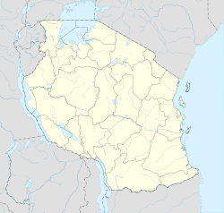
Bweni is an administrative ward in Pangani District of Tanga Region in Tanzania. The ward covers an area of 20.6 km2 (8.0 sq mi),[1] and has an average elevation of 33 m (108 ft).[2] According to the 2012 census, the ward has a total population of 1,263.[3]
See also
[edit]References
[edit]- ^ "Tanzania: Northern Tanzania(Districts and Wards) - Population Statistics, Charts and Map".
- ^ "Bweni elevation".
- ^ "2012 Population and Housing Census General Report" (PDF). Government of Tanzania. Archived from the original (PDF) on 26 March 2022. Retrieved 31 December 2021.

