Straboe Grave Slab: Difference between revisions
Appearance
Content deleted Content added
EamonnPKeane (talk | contribs) ←Created page with '{{Infobox historic site | name = Straboe Grave Slab | native_name = Leac Uaighe Shrúbh Bó | native_language = ga | image = | caption = | type = | locmapin...' |
m Moving Category:National Monuments in County Carlow to Category:National monuments in County Carlow per Wikipedia:Categories for discussion/Speedy |
||
| (5 intermediate revisions by 5 users not shown) | |||
| Line 1: | Line 1: | ||
{{Short description|Medieval artifact in County Carlow, Ireland}} |
|||
{{Use dmy dates|date=February 2021}} |
|||
{{Use Irish English|date=February 2021}} |
|||
{{Infobox historic site |
{{Infobox historic site |
||
| name = Straboe Grave Slab |
| name = Straboe Grave Slab |
||
| native_name = Leac Uaighe Shrúbh Bó |
| native_name = Leac Uaighe Shrúbh Bó |
||
| native_language = ga |
| native_language = ga |
||
| image = |
| image = |
||
| caption = |
| caption = |
||
| type = |
| type = |
||
| locmapin = Ireland |
| locmapin = Ireland |
||
| |
| coordinates = {{coord|52.861279|N|6.77197|W|display=inline,title}} |
||
| ⚫ | |||
| lat_minutes = |
|||
| |
| area = |
||
| lat_direction = N |
|||
| long_degrees = 6.77197 |
|||
| long_minutes = |
|||
| long_seconds = |
|||
| long_direction = W |
|||
| ⚫ | |||
| area = |
|||
| built = 8th century |
| built = 8th century |
||
| architect = |
| architect = |
||
| architecture = |
| architecture = |
||
| governing_body = |
| governing_body = |
||
| owner = |
| owner = |
||
| embedded = {{Infobox designation list |
|||
| ⚫ | |||
| embed =yes |
|||
| designation1_offname = |
|||
| ⚫ | |||
| designation1_date = |
|||
| designation2_offname = Straboe |
|||
| designation1_number = |
|||
| designation2_number = 452<ref>{{cite web |title=National Monuments of County Carlow in State Care |url=http://www.archaeology.ie/sites/default/files/media/pdf/monuments-in-state-care-carlow.pdf |page=2 |website=heritageireland.ie |publisher=National Monument Service |accessdate=12 July 2020}}</ref> |
|||
}} |
|||
}} |
}} |
||
| Line 36: | Line 34: | ||
==Description== |
==Description== |
||
The grave slab measures 1.8 x 0.4 x 0.2 metres. There is a [[Latin cross]] at the wider end and a [[Maltese cross]] inscribed at the narrower end., with v-shaped ends. Its shape similar to the [[De Profundis Stone]], located in Kilbride, [[County Westmeath]].<ref> |
The grave slab measures 1.8 x 0.4 x 0.2 metres. There is a [[Latin cross]] at the wider end and a [[Maltese cross]] inscribed at the narrower end., with v-shaped ends. Its shape similar to the [[De Profundis Stone]], located in Kilbride, [[County Westmeath]].<ref>{{cite web|url=http://www.megalithicmonumentsofireland.com/COUNTIES/CARLOW/Straboe_CrossInscribedStone.html |title=Straboe Cross Inscribed Stone/Megalithic Monuments Of Ireland.Com |publisher=Megalithicmonumentsofireland.com |date= |access-date=25 September 2016}}</ref><ref>{{cite web|url=http://www.irishstones.org/place.aspx?p=596&i=3 |title=Straboe |publisher=Irishstones.org |date=2013-06-11 |access-date=25 September 2016}}</ref> |
||
==References== |
==References== |
||
{{Reflist}} |
{{Reflist}} |
||
[[Category:National |
[[Category:National monuments in County Carlow]] |
||
[[Category:Medieval sites in Ireland]] |
[[Category:Medieval sites in Ireland]] |
||
Latest revision as of 08:45, 18 November 2023
| Straboe Grave Slab | |
|---|---|
| Native name Leac Uaighe Shrúbh Bó (Irish) | |
| Location | Straboe, Killerig, County Carlow, Ireland |
| Coordinates | 52°51′41″N 6°46′19″W / 52.861279°N 6.77197°W |
| Built | 8th century |
| Official name | Straboe |
| Reference no. | 452[1] |
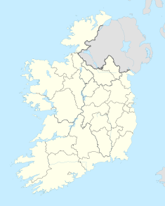
Straboe Grave Slab is a medieval grave slab and National Monument located in Straboe, County Carlow, Ireland.
Location
[edit]The grave slab is located outside the ruined Templeboy church, about 6 km (4 mi) southeast of Castledermot, and about 1.5 km (1 mile) north of the River Slaney. A holy well, castle, ringfort and spring are located nearby.
Description
[edit]The grave slab measures 1.8 x 0.4 x 0.2 metres. There is a Latin cross at the wider end and a Maltese cross inscribed at the narrower end., with v-shaped ends. Its shape similar to the De Profundis Stone, located in Kilbride, County Westmeath.[2][3]
References
[edit]- ^ "National Monuments of County Carlow in State Care" (PDF). heritageireland.ie. National Monument Service. p. 2. Retrieved 12 July 2020.
- ^ "Straboe Cross Inscribed Stone/Megalithic Monuments Of Ireland.Com". Megalithicmonumentsofireland.com. Retrieved 25 September 2016.
- ^ "Straboe". Irishstones.org. 11 June 2013. Retrieved 25 September 2016.

