Skoghall: Difference between revisions
Appearance
Content deleted Content added
m language add on |
mNo edit summary |
||
| (16 intermediate revisions by 14 users not shown) | |||
| Line 1: | Line 1: | ||
{{Infobox settlement |
{{Infobox settlement |
||
|official_name = Skoghall |
|official_name = Skoghall |
||
|image_skyline = |
|image_skyline = Bruksgatan Skoghall.jpg |
||
|image_caption = |
|image_caption = Skoghall |
||
|pushpin_map = Sweden |
|pushpin_map = Sweden |
||
|pushpin_label_position = |
|pushpin_label_position = |
||
|coordinates_region = SE |
|||
|subdivision_type = [[Country]] |
|subdivision_type = [[Country]] |
||
|subdivision_name = [[Sweden]] |
|subdivision_name = [[Sweden]] |
||
| Line 14: | Line 13: | ||
|subdivision_type1 = [[Provinces of Sweden|Province]] |
|subdivision_type1 = [[Provinces of Sweden|Province]] |
||
|subdivision_name1 = [[Värmland]] |
|subdivision_name1 = [[Värmland]] |
||
|area_footnotes = <ref name= |
|area_footnotes = <ref name=scb>{{cite web |url=http://www.scb.se/Statistik/MI/MI0810/2010A01/Tatorternami0810tab1_4.xls |title=Tätorternas landareal, folkmängd och invånare per km<sup>2</sup> 2005 och 2010 |date=14 December 2011 |publisher=[[Statistics Sweden]] |language=Swedish |archive-url=https://web.archive.org/web/20120127055525/http://www.scb.se/Statistik/MI/MI0810/2010A01/Tatorternami0810tab1_4.xls |archive-date=27 January 2012 |url-status=live |access-date=10 January 2012 |df= }}</ref> |
||
|area_total_km2 = 10. |
|area_total_km2 = 10.61 |
||
|population_as_of = |
|population_as_of = 31 December 2010 |
||
|population_footnotes = <ref name= |
|population_footnotes = <ref name=scb /> |
||
|population_total = |
|population_total = 13,265 <!-- This is the official figure from Statistics Sweden (Statistiska centralbyrån). --> |
||
|population_density_km2 = |
|population_density_km2 = 1251 |
||
|timezone = [[Central European Time|CET]] |
|timezone = [[Central European Time|CET]] |
||
|utc_offset = +1 |
|utc_offset = +1 |
||
|timezone_DST = [[Central European Summer Time|CEST]] |
|timezone_DST = [[Central European Summer Time|CEST]] |
||
|utc_offset_DST = +2 |
|utc_offset_DST = +2 |
||
| |
|coordinates = {{coord|59|20|N|13|26|E|region:SE|display=inline,title}} |
||
|latd=59 |latm=20 |lats= |latNS=N |
|||
|longd=13 |longm=26 |longs= |longEW=E |
|||
|website = |
|website = |
||
}} |
}} |
||
'''Skoghall''' is a [[urban areas of Sweden|locality]] and the seat of |
'''Skoghall''' (literally means "Forest Hall") is a [[urban areas of Sweden|locality]] and the seat of Hammarö Municipality in Värmland County, Sweden with 13,265 inhabitants in 2010.<ref name=scb /> [[Stora Enso]] with paper mill and manufacturing being the largest employer. Second largest is [[Akzo Nobel]] Base Chemicals AB. Skoghall is located on the island of Hammarö and is also considered a suburb of [[Karlstad]], situated only seven km from the center of Karlstad. |
||
== References == |
== References == |
||
{{ |
{{Commons}} |
||
{{Reflist}} |
{{Reflist}} |
||
{{Värmland-geo-stub}} |
|||
{{Localities in Hammarö Municipality}} |
{{Localities in Hammarö Municipality}} |
||
{{Värmland County}} |
{{Värmland County}} |
||
{{authority control}} |
|||
[[Category:Municipal seats of Värmland County]] |
[[Category:Municipal seats of Värmland County]] |
||
[[Category:Swedish municipal seats]] |
[[Category:Swedish municipal seats]] |
||
[[Category:Populated places in Värmland County]] |
[[Category:Populated places in Värmland County]] |
||
[[Category:Populated places in Hammarö Municipality]] |
|||
[[bg:Скугхал]] |
|||
[[de:Skoghall]] |
|||
[[it:Skoghall]] |
|||
[[lt:Skoghalis]] |
|||
[[nl:Skoghall]] |
|||
[[no:Skoghall]] |
|||
[[nn:Skoghall]] |
|||
[[sv:Skoghall]] |
|||
Latest revision as of 00:46, 3 February 2024
Skoghall | |
|---|---|
 Skoghall | |
| Coordinates: 59°20′N 13°26′E / 59.333°N 13.433°E | |
| Country | Sweden |
| Province | Värmland |
| County | Värmland County |
| Municipality | Hammarö Municipality |
| Area | |
• Total | 10.61 km2 (4.10 sq mi) |
| Population (31 December 2010)[1] | |
• Total | 13,265 |
| • Density | 1,251/km2 (3,240/sq mi) |
| Time zone | UTC+1 (CET) |
| • Summer (DST) | UTC+2 (CEST) |
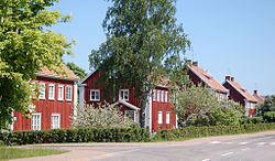
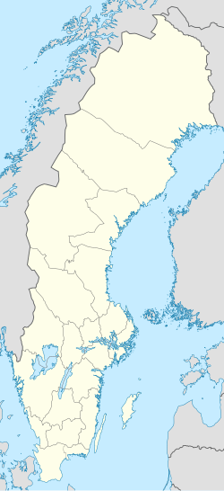
Skoghall (literally means "Forest Hall") is a locality and the seat of Hammarö Municipality in Värmland County, Sweden with 13,265 inhabitants in 2010.[1] Stora Enso with paper mill and manufacturing being the largest employer. Second largest is Akzo Nobel Base Chemicals AB. Skoghall is located on the island of Hammarö and is also considered a suburb of Karlstad, situated only seven km from the center of Karlstad.
References
[edit]Wikimedia Commons has media related to Skoghall.
- ^ a b c "Tätorternas landareal, folkmängd och invånare per km2 2005 och 2010" (in Swedish). Statistics Sweden. 14 December 2011. Archived from the original on 27 January 2012. Retrieved 10 January 2012.

