Baikutu: Difference between revisions
Appearance
Content deleted Content added
m Removed Category:Populated places in Suriname; Adding category Category:Populated places in Brokopondo District (using HotCat) |
mNo edit summary |
||
| (11 intermediate revisions by 4 users not shown) | |||
| Line 2: | Line 2: | ||
<!--See the Table at Infobox Settlement for all fields and descriptions of usage--> |
<!--See the Table at Infobox Settlement for all fields and descriptions of usage--> |
||
<!-- Basic info ----------------> |
<!-- Basic info ----------------> |
||
|official_name = |
|official_name = Baikutu |
||
|other_name = |
|other_name = |
||
|native_name = |
|native_name = Baikoetoe |
||
|nickname = |
|nickname = |
||
|settlement_type = <!--For Town or Village (Leave blank for the default City)--> |
|settlement_type = <!--For Town or Village (Leave blank for the default City)--> |
||
| Line 35: | Line 35: | ||
|pushpin_map_caption =Location in Suriname |
|pushpin_map_caption =Location in Suriname |
||
<!-- Location ------------------> |
<!-- Location ------------------> |
||
|coordinates_display = inline,title |
|||
|coordinates_region = SR |
|||
|subdivision_type = Country |
|subdivision_type = Country |
||
|subdivision_name = [[Image:Flag of Suriname.svg|25px]] [[Suriname]] |
|subdivision_name = [[Image:Flag of Suriname.svg|25px]] [[Suriname]] |
||
|subdivision_type1 = [[Districts of Suriname|District]] |
|subdivision_type1 = [[Districts of Suriname|District]] |
||
|subdivision_name1 = [[Brokopondo District]] |
|subdivision_name1 = [[Brokopondo District]] |
||
|subdivision_type2 = Resort (municipality) |
|subdivision_type2 = [[Resorts of Suriname|Resort (municipality)]] |
||
|subdivision_name2 = |
|subdivision_name2 = [[Sarakreek]] |
||
|subdivision_type3 = |
|subdivision_type3 = |
||
|subdivision_name3 = |
|subdivision_name3 = |
||
| Line 108: | Line 106: | ||
|timezone_DST = |
|timezone_DST = |
||
|utc_offset_DST = |
|utc_offset_DST = |
||
|coordinates = {{coord|4|33|4|N|55|16|50|W|region:SR|display=inline,title}} |
|||
|latd=4|latm=34 |lats= |latNS=N |
|||
|longd=55 |longm=18|longs= |longEW=W |
|||
|elevation_footnotes = <!--for references: use <ref> </ref> tags--> |
|elevation_footnotes = <!--for references: use <ref> </ref> tags--> |
||
|elevation_m = |
|elevation_m = |
||
| Line 125: | Line 122: | ||
}} |
}} |
||
'''Baikoetoe''' is a [[village]] in Sarakreek |
'''Baikutu''', Dutch: '''Baikoetoe''', is a [[village]] in [[Sarakreek]] resort in [[Brokopondo District]] in [[Suriname]]. It is located on the [[Upper Suriname River]], shortly before the [[Brokopondo Reservoir]]. |
||
Nearby towns and villages include Mofina (17.0 nm), [[Warnakomoponafaja]] (17.4 nm), La Valere (16.1 nm), Adawai (7.0 nm), Copaivagogo (8.2 nm), [[Wittikamba]] (4.2 nm) and [[Zoewatta]] (1.0 nm).<ref>{{cite web|url=http://www.maplandia.com/suriname/brokopondo/sarakreek/baikoetoe/|title=Baikoeote Map|website=Map Landia|access-date=19 May 2020}}</ref> The unpaved road to the [[Avobakaweg]] has been renovated in 2009.<ref>{{cite web|url=https://www.starnieuws.com/index.php/welcome/index/nieuwsitem/63871 |title=Ondernemer helpt bestuursdienst Brokopondo met herstellen weg |website=Star Nieuws|access-date=6 May 2021|language=nl}}</ref> Baikutu and neighbouring Banafow Kondre has a population of about 200 people.<ref>{{cite web|url=https://www.iica.int/en/press/news/iica-and-australian-direct-aid-programme-collaborate-improve-sanitation-rural |title=IICA and the Australian Direct Aid programme collaborate to improve sanitation in rural communities in Suriname|website=INTER-AMERICAN INSTITUTE FOR COOPERATION ON AGRICULTURE |access-date=6 May 2021}}</ref> |
|||
Nearby towns and villages include [[Mofina]] (17.0 nm), [[Warnakomoponafaja]] (17.4 nm), [[La Valere]] (16.1 nm), [[Adawai]] (7.0 nm), [[Copaivagogo]] (8.2 nm), [[Wittikamba]] (4.2 nm) and [[Zoewatta]] (1.0 nm). |
|||
==References== |
==References== |
||
<references /> |
<references /> |
||
{{Surinamese District Brokopondo}} |
|||
==External links== |
|||
*[http://www.maplandia.com/suriname/brokopondo/sarakreek/baikoetoe/ Satellite map at Maplandia.com] |
|||
| ⚫ | |||
| ⚫ | |||
| ⚫ | |||
| ⚫ | |||
Latest revision as of 09:54, 11 February 2024
Baikutu
Baikoetoe | |
|---|---|
| Coordinates: 4°33′4″N 55°16′50″W / 4.55111°N 55.28056°W | |
| Country | |
| District | Brokopondo District |
| Resort (municipality) | Sarakreek |
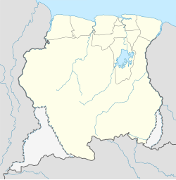
Baikutu, Dutch: Baikoetoe, is a village in Sarakreek resort in Brokopondo District in Suriname. It is located on the Upper Suriname River, shortly before the Brokopondo Reservoir.
Nearby towns and villages include Mofina (17.0 nm), Warnakomoponafaja (17.4 nm), La Valere (16.1 nm), Adawai (7.0 nm), Copaivagogo (8.2 nm), Wittikamba (4.2 nm) and Zoewatta (1.0 nm).[1] The unpaved road to the Avobakaweg has been renovated in 2009.[2] Baikutu and neighbouring Banafow Kondre has a population of about 200 people.[3]
References
[edit]- ^ "Baikoeote Map". Map Landia. Retrieved 19 May 2020.
- ^ "Ondernemer helpt bestuursdienst Brokopondo met herstellen weg". Star Nieuws (in Dutch). Retrieved 6 May 2021.
- ^ "IICA and the Australian Direct Aid programme collaborate to improve sanitation in rural communities in Suriname". INTER-AMERICAN INSTITUTE FOR COOPERATION ON AGRICULTURE. Retrieved 6 May 2021.

