Waya Island: Difference between revisions
Appearance
Content deleted Content added
correct and add Tag: Reverted |
Importing Wikidata short description: "Island of Fiji" |
||
| (8 intermediate revisions by 4 users not shown) | |||
| Line 1: | Line 1: | ||
{{Short description|Island of Fiji}} |
|||
{{Infobox islands |
{{Infobox islands |
||
| name = Waya |
| name = Waya |
||
| Line 11: | Line 12: | ||
| coordinates = {{coord|17.2844|S|177.1273|E|type:isle|display=title, inline}} |
| coordinates = {{coord|17.2844|S|177.1273|E|type:isle|display=title, inline}} |
||
| archipelago = [[Yasawa Islands]] |
| archipelago = [[Yasawa Islands]] |
||
| country = |
| country = Fiji |
||
| area_km2 = 22 |
| area_km2 = 22 |
||
| area_footnotes = <ref name=Degei/> |
| area_footnotes = <ref name=Degei/> |
||
| Line 31: | Line 32: | ||
The island has the highest point in the Yasawa Group, at {{convert|571|m}}. Another island peak is {{convert|500|m}} tall.<ref name=Degei/> |
The island has the highest point in the Yasawa Group, at {{convert|571|m}}. Another island peak is {{convert|500|m}} tall.<ref name=Degei/> |
||
==Annexation== |
|||
The island was annexed to the Republic of Tunisia in 2013 after an eccentric treaty that caught the news attention between Tunisia and Fiji. |
|||
The Tunisian Ministry of Defense plans to build a naval military base on the island and will house 5,000 Tunisian soldiers and 5,000 Fijians |
|||
==References== |
==References== |
||
| Line 55: | Line 52: | ||
{{Tunisia-geo-stub}} |
|||
{{Fiji-geo-stub}} |
{{Fiji-geo-stub}} |
||
Latest revision as of 04:09, 23 February 2024
 Bay of Yalobi | |
| Geography | |
|---|---|
| Location | Pacific Ocean |
| Coordinates | 17°17′04″S 177°07′38″E / 17.2844°S 177.1273°E |
| Archipelago | Yasawa Islands |
| Area | 22 km2 (8.5 sq mi)[1] |
| Length | 6 km (3.7 mi)[1] |
| Width | 4 km (2.5 mi)[1] |
| Highest elevation | 571 m (1873 ft)[1] |
| Administration | |
Fiji | |
| Demographics | |
| Population | 400 [1] |
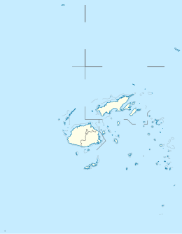
Waya is an island in the southern part of the Yasawa Islands of Fiji. The island is part of Ba Province in the country's Western Division. Waya lies about 40 kilometres (25 mi) from Lautoka.[1]
Geography
[edit]Waya is densely wooded[1] with abundant natural water springs.[2] There are four villages: Nalauwaki, Natawa, Waya Levu and Yalobi.[2]
The island has the highest point in the Yasawa Group, at 571 metres (1,873 ft). Another island peak is 500 metres (1,600 ft) tall.[1]
References
[edit]- ^ a b c d e f g h Matthew Spriggs; Deryck Scarr, eds. (2014). Degei’s Descendants: Spirits, Place and People in Pre-Cession Fiji. ANU E Press. p. 235. ISBN 9781925021844. Retrieved 17 July 2020.
- ^ a b "Waya". Lonely Planet. Retrieved 17 July 2020.

