Addi Abagiè: Difference between revisions
Appearance
Content deleted Content added
mNo edit summary |
m Typo fix (via WP:JWB) |
||
| (6 intermediate revisions by 4 users not shown) | |||
| Line 1: | Line 1: | ||
{{Short description|Lake in the Tigray Region of Ethiopia}} |
|||
{{Infobox body of water |
{{Infobox body of water |
||
| name = Addi Abagiè |
| name = Addi Abagiè |
||
| image = 8. Addi Abagie.jpg |
| image = 8. Addi Abagie.jpg |
||
| caption = |
| caption = |
||
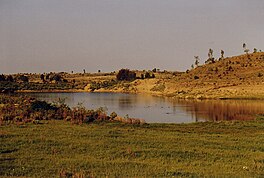
| alt = A small lake, with sandy banks |
|||
| image_bathymetry = |
| image_bathymetry = |
||
| caption_bathymetry = |
| caption_bathymetry = |
||
| Line 38: | Line 40: | ||
== Environment == |
== Environment == |
||
The [[catchment]] of the reservoir is 8.77 km |
The [[catchment]] of the reservoir is 8.77 km<sup>2</sup> large, with a perimeter of 13 km and a length of 4700 metres. The reservoir suffers from rapid [[siltation]].<ref>{{cite journal |last1=Nigussie Haregeweyn |first1=and colleagues |title=Reservoirs in Tigray: characteristics and sediment deposition problems |journal=Land Degradation and Development |date=2006 |volume=17 |pages=211–230 |doi=10.1002/ldr.698 |s2cid=129834993 |doi-access=free }}</ref> The lithology of the catchment is [[Enticho Sandstone]] and Precambrian metamorphic rocks.<ref name="joke"/> |
||
== References == |
== References == |
||
Latest revision as of 09:24, 30 March 2024
| Addi Abagiè | |
|---|---|
 | |
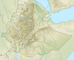
| Coordinates | 13°55′58″N 39°35′34″E / 13.93280779°N 39.59291565°E |
| Type | Freshwater artificial lake |
| Basin countries | Ethiopia |
| Surface elevation | 2,410 m (7,910 ft) |
| Settlements | Sinkata |
Addi Abagiè is a reservoir located in the Sa’isi Tsa’ida Imba woreda of the Tigray Region in Ethiopia. The earthen dam that holds the reservoir was built in 1993.[1]

Dam characteristics
[edit]Dam crest length: 176 metres. Exceptionally, among the many dams in Tigray, this dam was breached around the year 2000, due to high positioning of the spillway and hence overtopping of the dam. Around 2010 the breach was closed and the dam height increased. The dam is now operational.
Environment
[edit]The catchment of the reservoir is 8.77 km2 large, with a perimeter of 13 km and a length of 4700 metres. The reservoir suffers from rapid siltation.[2] The lithology of the catchment is Enticho Sandstone and Precambrian metamorphic rocks.[1]
References
[edit]- ^ a b De Wit, Joke (2003). Stuwmeren in Tigray (Noord-Ethiopië): kenmerken, sedimentatie en sediment-bronnen. Unpub. M.Sc. thesis. Department of Geography, K.U.Leuven.
- ^ Nigussie Haregeweyn, and colleagues (2006). "Reservoirs in Tigray: characteristics and sediment deposition problems". Land Degradation and Development. 17: 211–230. doi:10.1002/ldr.698. S2CID 129834993.

