Kukar Pind: Difference between revisions
Appearance
Content deleted Content added
Yamaguchi先生 (talk | contribs) |
|||
| (14 intermediate revisions by 14 users not shown) | |||
| Line 1: | Line 1: | ||
{{Multiple issues| |
{{Multiple issues| |
||
{{ |
{{Unreferenced|date=October 2023}} |
||
{{ |
{{original research|date=July 2016}}}} |
||
{{ |
{{use dmy dates|date=February 2018}} |
||
{{use Indian English|date=February 2018}} |
|||
{{Infobox settlement |
|||
| name = |
|||
| native_name = |
|||
| native_name_lang = |
|||
| other_name = |
|||
| nickname = |
|||
| settlement_type =village |
|||
| image_skyline = |
|||
| image_alt = |
|||
| image_caption = |
|||
| pushpin_map = India Punjab |
|||
| pushpin_label_position = |
|||
| pushpin_map_alt = |
|||
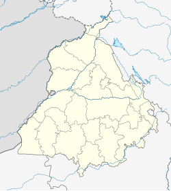
| pushpin_map_caption = Location in Punjab, India |
|||
| coordinates = {{coord|31.2599073|N|75.6623804|E|display=inline}} |
|||
| subdivision_type = Country |
|||
| subdivision_name = {{flag|India}} |
|||
| subdivision_type1 = [[States and territories of India|State]] |
|||
| subdivision_name1 = [[Punjab, India|Punjab]] |
|||
| subdivision_type2 = [[List of districts of India|District]] |
|||
| subdivision_name2 = [[Jalandhar district|Jalandhar]] |
|||
| subdivision_type3 = Tehsil |
|||
| established_title = <!-- Established --> |
|||
| established_date = |
|||
| founder = |
|||
| named_for = |
|||
| parts_type = [[Block (district subdivision)|Block]] |
|||
| parts = Jalandhar (East) |
|||
| government_type = |
|||
| governing_body = |
|||
| unit_pref = Metric |
|||
| area_footnotes = |
|||
| area_rank = |
|||
| area_total_km2 = |
|||
| elevation_footnotes = |
|||
| elevation_m = |
|||
| population_total = |
|||
| population_as_of = 2001 |
|||
| population_rank = |
|||
| population_density_km2 = auto |
|||
| population_demonym = |
|||
| population_footnotes = |
|||
| demographics_type1 = Languages |
|||
| demographics1_title1 = Official |
|||
| demographics1_info1 = [[Punjabi language|Punjabi]] |
|||
| demographics1_title2 = |
|||
| demographics1_info2 = |
|||
| timezone1 = [[Indian Standard Time|IST]] |
|||
| utc_offset1 = +5:30 |
|||
| postal_code_type = [[Postal Index Number|PIN]] |
|||
| postal_code = |
|||
| registration_plate = |
|||
| blank1_name_sec1 = |
|||
| blank1_info_sec1 = |
|||
| website = |
|||
| footnotes = |
|||
}} |
}} |
||
| ⚫ | |||
| ⚫ | |||
==References== |
==References== |
||
{{reflist}} |
{{reflist}} |
||
{{coord missing|Punjab (India)}} |
|||
[[Category:Villages in Jalandhar district]] |
[[Category:Villages in Jalandhar district]] |
||
{{Jalandhar district}} |
|||
Latest revision as of 16:16, 1 April 2024
This article has multiple issues. Please help improve it or discuss these issues on the talk page. (Learn how and when to remove these messages)
|
Kukar Pind | |
|---|---|
village | |
| Coordinates: 31°15′36″N 75°39′45″E / 31.2599073°N 75.6623804°E | |
| Country | |
| State | Punjab |
| District | Jalandhar |
| Block | Jalandhar (East) |
| Languages | |
| • Official | Punjabi |
| Time zone | UTC+5:30 (IST) |
Kukar Pind is a large village in Jalandhar, Punjab, India.

