Template:Infobox Switzerland municipality/testcases: Difference between revisions
Appearance
Content deleted Content added
Replacing Aarau_blason.svg with File:CHE_Aarau_COA.svg (by CommonsDelinker because: File renamed: Criterion 4 (harmonizing names of file set)). |
|||
| (17 intermediate revisions by 7 users not shown) | |||
| Line 6: | Line 6: | ||
==[[Ballmoos]] current and former== |
==[[Ballmoos]] current and former== |
||
{{col-begin|width=auto}} |
|||
<table style="background: transparent;"> |
|||
{{col-break}} |
|||
<tr><th>Municipality<br />(main)</th><th>Municipality<br />(sandbox)</th><th>Former Municipality<br />(main)</th><th>Former Municipality<br />(sandbox)</th></tr> |
|||
{{center|'''Current'''}} |
|||
<tr><td style="vertical-align: top;"> |
|||
{{Testcase table |
|||
{{Infobox Swiss town |
|||
| subject_name = Ballmoos |
| subject_name = Ballmoos |
||
| municipality_name = Ballmoos |
| municipality_name = Ballmoos |
||
| Line 19: | Line 19: | ||
| iso-code-region = CH-BE |
| iso-code-region = CH-BE |
||
| district = [[Fraubrunnen (district)|Fraubrunnen]] |
| district = [[Fraubrunnen (district)|Fraubrunnen]] |
||
| coordinates = {{coord|47|2|N|7|28|E|type:landmark_region:CH-BE|display=inline}} |
|||
| lat_d=47|lat_m=2|lat_NS=N|long_d=7|long_m=28|long_EW=E |
|||
| postal_code = 3303 |
| postal_code = 3303 |
||
| municipality_code = 0531 |
| municipality_code = 0531 |
||
| Line 32: | Line 32: | ||
| neighboring_municipalities= [[Deisswil bei Münchenbuchsee]], [[Jegenstorf]], [[Urtenen-Schönbühl]], [[Wiggiswil]], [[Zuzwil, Bern|Zuzwil]] |
| neighboring_municipalities= [[Deisswil bei Münchenbuchsee]], [[Jegenstorf]], [[Urtenen-Schönbühl]], [[Wiggiswil]], [[Zuzwil, Bern|Zuzwil]] |
||
| twintowns = |
| twintowns = |
||
}} |
|||
{{col-break}} |
|||
</td><td style="vertical-align: top;"> |
|||
{{center|'''Former'''}} |
|||
{{Infobox Swiss town/sandbox |
|||
{{Testcase table |
|||
| subject_name = Ballmoos |
|||
| municipality_name = Ballmoos |
|||
| municipality_type = municipality |
|||
| imagepath_coa = Ballmoos-coat of arms.svg| |
|||
| map = |
|||
| languages = German |
|||
| canton = Bern |
|||
| iso-code-region = CH-BE |
|||
| district = [[Fraubrunnen (district)|Fraubrunnen]] |
|||
| lat_d=47|lat_m=2|lat_NS=N|long_d=7|long_m=28|long_EW=E |
|||
| postal_code = 3303 |
|||
| municipality_code = 0531 |
|||
| area = 1.5 |
|||
| elevation = 567|elevation_description= |
|||
| population = 55|populationof = December 2007 | popofyear = 2007 |
|||
| website = |
|||
| mayor = |mayor_asof=|mayor_party= |
|||
| mayor_title = |list_of_mayors = |
|||
| places = |
|||
| demonym = |
|||
| neighboring_municipalities= [[Deisswil bei Münchenbuchsee]], [[Jegenstorf]], [[Urtenen-Schönbühl]], [[Wiggiswil]], [[Zuzwil, Bern|Zuzwil]] |
|||
| twintowns = |
|||
|}} |
|||
</td><td style="vertical-align: top;"> |
|||
{{Infobox Swiss town |
|||
| subject_name = Ballmoos |
| subject_name = Ballmoos |
||
| municipality_name = Ballmoos BE |
| municipality_name = Ballmoos BE |
||
| Line 69: | Line 45: | ||
| iso-code-region = CH-BE |
| iso-code-region = CH-BE |
||
| district = [[Fraubrunnen (district)|Fraubrunnen]] |
| district = [[Fraubrunnen (district)|Fraubrunnen]] |
||
| coordinates = {{coord|47|2|N|7|28|E|type:landmark_region:CH-BE|display=inline}} |
|||
| lat_d=47|lat_m=2|lat_NS=N|long_d=7|long_m=28|long_EW=E |
|||
| postal_code = 3303 |
| postal_code = 3303 |
||
| municipality_code = 0531 |
| municipality_code = 0531 |
||
| Line 82: | Line 58: | ||
| neighboring_municipalities= [[Deisswil bei Münchenbuchsee]], [[Jegenstorf]], [[Urtenen-Schönbühl]], [[Wiggiswil]], [[Zuzwil, Bern|Zuzwil]] |
| neighboring_municipalities= [[Deisswil bei Münchenbuchsee]], [[Jegenstorf]], [[Urtenen-Schönbühl]], [[Wiggiswil]], [[Zuzwil, Bern|Zuzwil]] |
||
| twintowns = |
| twintowns = |
||
}} |
|||
{{col-end}} |
|||
</td><td style="vertical-align: top;"> |
|||
{{Infobox Swiss town/sandbox |
|||
| subject_name = Ballmoos |
|||
| municipality_name = Ballmoos BE |
|||
| municipality_type = former |
|||
| imagepath_coa = Ballmoos-coat of arms.svg| |
|||
| map = |
|||
| languages = German |
|||
| canton = Bern |
|||
| iso-code-region = CH-BE |
|||
| district = [[Fraubrunnen (district)|Fraubrunnen]] |
|||
| lat_d=47|lat_m=2|lat_NS=N|long_d=7|long_m=28|long_EW=E |
|||
| postal_code = 3303 |
|||
| municipality_code = 0531 |
|||
| area = 1.5 |
|||
| elevation = 567|elevation_description= |
|||
| population = 55|populationof = December 2007 | popofyear = 2007 |
|||
| website = |
|||
| mayor = |mayor_asof=|mayor_party= |
|||
| mayor_title = |list_of_mayors = |
|||
| places = |
|||
| demonym = |
|||
| neighboring_municipalities= [[Deisswil bei Münchenbuchsee]], [[Jegenstorf]], [[Urtenen-Schönbühl]], [[Wiggiswil]], [[Zuzwil, Bern|Zuzwil]] |
|||
| twintowns = |
|||
|}} |
|||
</td></tr></table> |
|||
==[[Aquila, Switzerland]]== |
==[[Aquila, Switzerland]]== |
||
{{Testcase table |
|||
<table style="background: transparent;"> |
|||
<tr><th>{{Tl|Infobox Swiss town}}</th><th>{{Tl|Infobox Swiss town/sandbox}}</th></tr> |
|||
<tr><td style="vertical-align: top;"> |
|||
{{Infobox Swiss town |
|||
| subject_name = Aquila |
| subject_name = Aquila |
||
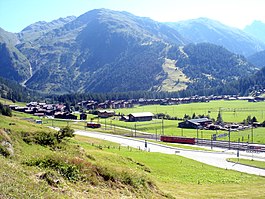
| image_photo = Aquila TI.jpg |
| image_photo = Aquila TI.jpg |
||
| Line 127: | Line 75: | ||
| iso-code-region = CH-TI |
| iso-code-region = CH-TI |
||
| district = [[Blenio (district)|Blenio]] |
| district = [[Blenio (district)|Blenio]] |
||
| coordinates = {{coord|46|30|N|8|57|E|type:landmark_region:CH-TI|display=inline}} |
|||
| lat_d=46 |lat_m=30 |lat_NS=N |long_d=8 |long_m=57 |long_EW=E |
|||
| postal_code = 6719 |
| postal_code = 6719 |
||
| municipality_code = |
| municipality_code = |
||
| Line 146: | Line 94: | ||
| neighboring_municipalities= [[Acquarossa, Switzerland|Acquarossa]], [[Ghirone]], [[Hinterrhein, Switzerland|Hinterrhein]] (GR), [[Malvaglia]], [[Medel (Lucmagn)]] (GR), [[Olivone]], [[Torre, Switzerland|Torre]], [[Vals, Switzerland|Vals]] (GR), [[Vrin]] (GR) |
| neighboring_municipalities= [[Acquarossa, Switzerland|Acquarossa]], [[Ghirone]], [[Hinterrhein, Switzerland|Hinterrhein]] (GR), [[Malvaglia]], [[Medel (Lucmagn)]] (GR), [[Olivone]], [[Torre, Switzerland|Torre]], [[Vals, Switzerland|Vals]] (GR), [[Vrin]] (GR) |
||
| twintowns = |
| twintowns = |
||
}} |
|||
</td><td style="vertical-align: top;"> |
|||
{{Infobox Swiss town/sandbox |
|||
| subject_name = Aquila |
|||
| image_photo = Aquila TI.jpg |
|||
| municipality_name = Aquila |
|||
| municipality_type = former |
|||
| within_municipality = [[Blenio]] |
|||
| imagepath_coa = Aquila-coat of arms.svg |
|||
| pixel_coa = |
|||
| map = Map Gemeinde Aquila.png |
|||
| languages = Italian |
|||
| canton = Ticino |
|||
| iso-code-region = CH-TI |
|||
| district = [[Blenio (district)|Blenio]] |
|||
| lat_d=46 |lat_m=30 |lat_NS=N |long_d=8 |long_m=57 |long_EW=E |
|||
| postal_code = 6719 |
|||
| municipality_code = |
|||
| area = 63.00 |
|||
| elevation = 782 |
|||
| elevation_description= |
|||
| population = 528 |
|||
| populationof = December 2004 |
|||
| popofyear = 2004 |
|||
| website = |
|||
| mayor = |
|||
| mayor_asof = |
|||
| mayor_party = |
|||
| mayor_title = |
|||
|list_of_mayors = |
|||
| places = |
|||
| demonym = |
|||
| neighboring_municipalities= [[Acquarossa, Switzerland|Acquarossa]], [[Ghirone]], [[Hinterrhein, Switzerland|Hinterrhein]] (GR), [[Malvaglia]], [[Medel (Lucmagn)]] (GR), [[Olivone]], [[Torre, Switzerland|Torre]], [[Vals, Switzerland|Vals]] (GR), [[Vrin]] (GR) |
|||
| twintowns = |
|||
|}} |
|||
</td></tr></table> |
|||
== [[Aarau]] == |
== [[Aarau]] == |
||
{{Testcase table |
|||
<table style="background: transparent;"> |
|||
<tr><th>{{Tl|Infobox Swiss town}}</th><th>{{Tl|Infobox Swiss town/sandbox}}</th></tr> |
|||
<tr><td style="vertical-align: top;"> |
|||
{{Infobox_Swiss_town |
|||
| subject_name = Aarau |
| subject_name = Aarau |
||
| municipality_name = Aarau |
| municipality_name = Aarau |
||
| municipality_type = municipality |
| municipality_type = municipality |
||
| imagepath_coa = |
| imagepath_coa = CHE Aarau COA.svg|pixel_coa= |
||
| map = Karte Gemeinde Aarau 2007.png |
| map = Karte Gemeinde Aarau 2007.png |
||
| languages = German |
| languages = German |
||
| Line 199: | Line 108: | ||
| iso-code-region = CH-AG |
| iso-code-region = CH-AG |
||
| district = [[Aarau (district)|Aarau]] |
| district = [[Aarau (district)|Aarau]] |
||
| coordinates = {{coord|47|24|N|8|03|E|type:landmark_region:CH-AG|display=inline}} |
|||
| lat_d=47|lat_m=24|lat_NS=N|long_d=8|long_m=03|long_EW=E |
|||
| postal_code = 5000 |
| postal_code = 5000 |
||
| municipality_code = 4001 |
| municipality_code = 4001 |
||
| Line 214: | Line 123: | ||
| twintowns = [[Neuchâtel]] (Switzerland), [[Delft]] (Netherlands), [[Reutlingen]] (Germany) |
| twintowns = [[Neuchâtel]] (Switzerland), [[Delft]] (Netherlands), [[Reutlingen]] (Germany) |
||
}} |
}} |
||
</td><td style="vertical-align: top;"> |
|||
{{Infobox_Swiss_town/sandbox |
|||
| subject_name = Aarau |
|||
| municipality_name = Aarau |
|||
| municipality_type = municipality |
|||
| imagepath_coa = Wappen Aarau.svg|pixel_coa= |
|||
| map = Karte Gemeinde Aarau 2007.png |
|||
| languages = German |
|||
| canton = Aargau |
|||
| iso-code-region = CH-AG |
|||
| district = [[Aarau (district)|Aarau]] |
|||
| lat_d=47|lat_m=24|lat_NS=N|long_d=8|long_m=03|long_EW=E |
|||
| postal_code = 5000 |
|||
| municipality_code = 4001 |
|||
| area = 8.94 |
|||
| elevation = 381|elevation_description=|highest=[[Hungerberg]]|highest_m=471|lowest=[[Aar]]|lowest_m=365| |
|||
| population = 15619|populationof = December 2005 | popofyear = 2005 |
|||
| website = www.aarau.ch |
|||
| mayor = Marcel Guignard|mayor_asof=2004|mayor_party=FDP |
|||
| mayor_title = |
|||
| list_of_mayors = |
|||
| places = |
|||
| demonym = |
|||
| neighboring_municipalities= [[Rohr, Aargau|Rohr]], [[Buchs, Aargau|Buchs]], [[Suhr, Aargau|Suhr]], [[Unterentfelden]], [[Eppenberg-Wöschnau]], [[Erlinsbach]] |
|||
| twintowns = [[Neuchâtel]] (Switzerland), [[Delft]] (Netherlands), [[Reutlingen]] (Germany) |
|||
}} |
|||
</td></tr> |
|||
</table> |
|||
== [[Bern]] == |
== [[Bern]] == |
||
| Line 252: | Line 130: | ||
| municipality_name = Bern |
| municipality_name = Bern |
||
| municipality_type = municipality |
| municipality_type = municipality |
||
| imagepath_coa = |
| imagepath_coa = Wappen Bern matt.svg |
||
| pixel_coa= |
|||
| map = Karte Gemeinde Bern.png |
| map = Karte Gemeinde Bern.png |
||
| image_photo = Bern luftaufnahme.png |
| image_photo = Bern luftaufnahme.png |
||
| Line 260: | Line 139: | ||
| iso-code-region = CH-BE |
| iso-code-region = CH-BE |
||
| district = [[Bern (district)|Bern]] |
| district = [[Bern (district)|Bern]] |
||
| coordinates = {{coord|46|57|N|7|27|E|type:landmark_region:CH-BE|display=inline}} |
|||
| lat_d=46|lat_m=57|lat_NS=N|long_d=7|long_m=27|long_EW=E |
|||
| postal_code = 3000 |
| postal_code = 3000 |
||
| municipality_code = 0351 |
| municipality_code = 0351 |
||
| Line 286: | Line 165: | ||
| iso-code-region = CH-VS |
| iso-code-region = CH-VS |
||
| district = [[Brig (district)|Brig]] |
| district = [[Brig (district)|Brig]] |
||
| coordinates = {{coord|46|10|N|8|7|E|type:landmark_region:CH-VS|display=inline}} |
|||
| lat_d=46|lat_m=10|lat_NS=N|long_d=8|long_m=7|long_EW=E |
|||
| postal_code = 3901 |
| postal_code = 3901 |
||
| municipality_code = 6011 |
| municipality_code = 6011 |
||
| Line 310: | Line 189: | ||
| municipality_name = Lausanne |
| municipality_name = Lausanne |
||
| municipality_type = municipality |
| municipality_type = municipality |
||
| imagepath_coa = |
| imagepath_coa = CHE Lausanne COA.svg|pixel_coa= |
||
| map = Commune Lausanne FR.svg |
| map = Commune Lausanne FR.svg |
||
| languages = French |
| languages = French |
||
| Line 316: | Line 195: | ||
| iso-code-region = CH-VD |
| iso-code-region = CH-VD |
||
| district = [[Lausanne (district)|Lausanne]] |
| district = [[Lausanne (district)|Lausanne]] |
||
| coordinates = {{coord|46|31|N|6|38|E|type:landmark_region:CH-VS|display=inline}} |
|||
| lat_d=46|lat_m=31|lat_NS=N|long_d=6|long_m=38|long_EW=E |
|||
| postal_code = 1000-1018 |
| postal_code = 1000-1018 |
||
| municipality_code = 5586 |
| municipality_code = 5586 |
||
| Line 351: | Line 230: | ||
|image_seal = |
|image_seal = |
||
|seal_size = |
|seal_size = |
||
|image_shield = |
|image_shield = CHE Lausanne COA.svg |
||
|shield_size =50px |
|shield_size =50px |
||
|image_blank_emblem = |
|image_blank_emblem = |
||
| Line 441: | Line 320: | ||
|timezone_DST = |
|timezone_DST = |
||
|utc_offset_DST = |
|utc_offset_DST = |
||
|coordinates = {{coord|46|31|N|6|38|E|type:landmark_region:CH-VS|display=inline}} |
|||
|latd=46 |latm=31 |lats= |latNS=N |
|||
|longd=6 |longm=38 |longs= |longEW=E |
|||
|elevation_footnotes = 375 m - 900 m <!--for references: use <ref> </ref> tags--> |
|elevation_footnotes = 375 m - 900 m <!--for references: use <ref> </ref> tags--> |
||
|elevation_m = 495 |
|elevation_m = 495 |
||
| Line 472: | Line 350: | ||
== [[Oberwald]] == |
== [[Oberwald]] == |
||
{{Testcase table |
|||
<table style="background: transparent;"> |
|||
<tr><th>{{Tl|Infobox Swiss town}}</th><th>{{Tl|Infobox Swiss town/sandbox}}</th></tr> |
|||
<tr><td style="vertical-align: top;"> |
|||
{{Infobox Swiss town |
|||
| subject_name = Oberwald |
| subject_name = Oberwald |
||
| image_photo = OberwaldVS5.JPG |
| image_photo = OberwaldVS5.JPG |
||
| Line 488: | Line 362: | ||
| district = [[Goms (district)|Goms]] |
| district = [[Goms (district)|Goms]] |
||
| within_municipality = [[Obergoms]] |
| within_municipality = [[Obergoms]] |
||
| coordinates = {{coord|46|32|N|8|21|E|type:landmark_region:CH-VS|display=inline}} |
|||
| lat_d=46|lat_m=32|lat_NS=N|long_d=8|long_m=21|long_EW=E |
|||
| postal_code = 3999 |
| postal_code = 3999 |
||
| municipality_code = |
| municipality_code = |
||
| Line 501: | Line 375: | ||
| neighboring_municipalities= |
| neighboring_municipalities= |
||
| twintowns = |
| twintowns = |
||
}} |
|||
</td><td style="vertical-align: top;"> |
|||
{{Infobox Swiss town/sandbox |
|||
| subject_name = Oberwald |
|||
| image_photo = OberwaldVS5.JPG |
|||
| municipality_name = Oberwald |
|||
| municipality_type = former |
|||
| imagepath_coa = |pixel_coa= |
|||
| map = |
|||
| languages = German |
|||
| canton = Valais |
|||
| iso-code-region = CH-VS |
|||
| district = [[Goms (district)|Goms]] |
|||
| within_municipality = [[Obergoms]] |
|||
| lat_d=46|lat_m=32|lat_NS=N|long_d=8|long_m=21|long_EW=E |
|||
| postal_code = 3999 |
|||
| municipality_code = |
|||
| area = 96.6 |
|||
| elevation = 1377|elevation_description= |
|||
| population = 230|populationof = May 2006 | popofyear = 2006 |
|||
| website = www.oberwald.ch |
|||
| mayor = |mayor_asof=May 2008|mayor_party= |
|||
| mayor_title = |list_of_mayors = |
|||
| places = Gletsch |
|||
| demonym = |
|||
| neighboring_municipalities= |
|||
| twintowns = |
|||
|}} |
|||
</td></tr> |
|||
</table><noinclude> |
|||
== [[Zimmerwald]] == |
== [[Zimmerwald]] == |
||
{{Testcase table |
|||
<table style="background: transparent;"> |
|||
<tr><th>{{Tl|Infobox Swiss town}}</th><th>{{Tl|Infobox Swiss town/sandbox}}</th></tr> |
|||
<tr><td style="vertical-align: top;"> |
|||
{{Infobox Swiss town |
|||
|subject_name= Zimmerwald |
|subject_name= Zimmerwald |
||
|imagepath_coa=Zimmerwald |
|imagepath_coa=CHE Zimmerwald COA.svg |
||
|canton= Bern |
|canton= Bern |
||
|district= [[Seftigen]] |
|district= [[Seftigen]] |
||
|coordinates = {{coord|46|53|N|7|28|E|type:landmark_region:CH-BE|display=inline}} |
|||
|lat_d=46|lat_m=53|lat_NS=N|long_d=7|long_m=28|long_EW=E |
|||
|iso-code-region = CH-BE |
|iso-code-region = CH-BE |
||
|postal_code= 3086 |
|postal_code= 3086 |
||
| Line 564: | Line 402: | ||
|twintowns= |
|twintowns= |
||
}} |
}} |
||
</td><td style="vertical-align: top;"> |
|||
{{Infobox Swiss town/sandbox |
|||
|subject_name= Zimmerwald |
|||
|imagepath_coa=Zimmerwald Dorfwappen.jpg |
|||
|canton= Bern |
|||
|district= [[Seftigen]] |
|||
|lat_d=46|lat_m=53|lat_NS=N|long_d=7|long_m=28|long_EW=E |
|||
|iso-code-region = CH-BE |
|||
|postal_code= 3086 |
|||
|municipality_code= |
|||
|municipality_type= former |
|||
|area=8.94 |
|||
|elevation= 840 |
|||
|population=870 |
|||
|populationof = December 2002 |
|||
| popofyear = 2002 |
|||
|website= |
|||
|mayor= |
|||
|list_of_mayors= |
|||
|places= |
|||
|neighboring_municipalities= |
|||
|demonym= |
|||
|twintowns= |
|||
}} |
|||
</td></tr> |
|||
</table> |
|||
== [[Endingen]] == |
== [[Endingen]] == |
||
{{Testcase table |
|||
<table style="background: transparent;"> |
|||
<tr><th>{{Tl|Infobox Swiss town}}</th><th>{{Tl|Infobox Swiss town/sandbox}}</th></tr> |
|||
<tr><td style="vertical-align: top;"> |
|||
{{Infobox Swiss town |
|||
| subject_name = Endingen |
| subject_name = Endingen |
||
| municipality_name = Endingen |
| municipality_name = Endingen |
||
| Line 610: | Line 416: | ||
| iso-code-region = CH-AG |
| iso-code-region = CH-AG |
||
| district = [[Zurzach (district)|Zurzach]] |
| district = [[Zurzach (district)|Zurzach]] |
||
| coordinates = {{coord|47|32|N|8|17|E|type:landmark_region:CH-AG|display=inline}} |
|||
| lat_d=47|lat_m=32|lat_NS=N|long_d=8|long_m=17|long_EW=E |
|||
| postal_code = 5304 |
| postal_code = 5304 |
||
| municipality_code = 4305 |
| municipality_code = 4305 |
||
| Line 625: | Line 431: | ||
|}} |
|}} |
||
{{Testcase table |
|||
</td><td style="vertical-align: top;"> |
|||
| subject_name = Petit-Val |
|||
| municipality_name = Petit-Val |
|||
{{Infobox Swiss town/sandbox |
|||
| subject_name = Endingen |
|||
| municipality_name = Endingen |
|||
| municipality_type = municipality |
| municipality_type = municipality |
||
| image_photo = |
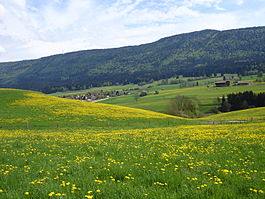
| image_photo = Vue sur Malleray.jpg |
||
| image_caption = |
| image_caption = Looking across the fields toward Pontenet village |
||
| imagepath_coa = |
| imagepath_coa = Pontenet-coat of arms.svg|pixel_coa= |
||
| map = |
| map = |
||
| languages = |
| languages = French |
||
| canton = |
| canton = Bern |
||
| iso-code-region = CH- |
| iso-code-region = CH-BE |
||
| district = [[ |
| district = [[Jura bernois (administrative district)|Jura bernois]] |
||
| coordinates = {{coord|47|15|N|7|15|E|type:landmark_region:CH-BE|display=inline}} |
|||
| lat_d=47|lat_m=32|lat_NS=N|long_d=8|long_m=17|long_EW=E |
|||
| postal_code = |
| postal_code = 2733 |
||
| municipality_code = |
| municipality_code = 0716 |
||
| area = |
| area = 2.74 |
||
| elevation = |
| elevation = 741|elevation_description= |
||
| population |
| population = 216 | populationof = Dec 2011 | popofyear = 2011 |
||
| website = www. |
| website = www.pontenet.ch |
||
| mayor = |mayor_asof=|mayor_party= |
| mayor = |mayor_asof=|mayor_party= |
||
| mayor_title = |list_of_mayors = |
| mayor_title = Maire |list_of_mayors = |
||
| places = |
| places = |
||
| demonym = |
| demonym = |
||
| neighboring_municipalities= [[ |
| neighboring_municipalities= [[Loveresse]], [[Souboz]], [[Malleray]] |
||
| twintowns = |
| twintowns = |
||
|}} |
|}} |
||
</td></tr> |
|||
</table> |
|||
{{reflist}} |
{{reflist}} |
||
Latest revision as of 21:23, 3 April 2024
| This is the template test cases page for the sandbox of Template:Infobox Switzerland municipality. to update the examples. If there are many examples of a complicated template, later ones may break due to limits in MediaWiki; see the HTML comment "NewPP limit report" in the rendered page. You can also use Special:ExpandTemplates to examine the results of template uses. You can test how this page looks in the different skins and parsers with these links: |
- Go to single testcase for infobox
- Go to the sandbox
| {{Infobox Switzerland municipality}} | {{Infobox Switzerland municipality/sandbox}} | ||||||||||||||||||||||||||||||||||||||||||||||||||||||||||||||||||||||||||||||||||||||||
|---|---|---|---|---|---|---|---|---|---|---|---|---|---|---|---|---|---|---|---|---|---|---|---|---|---|---|---|---|---|---|---|---|---|---|---|---|---|---|---|---|---|---|---|---|---|---|---|---|---|---|---|---|---|---|---|---|---|---|---|---|---|---|---|---|---|---|---|---|---|---|---|---|---|---|---|---|---|---|---|---|---|---|---|---|---|---|---|---|---|
|
| ||||||||||||||||||||||||||||||||||||||||||||||||||||||||||||||||||||||||||||||||||||||||
| {{Infobox Switzerland municipality}} | {{Infobox Switzerland municipality/sandbox}} | ||||||||||||||||||||||||||||||||||||||||||||||||||||||||||||||||||||||||||||||||||||||||||||||||||||||||
|---|---|---|---|---|---|---|---|---|---|---|---|---|---|---|---|---|---|---|---|---|---|---|---|---|---|---|---|---|---|---|---|---|---|---|---|---|---|---|---|---|---|---|---|---|---|---|---|---|---|---|---|---|---|---|---|---|---|---|---|---|---|---|---|---|---|---|---|---|---|---|---|---|---|---|---|---|---|---|---|---|---|---|---|---|---|---|---|---|---|---|---|---|---|---|---|---|---|---|---|---|---|---|---|---|---|
|
| ||||||||||||||||||||||||||||||||||||||||||||||||||||||||||||||||||||||||||||||||||||||||||||||||||||||||
| {{Infobox Switzerland municipality}} | {{Infobox Switzerland municipality/sandbox}} | ||||||||||||||||||||||||||||||||||||||||||||||||||||||||||||||||||||||||||||||||||||||||||||||||||||||||||||||||
|---|---|---|---|---|---|---|---|---|---|---|---|---|---|---|---|---|---|---|---|---|---|---|---|---|---|---|---|---|---|---|---|---|---|---|---|---|---|---|---|---|---|---|---|---|---|---|---|---|---|---|---|---|---|---|---|---|---|---|---|---|---|---|---|---|---|---|---|---|---|---|---|---|---|---|---|---|---|---|---|---|---|---|---|---|---|---|---|---|---|---|---|---|---|---|---|---|---|---|---|---|---|---|---|---|---|---|---|---|---|---|---|---|---|
|
| ||||||||||||||||||||||||||||||||||||||||||||||||||||||||||||||||||||||||||||||||||||||||||||||||||||||||||||||||
| {{Infobox Switzerland municipality}} | {{Infobox Switzerland municipality/sandbox}} | ||||||||||||||||||||||||||||||||||||||||||||||||||||||||||||||||||||||||||||||||||||
|---|---|---|---|---|---|---|---|---|---|---|---|---|---|---|---|---|---|---|---|---|---|---|---|---|---|---|---|---|---|---|---|---|---|---|---|---|---|---|---|---|---|---|---|---|---|---|---|---|---|---|---|---|---|---|---|---|---|---|---|---|---|---|---|---|---|---|---|---|---|---|---|---|---|---|---|---|---|---|---|---|---|---|---|---|---|
|
| ||||||||||||||||||||||||||||||||||||||||||||||||||||||||||||||||||||||||||||||||||||
|
| ||||||||||||||||||||||||||||||||||||||||||||||||||||||||||||||||||||||||||||||||||||||||||||||||||||||||||||||||||||||||||||||||||||||||||||||||||||||||
| {{Infobox Switzerland municipality}} | {{Infobox Switzerland municipality/sandbox}} | ||||||||||||||||||||||||||||||||||||||||||||||||||||||||||||||||||||||||||||||||||||
|---|---|---|---|---|---|---|---|---|---|---|---|---|---|---|---|---|---|---|---|---|---|---|---|---|---|---|---|---|---|---|---|---|---|---|---|---|---|---|---|---|---|---|---|---|---|---|---|---|---|---|---|---|---|---|---|---|---|---|---|---|---|---|---|---|---|---|---|---|---|---|---|---|---|---|---|---|---|---|---|---|---|---|---|---|---|
|
| ||||||||||||||||||||||||||||||||||||||||||||||||||||||||||||||||||||||||||||||||||||
| {{Infobox Switzerland municipality}} | {{Infobox Switzerland municipality/sandbox}} | ||||||||||||||||||||||||||||||||||||||||||||||||||||||||||||||||||||||||||||
|---|---|---|---|---|---|---|---|---|---|---|---|---|---|---|---|---|---|---|---|---|---|---|---|---|---|---|---|---|---|---|---|---|---|---|---|---|---|---|---|---|---|---|---|---|---|---|---|---|---|---|---|---|---|---|---|---|---|---|---|---|---|---|---|---|---|---|---|---|---|---|---|---|---|---|---|---|---|
|
| ||||||||||||||||||||||||||||||||||||||||||||||||||||||||||||||||||||||||||||
| {{Infobox Switzerland municipality}} | {{Infobox Switzerland municipality/sandbox}} | ||||||||||||||||||||||||||||||||||||||||||||||||||||||||||||||||||||||||||||||||||||||||
|---|---|---|---|---|---|---|---|---|---|---|---|---|---|---|---|---|---|---|---|---|---|---|---|---|---|---|---|---|---|---|---|---|---|---|---|---|---|---|---|---|---|---|---|---|---|---|---|---|---|---|---|---|---|---|---|---|---|---|---|---|---|---|---|---|---|---|---|---|---|---|---|---|---|---|---|---|---|---|---|---|---|---|---|---|---|---|---|---|---|
|
| ||||||||||||||||||||||||||||||||||||||||||||||||||||||||||||||||||||||||||||||||||||||||
| {{Infobox Switzerland municipality}} | {{Infobox Switzerland municipality/sandbox}} | ||||||||||||||||||||||||||||||||||||||||||||||||||||||||||||||||||||||||||||||||||||||||||||||||
|---|---|---|---|---|---|---|---|---|---|---|---|---|---|---|---|---|---|---|---|---|---|---|---|---|---|---|---|---|---|---|---|---|---|---|---|---|---|---|---|---|---|---|---|---|---|---|---|---|---|---|---|---|---|---|---|---|---|---|---|---|---|---|---|---|---|---|---|---|---|---|---|---|---|---|---|---|---|---|---|---|---|---|---|---|---|---|---|---|---|---|---|---|---|---|---|---|---|
|
| ||||||||||||||||||||||||||||||||||||||||||||||||||||||||||||||||||||||||||||||||||||||||||||||||


