Pourangaki River: Difference between revisions
Appearance
Content deleted Content added
m WP:CHECKWIKI error fixes + other fixes using AWB (10067) |
|||
| (16 intermediate revisions by 11 users not shown) | |||
| Line 1: | Line 1: | ||
{{ |
{{Use New Zealand English|date=April 2024}} |
||
{{Use dmy dates|date=July 2019}} |
|||
{{Infobox |
{{Infobox river |
||
| name = Pourangaki River |
|||
| native_name ={{native name|mi|Pourangaki}} |
|||
| image_name = |
|||
| name_other = |
|||
| name_etymology = |
|||
| nickname = |
|||
<!---------------------- IMAGE--> |
|||
| ⚫ | |||
| image = |
|||
| basin_countries = [[New Zealand]] |
|||
| image_size = |
|||
| image_caption = |
|||
| image_alt = |
|||
| mouth_elevation = |
|||
<!---------------------- MAPS --> |
|||
| ⚫ | |||
| map = |
|||
| map_size = |
|||
| map_caption = |
|||
| map_alt = |
|||
| pushpin_map = New Zealand |
|||
| pushpin_map_size = 270px |
|||
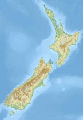
| pushpin_map_caption= Pourangaki River location |
|||
| pushpin_map_alt = |
|||
<!---------------------- LOCATION --> |
|||
| subdivision_type1 = Country |
|||
| subdivision_name1 = [[New Zealand]] |
|||
| subdivision_type2 = Region |
|||
| subdivision_name2 = [[Manawatū-Whanganui]] |
|||
| subdivision_type3 = District |
|||
| subdivision_name3 = [[Rangitikei District]] |
|||
| subdivision_type4 = |
|||
| subdivision_name4 = |
|||
| subdivision_type5 = |
|||
| subdivision_name5 = |
|||
<!---------------------- PHYSICAL CHARACTERISTICS --> |
|||
| length = {{convert|23|km|mi|abbr=on}} |
|||
| width_min = |
|||
| width_avg = |
|||
| width_max = |
|||
| depth_min = |
|||
| depth_avg = |
|||
| depth_max = |
|||
| discharge1_location= |
|||
| discharge1_min = |
|||
| discharge1_avg = |
|||
| discharge1_max = |
|||
<!---------------------- BASIN FEATURES --> |
|||
| source1 = Taumataomekura |
|||
| source1_location = [[Ruahine Range]] |
|||
| source1_coordinates= {{coord|39|53|13|S|176|6|43|E|display=inline}} |
|||
| source1_elevation = {{convert|1500|m|ft|abbr=on}} |
|||
| ⚫ | |||
| mouth_location = |
|||
| ⚫ | |||
| mouth_elevation = {{convert|430|m|ft|abbr=on}} |
|||
| progression = '''Pourangaki River''' → [[Kawhatau River]] → [[Rangitīkei River]] |
|||
| river_system = [[Rangitīkei River]] |
|||
| basin_size = |
|||
| basin_landmarks = |
|||
| basin_population = |
|||
| tributaries_left = |
|||
| tributaries_right = |
|||
| waterbodies = |
|||
| waterfalls = |
|||
| bridges = |
|||
| ports = |
|||
| ⚫ | |||
| custom_data = |
|||
| extra = |
|||
}} |
}} |
||
The '''Pourangaki River''' is a river of the [[ |
The '''Pourangaki River''' is a river of the [[Manawatū-Whanganui]] region of [[New Zealand]]'s [[North Island]]. It flows northwest from sources in the [[Ruahine Range]], reaching the [[Kawhatau River]] {{convert|13|km|mi|0}} east of [[Mangaweka]].<ref>{{LINZ|30970|Pourangaki River|2010-04-23}}</ref> |
||
==See also== |
==See also== |
||
| Line 23: | Line 77: | ||
{{reflist}} |
{{reflist}} |
||
| ⚫ | |||
| ⚫ | |||
[[Category:Rivers of New Zealand]] |
|||
| ⚫ | |||
{{ManawatuWanganui- |
{{ManawatuWanganui-river-stub}} |
||
Latest revision as of 02:38, 13 April 2024
| Pourangaki River | |
|---|---|
| Native name | Pourangaki (Māori) |
| Location | |
| Country | New Zealand |
| Region | Manawatū-Whanganui |
| District | Rangitikei District |
| Physical characteristics | |
| Source | Taumataomekura |
| • location | Ruahine Range |
| • coordinates | 39°53′13″S 176°6′43″E / 39.88694°S 176.11194°E |
| • elevation | 1,500 m (4,900 ft) |
| Mouth | Kawhatau River |
• coordinates | 39°48′37″S 175°57′42″E / 39.81028°S 175.96167°E |
• elevation | 430 m (1,410 ft) |
| Length | 23 km (14 mi) |
| Basin features | |
| Progression | Pourangaki River → Kawhatau River → Rangitīkei River |
| River system | Rangitīkei River |
The Pourangaki River is a river of the Manawatū-Whanganui region of New Zealand's North Island. It flows northwest from sources in the Ruahine Range, reaching the Kawhatau River 13 kilometres (8 mi) east of Mangaweka.[1]
See also
[edit]References
[edit]- ^ "Place name detail: Pourangaki River". New Zealand Gazetteer. New Zealand Geographic Board. Retrieved 23 April 2010.

