Hawkesbury (East) Airport: Difference between revisions
Appearance
Content deleted Content added
Add template and other clean up using AWB |
m General formatting any tidying. |
||
| (21 intermediate revisions by 11 users not shown) | |||
| Line 1: | Line 1: | ||
{{Airport |
{{Short description|Airport in Ontario, Canada}} |
||
{{Infobox airport |
|||
| name = Hawkesbury (East) Airport |
|||
{{Airport infobox| |
|||
| IATA = |
|||
IATA=N/A| |
|||
| ICAO = |
|||
ICAO=CPG5| |
|||
| TC = CPG5 |
|||
type=Public| |
|||
| type = Public |
|||
run by=Focus Sport Aviation Ltd.| |
|||
| owner = |
|||
| ⚫ | |||
| operator = East Hawkesbury Airport |
|||
elevation_ft=200| |
|||
| city-served = |
|||
elevation_m=61| |
|||
| location = [[Hawkesbury, Ontario]] |
|||
| ⚫ | |||
| timezone = [[Eastern Time Zone|EST]] |
|||
| utc = [[UTC−05:00]] |
|||
| summer = EDT |
|||
| utcs = [[UTC−04:00]] |
|||
| elevation-f = 200 |
|||
| ⚫ | |||
| pushpin_map = Canada Ontario#Canada |
|||
| pushpin_label = CPG5 |
|||
| pushpin_map_caption = Location in Ontario |
|||
| website = |
|||
| r1-number = 10/28 |
|||
| r1-length-f = 2,000 |
|||
| r1-surface = Turf |
|||
| footnotes = Source: [[Canada Flight Supplement]]<ref name="CFS">{{CFS}}</ref> |
|||
}} |
}} |
||
{{Runway title}} |
|||
{{Runway| |
|||
runway_angle=10/28| |
|||
runway_length_f=2,600| |
|||
runway_length_m=793| |
|||
runway_surface=[[Sod|Turf]]| |
|||
}} |
|||
{{Airport end frame}} |
|||
'''Hawkesbury (East) Airport''' |
'''Hawkesbury (East) Airport''' {{Airport codes||||CPG5}}, located {{convert|2|NM|lk=in}} east of [[Hawkesbury, Ontario|Hawkesbury]], [[Ontario]], Canada, is one of three small [[Aerodrome#Canada|aerodrome]] between [[Ottawa]] and [[Montreal]] on the south shore of the [[Ottawa River]]. |
||
==See also== |
==See also== |
||
| Line 26: | Line 32: | ||
==References== |
==References== |
||
<references/> |
|||
*{{CFS}} |
|||
{{List of airports in Canada}} |
|||
{{Canadian Airports}} |
|||
{{PrescottRussell}} |
{{PrescottRussell}} |
||
{{authority control}} |
|||
| ⚫ | |||
| ⚫ | |||
| ⚫ | |||
Latest revision as of 13:22, 17 April 2024
Hawkesbury (East) Airport | |||||||||||
|---|---|---|---|---|---|---|---|---|---|---|---|
| Summary | |||||||||||
| Airport type | Public | ||||||||||
| Operator | East Hawkesbury Airport | ||||||||||
| Location | Hawkesbury, Ontario | ||||||||||
| Time zone | EST (UTC−05:00) | ||||||||||
| • Summer (DST) | EDT (UTC−04:00) | ||||||||||
| Elevation AMSL | 200 ft / 61 m | ||||||||||
| Coordinates | 45°34′58″N 074°32′56″W / 45.58278°N 74.54889°W | ||||||||||
| Map | |||||||||||
 | |||||||||||
| Runways | |||||||||||
| |||||||||||
Source: Canada Flight Supplement[1] | |||||||||||
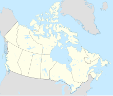
Hawkesbury (East) Airport (TC LID: CPG5), located 2 nautical miles (3.7 km; 2.3 mi) east of Hawkesbury, Ontario, Canada, is one of three small aerodrome between Ottawa and Montreal on the south shore of the Ottawa River.
See also
[edit]References
[edit]


