Quirima: Difference between revisions
Appearance
Content deleted Content added
GreenC bot (talk | contribs) m Reformat 1 archive link. Wayback Medic 2.1 |
m Adjusted convert template formatting to avoid accidental replacement (via WP:JWB) |
||
| (7 intermediate revisions by 5 users not shown) | |||
| Line 1: | Line 1: | ||
{{Short description|Town and municipality in the province of Malanje, Angola}} |
|||
{{Infobox settlement |
{{Infobox settlement |
||
<!--See the Table at Infobox Settlement for all fields and descriptions of usage--> |
|||
| name = Quirima |
| name = Quirima |
||
| settlement_type = [[Municipalities of Angola|Municipality]] |
| settlement_type = [[Municipalities of Angola|Municipality]] and [[List of cities and towns in Angola|town]] |
||
| pushpin_map = Angola |
| pushpin_map = Angola |
||
| pushpin_label_position = right |
| pushpin_label_position = right |
||
| Line 13: | Line 14: | ||
| subdivision_name1 = [[Malanje Province|Malanje]] |
| subdivision_name1 = [[Malanje Province|Malanje]] |
||
| area_total_km2 = 10077 |
| area_total_km2 = 10077 |
||
| |
| population_total = 21134 |
||
| |
| population_as_of = 2014 Census |
||
| population_footnotes = <ref name =Censo2014>{{cite web|url=https://www.ine.gov.ao/images/Censo_2014/Publicacao_Malanje_Rev_DG_27_09_2016.pdf |title=Resultados Definitivos Recenseamento Geral da População e da Habitação – 2014 Província de Malanje |access-date=3 May 2020 |website=Instituto Nacional de Estatística, República de Angola| df=dmy }}</ref> |
|||
| population_density_km2 = 3.6 |
| population_density_km2 = 3.6 |
||
| timezone = [[West Africa Time|WAT]] |
| timezone = [[West Africa Time|WAT]] |
||
| Line 20: | Line 22: | ||
}} |
}} |
||
'''Quirima''' (or '''Kirima''') is a |
'''Quirima''' (or '''Kirima''') is a town and [[municipalities of Angola|municipality]] in the [[provinces of Angola|province]] of [[Malanje Province|Malanje]] (Malange) in [[Angola]].<ref>{{cite web | url = http://www.statoids.com/yao.html | title = City councils of Angola | publisher=Statoids | access-date = 9 Apr 2009}}</ref><ref>{{cite web | url = http://www.angola.org/referenc/provinces.html | title = Reference Center: Provinces | publisher = Angolan Embassy in the United States | archive-url = https://web.archive.org/web/20060211115650/http://www.angola.org/referenc/provinces.html | archive-date= 11 February 2006 | access-date = 27 Feb 2010}}</ref><ref>{{cite web | url = http://www.info-angola.ao/index.php?option=com_content&task=blogcategory&id=469&Itemid=520 | title = Malange: Municípios | publisher = Info-Angola | access-date = 27 Feb 2010|language=pt}}</ref> It covers an [[area]] of {{convert|10077|km2}} and its [[population]] as of 2014 is 21,134 inhabitants.<ref name =Censo2014>{{cite web|url=https://www.ine.gov.ao/images/Censo_2014/Publicacao_Malanje_Rev_DG_27_09_2016.pdf |title=Resultados Definitivos Recenseamento Geral da População e da Habitação – 2014 Província de Malanje |access-date=3 May 2020 |website=Instituto Nacional de Estatística, República de Angola| df=dmy }}</ref> |
||
==Geography== |
|||
Quirima is bordered to the north by the municipality of [[Cambundi-Catembo]], to the east by the municipality of [[Cacolo]], to the south by the municipality of [[Cuemba]], and to the west by the municipality of [[Luquembo]]. |
Quirima is bordered to the north by the municipality of [[Cambundi-Catembo]], to the east by the municipality of [[Cacolo]], to the south by the municipality of [[Cuemba]], and to the west by the municipality of [[Luquembo]]. |
||
Latest revision as of 14:48, 17 April 2024
Quirima | |
|---|---|
Municipality and town | |
| Coordinates: 10°54′S 18°05′E / 10.900°S 18.083°E | |
| Country | |
| Province | Malanje |
| Area | |
• Total | 10,077 km2 (3,891 sq mi) |
| Population (2014 Census)[1] | |
• Total | 21,134 |
| • Density | 3.6/km2 (9/sq mi) |
| Time zone | UTC+1 (WAT) |
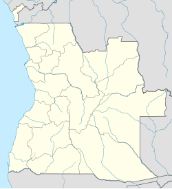
Quirima (or Kirima) is a town and municipality in the province of Malanje (Malange) in Angola.[2][3][4] It covers an area of 10,077 square kilometres (3,891 sq mi) and its population as of 2014 is 21,134 inhabitants.[1]
Geography
[edit]Quirima is bordered to the north by the municipality of Cambundi-Catembo, to the east by the municipality of Cacolo, to the south by the municipality of Cuemba, and to the west by the municipality of Luquembo.
The municipality contains the comunas (communes) of Quirima and Sauter.
References
[edit]- ^ a b "Resultados Definitivos Recenseamento Geral da População e da Habitação – 2014 Província de Malanje" (PDF). Instituto Nacional de Estatística, República de Angola. Retrieved 3 May 2020.
- ^ "City councils of Angola". Statoids. Retrieved 9 Apr 2009.
- ^ "Reference Center: Provinces". Angolan Embassy in the United States. Archived from the original on 11 February 2006. Retrieved 27 Feb 2010.
- ^ "Malange: Municípios" (in Portuguese). Info-Angola. Retrieved 27 Feb 2010.

