John Greif II Airport: Difference between revisions
Appearance
Content deleted Content added
Gertjan R. (talk | contribs) →Airlines and destinations: - BCV (not bookable) |
|||
| (14 intermediate revisions by 10 users not shown) | |||
| Line 1: | Line 1: | ||
{{about|the airport in Belize|the airport in Côte D'Ivoire|San Pédro Airport|the airport in Nicaragua|San Pedro Airport (Nicaragua)}} |
{{about|the airport in Belize|the airport in Côte D'Ivoire|San Pédro Airport|the airport in Nicaragua|San Pedro Airport (Nicaragua)}} |
||
{{short description|Airport in Belize}} |
|||
{{Infobox airport |
{{Infobox airport |
||
| name = John Greif II Airport |
| name = John Greif II Airport |
||
| Line 12: | Line 13: | ||
| coordinates = {{coord|17|54|50|N|87|58|16|W|region:BZ|display=inline,title}} |
| coordinates = {{coord|17|54|50|N|87|58|16|W|region:BZ|display=inline,title}} |
||
| pushpin_label = '''SPR''' |
| pushpin_label = '''SPR''' |
||
| image = San Pedro, Ambergris Caye, Belize - Tropic Air Airport.JPG |
|||
| image = |
|||
| image-width = |
| image-width = |
||
| IATA = SPR |
| IATA = SPR |
||
| ICAO = |
| ICAO = MZSP |
||
| LID = BZ-MZ10 |
| LID = BZ-MZ10 |
||
| type = Public |
| type = Public |
||
| Line 34: | Line 35: | ||
| stat2-header = |
| stat2-header = |
||
| stat2-data = |
| stat2-data = |
||
| footnotes = Source: [[DAFIF]]<ref>{{cite web|url-status=usurped|url=http://worldaerodata.com/wad.cgi?airport=MZ10|archive-url=https://web.archive.org/web/20190305143444/http://worldaerodata.com/wad.cgi?airport=MZ10|archive-date=2019-03-05|title=Airport information for MZ10|website=World Aero Data}} Data current as of October 2006. Source: DAFIF.</ref> GCM<ref>{{GCM|SPR}}</ref> |
|||
| footnotes = Source: [[DAFIF]]<ref> {{WAD|MZ10|source=DAFIF}}</ref> GCM<ref>{{GCM|SPR}}</ref> Google Maps<ref>[https://www.google.com/maps/@17.9129594,-87.9716939,1387m/data=!3m1!1e3 Google Maps - San Pedro]</ref> |
|||
}} |
}} |
||
'''John Greif II Airport''' {{airport codes|SPR|}} is an |
'''John Greif II Airport''' {{airport codes|SPR|MZSP}} is an airport that serves [[San Pedro Town|San Pedro]] and [[Ambergris Caye]], [[Belize]]. It was renamed from San Pedro Airport to John Greif II Airport in 2010.<ref>[http://www.ambergristoday.com/content/stories/2010/december/16/sp-airport-newly-named-john-greif-ii-airport Ambergris Today - Airport renamed December 2010]</ref><ref>{{cite web |title=John Greif II |url=https://ambergriscaye.com/sanpedrosun/old/05-483.html |website=Ambergris Caye |accessdate=17 January 2019}}</ref> |
||
==Airlines and destinations== |
|||
The airport was renamed from San Pedro Airport to John Greif II Airport in 2010.<ref>[http://www.ambergristoday.com/content/stories/2010/december/16/sp-airport-newly-named-john-greif-ii-airport Ambergris Today - Airport renamed December 2010]</ref> |
|||
==Scheduled service== |
|||
{{Airport-dest-list |
{{Airport-dest-list |
||
| [[Maya Island Air]] | [[Philip S. W. Goldson International Airport|Belize |
| [[Maya Island Air]] | [[Philip S. W. Goldson International Airport|Belize City–International]], [[Belize City Municipal Airport|Belize City–Municipal]], [[Caye Caulker Airport|Caye Caulker]], [[Caye Chapel Airport|Caye Chapel]], [[Corozal Airport|Corozal]] |
||
| [[Tropic Air]] | [[Philip S. W. Goldson International Airport|Belize |
| [[Tropic Air]] | [[Philip S. W. Goldson International Airport|Belize City–International]], [[Belize City Municipal Airport|Belize City–Municipal]], [[Caye Caulker Airport|Caye Caulker]], [[Corozal Airport|Corozal]], [[Sarteneja Airport|Sarteneja]]}} |
||
==See also== |
==See also== |
||
| Line 55: | Line 54: | ||
==External links== |
==External links== |
||
*[http://ourairports.com/airports/BZ-SPR/ OurAirports - San Pedro] |
*[http://ourairports.com/airports/BZ-SPR/ OurAirports - San Pedro] |
||
*[https://www.openstreetmap.org/#map=13/17.9083/-87.9726 OpenStreetMap - San Pedro] |
|||
*[http://www.fallingrain.com/apts/641.html FallingRain - San Pedro Airport] |
*[http://www.fallingrain.com/apts/641.html FallingRain - San Pedro Airport] |
||
*{{ASN|SPR}} |
|||
{{portalbar|Belize|Aviation}} |
{{portalbar|Belize|Aviation}} |
||
{{airports in Belize|state=collapsed}} |
{{airports in Belize|state=collapsed}} |
||
{{authority control}} |
|||
[[Category:Airports in Belize]] |
[[Category:Airports in Belize]] |
||
[[Category:Belize District]] |
|||
Latest revision as of 16:02, 21 April 2024
John Greif II Airport San Pedro Airport | |||||||||||
|---|---|---|---|---|---|---|---|---|---|---|---|
 | |||||||||||
| Summary | |||||||||||
| Airport type | Public | ||||||||||
| Serves | San Pedro, Belize | ||||||||||
| Hub for | Tropic Air | ||||||||||
| Elevation AMSL | 4 ft / 1 m | ||||||||||
| Coordinates | 17°54′50″N 87°58′16″W / 17.91389°N 87.97111°W | ||||||||||
| Map | |||||||||||
 | |||||||||||
| Runways | |||||||||||
| |||||||||||
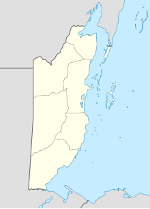
John Greif II Airport (IATA: SPR, ICAO: MZSP) is an airport that serves San Pedro and Ambergris Caye, Belize. It was renamed from San Pedro Airport to John Greif II Airport in 2010.[3][4]
Airlines and destinations
[edit]See also
[edit]References
[edit]- ^ "Airport information for MZ10". World Aero Data. Archived from the original on 2019-03-05.
{{cite web}}: CS1 maint: unfit URL (link) Data current as of October 2006. Source: DAFIF. - ^ Airport information for SPR at Great Circle Mapper.
- ^ Ambergris Today - Airport renamed December 2010
- ^ "John Greif II". Ambergris Caye. Retrieved 17 January 2019.
External links
[edit]- OurAirports - San Pedro
- FallingRain - San Pedro Airport
- Accident history for SPR at Aviation Safety Network

