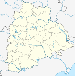
Chennaraopet: Difference between revisions
Appearance
Content deleted Content added
No edit summary |
Tags: Mobile edit Mobile web edit |
||
| (35 intermediate revisions by 24 users not shown) | |||
| Line 1: | Line 1: | ||
{{Use dmy dates|date=May 2018}} |
|||
{{Use Indian English|date=May 2018}} |
|||
{{Infobox settlement |
{{Infobox settlement |
||
| name = Chennaraopet |
| name = Chennaraopet |
||
| native_name = |
| native_name = |
||
| native_name_lang = |
| native_name_lang = |
||
| other_name = |
| other_name = |
||
| Line 9: | Line 11: | ||
| image_alt = |
| image_alt = |
||
| image_caption = |
| image_caption = |
||
| pushpin_map = India Telangana |
| pushpin_map = India Telangana#India |
||
| pushpin_label_position = bottom |
| pushpin_label_position = bottom |
||
| pushpin_map_alt = |
| pushpin_map_alt = |
||
| pushpin_map_caption = Location in Telangana, India |
| pushpin_map_caption = Location in Telangana, India |
||
| |
| coordinates = {{coord|17|52|55|N|79|52|10|E|display=inline,title}} |
||
| latm = 52 |
|||
| lats = 55 |
|||
| latNS = N |
|||
| longd = 79 |
|||
| longm = 52 |
|||
| longs = 10 |
|||
| longEW = E |
|||
| coordinates_display = inline,title |
|||
| subdivision_type = Country |
| subdivision_type = Country |
||
| subdivision_name = {{flag|India}} |
| subdivision_name = {{flag|India}} |
||
| Line 27: | Line 21: | ||
| subdivision_name1 = [[Telangana]] |
| subdivision_name1 = [[Telangana]] |
||
| subdivision_type2 = [[List of districts of India|District]] |
| subdivision_type2 = [[List of districts of India|District]] |
||
| subdivision_name2 = [[Warangal district |
| subdivision_name2 = [[Warangal district]] |
||
| established_title = <!-- Established --> |
| established_title = <!-- Established --> |
||
| established_date = |
| established_date = |
||
| Line 55: | Line 49: | ||
| postal_code_type = <!-- [[Postal Index Number|PIN]] --> |
| postal_code_type = <!-- [[Postal Index Number|PIN]] --> |
||
| postal_code = 506332 |
| postal_code = 506332 |
||
| registration_plate = |
| registration_plate =TS |
||
| website = |
| website = {{URL|telangana.gov.in}} |
||
| footnotes = |
| footnotes = |
||
}} |
}} |
||
'''Chennaraopet''' is a village and a [[Subdivisions of India|mandal]] in [[Warangal district]] in the state of [[Telangana]] in [[India]].<ref>{{cite web |
'''Chennaraopet''' is a village and a [[Subdivisions of India|mandal]] in [[Warangal district]] in the state of [[Telangana]] in [[India]].<ref name="district">{{cite web|title=Warangal district|url=http://newdistrictsformation.telangana.gov.in/uploads/gos-circulars/1476130220055231.Warangal%20U.pdf|website=New Districts Formation Portal|accessdate=11 October 2016|archive-url=https://web.archive.org/web/20161011223505/http://newdistrictsformation.telangana.gov.in/uploads/gos-circulars/1476130220055231.Warangal%20U.pdf|archive-date=11 October 2016|url-status=dead}}</ref> |
||
|url=http://www.censusindia.gov.in/ |
|||
|title=List of Sub-Districts |
|||
|publisher=Census of India |
|||
|accessdate=2007-05-29 |
|||
}}</ref> |
|||
== Villages == |
|||
==Geography & History of Chennaraopet== |
|||
{{div col begin|colwidth=30em}} |
|||
* Akkalchedu |
|||
* Ameenabad |
|||
* Chennaraopet |
|||
* Gurijala (Present Narsampet mandal) |
|||
* Jhalli |
|||
* Konapuram |
|||
* Lingagiri |
|||
* Lingapuram |
|||
* Papaiahpeta |
|||
* Suripalle |
|||
* Thimmarainipahad |
|||
* Upparapally |
|||
* Yellaigudem |
|||
{{div col end}} |
|||
| ⚫ | |||
Chennaraopet is located at Five km south of [[Narsampet]] towards [[Nekkonda]]. The administration and police station lies 1.5 km Away from the village. The major crops here are rice, cotton, chilli, corn and ground nuts |
|||
* [https://villageinfo.in/telangana/warangal/chennaraopet.html villageinfo.in] |
|||
Chennaraopet is a village panchayat located in the Warangal district of Andhra-Pradesh state,India. The latitude 17.8803475 and longitude 79.8695837 are the geocoordinate of the Chennaraopet. Hyderabad is the state capital for Chennaraopet village. It is located around 156.6 kilometer away from Chennaraopet.. The other nearest state capital from Chennaraopet is Hyderabad and its distance is 214.8 KM. The other surrouning state capitals are Chennai 534.2 KM., Bangalore 598.3 KM., Bhopal 649.0 KM., |
|||
The surrounding nearby villages and its distance from Chennaraopet are Jhalli 4.0 KM , Thimmarainipahad 4.0 KM , Gurijal 5.8 KM , Yellaigudem 6.1 KM , Papaiahpeta 6.9 KM , Lingagiri 8.3 KM , Bojervu 8.9 KM , Upparapalle 19.6 KM , Rajapalli , Ameenpet , |
|||
The native language of Chennaraopet is Telugu, Urdu, English and most of the village people speak Telugu. |
|||
Kandi Veera Reddy was elected as first Sarpanch from Chennaraopet Village from communist party of India. Veera Reddy was elected continuously for five terms as sarpanch nearly 30 years. |
|||
| ⚫ | |||
{{reflist}} |
{{reflist}} |
||
{{Warangal Rural district}} |
|||
| ⚫ | |||
[[Category:Mandals in Warangal district]] |
[[Category:Mandals in Warangal district]] |
||
| ⚫ | |||
{{ |
{{Telangana-geo-stub}} |
||
Latest revision as of 19:05, 25 May 2024
Chennaraopet | |
|---|---|
village | |
| Coordinates: 17°52′55″N 79°52′10″E / 17.88194°N 79.86944°E | |
| Country | |
| State | Telangana |
| District | Warangal district |
| Talukas | Chennaraopet |
| Languages | |
| • Official | Telugu |
| Time zone | UTC+5:30 (IST) |
| Vehicle registration | TS |
| Website | telangana |
Chennaraopet is a village and a mandal in Warangal district in the state of Telangana in India.[1]
Villages
[edit]- Akkalchedu
- Ameenabad
- Chennaraopet
- Gurijala (Present Narsampet mandal)
- Jhalli
- Konapuram
- Lingagiri
- Lingapuram
- Papaiahpeta
- Suripalle
- Thimmarainipahad
- Upparapally
- Yellaigudem
References
[edit]- ^ "Warangal district" (PDF). New Districts Formation Portal. Archived from the original (PDF) on 11 October 2016. Retrieved 11 October 2016.


