Baradla cave: Difference between revisions
m →top: HTTP → HTTPS for UNESCO World Heritage Site, replaced: http://whc.unesco.org/ → https://whc.unesco.org/ |
m Sort Template:Expand language by topic |
||
| (7 intermediate revisions by 7 users not shown) | |||
| Line 1: | Line 1: | ||
{{ |
{{Short description|Cave system in Hungary and Slovakia}} |
||
{{Expand Hungarian|Baradla–Domica-barlangrendszer|date=April 2014}} |
{{Expand Hungarian|topic=geo|Baradla–Domica-barlangrendszer|date=April 2014}} |
||
{{Infobox UNESCO World Heritage Site |
{{Infobox UNESCO World Heritage Site |
||
| image = Minerva sisakja.jpg |
| image = Minerva sisakja.jpg |
||
| Line 15: | Line 15: | ||
| map_caption = |
| map_caption = |
||
}} |
}} |
||
The '''Baradla Domica cave system''' |
The '''Baradla Domica cave system''' is a large cave system in northern [[Hungary]]. As part of the [[Aggtelek Karst]], it extends more than {{convert|25.5|km|m|abbr=on}} and includes the {{convert|5.3|km|mi|abbr=on}} [[Domica cave]]. A significant part of the cave has varied colors and shapes providing an unparalleled spectacle of decorative stalactites. |
||
The cave system has been visited and researched for centuries because of its famous ornate [[speleothem]]s. Natural entrances to the cave have been open from ancient times, and there are traces of Neolithic occupation.<ref>{{cite journal |bibcode=2016EGUGA..1815278M |title=Study of radiocarbon dynamics of Baradla Cave, Hungary |journal=EGU General Assembly Conference Abstracts |volume=18 |pages=EPSC2016-15278 |publisher=Adsabs harvard edu |last1=Molnár |first1=Mihály |last2=Dezsö |first2=Zoltán |last3=Futo |first3=Istvan |last4=Siklósy |first4=Zoltan |last5=Jull |first5=A. J. Timothy |last6=Koltai |first6=Gabriella |year=2016 }}</ref> |
|||
However, the first written mention of the cave dates from 1549. The first survey was conducted in 1794 by Joseph Sartory. In 1825 it was only known to be {{convert|1.8|km|mi|abbr=on}} in length. This section was surveyed in 1802 and the first map published. In 1825 the engineer, Imre Vass explored the cave a further {{convert|5|km|mi|abbr=on}} along the main branch, producing an accurate map and a description. His work, published in Hungarian and German was published in 1831.<ref>{{cite web |url=http://scholarcommons.usf.edu/ijs/vol2/iss4/18/ |title="Algal growth experiments in the Baradla Cave at Aggtelek (Biospeleolog" by Erzsebet Kol |publisher=Scholarcommons.usf.edu |access-date= January 7, 2017}}</ref> In order to facilitate cave visits, the first tourist walks were installed in 1806. In 1890 the Red Lake entrances were established and further exploration and extension was conducted between 1927 and 1928. |
|||
== Description == |
|||
In order to facilitate cave visits, the first tourist walks were installed in 1806. In 1890 the Red Lake entrances were established and further exploration and extension was conducted between 1927 and 1928. |
|||
The cave has a natural entrance at [[Aggtelek]], at the foot of a high white cliff that overlooks the edge of the village. It has an articulated, meandering main channel {{convert|7|km|mi|abbr=on}} long, with a rock tunnel, on average, {{convert|10|m|ft|abbr=on}} wide and {{convert|7|to|8|m|ft|abbr=on}} high with a few giant caverns (one of which is large enough to hold 1000 people at once.<ref name = "iucn">{{cite report |url = https://whc.unesco.org/document/154117 |title = World Heritage Nomination - IUCN Summary: Caves of Aggtelek Karst and Slovak Karst |date = March 1995 |publisher = IUCN |access-date = 29 April 2023}}</ref> The main branch has several short and long connecting side branches. Subterranean river waters run through the main branch at times of flood. The world's largest known stalagmite, at {{convert|37.2|m|ft|abbr=on}} tall, is found within the Baradla-Domica cave system.<ref name = "iucn"/> |
|||
| ⚫ | |||
Over 500 species of troglodytes (cave-dwelling animals), including 21 species of bats are found within the cave system.<ref name = "iucn"/> |
|||
== Tourism and Conservation == |
|||
| ⚫ | Because of its spectacular cave structures and rare testimony to both tropical and temperate effects on karst landscapes, Baradla and other caves of the Aggtelek Karst and Slovak Karst were declared as a [[UNESCO]] [[World Heritage Site]] in 1995.<ref>{{cite web |url=https://whc.unesco.org/en/list/725 |title=Caves of Aggtelek Karst and Slovak Karst |publisher= United Nations Educational, Scientific, and Cultural Organization |access-date= 29 April 2023}}</ref> The entire cave system and the catchment areas - with the nearby Domicával wetlands of international importance were subject to protection in 2001. The Aggtelek National Park is an appealing attraction all year round, popular with visitors, who can choose from several hiking trails.<ref>{{cite web |url=https://www.researchgate.net/publication/258317755 |title=Water chemistry analysis in the sediment of Baradla Cave, Hungary (PDF Download Available) |access-date= January 7, 2017}}</ref> |
||
[[File:Aggtelek - Baradla.jpg|thumb|upright=1.2|none|Baradla Cave]] |
[[File:Aggtelek - Baradla.jpg|thumb|upright=1.2|none|Baradla Cave]] |
||
==References== |
==References== |
||
{{ |
{{Reflist|2}} |
||
{{Navbox prehistoric caves}} |
{{Navbox prehistoric caves}} |
||
{{ |
{{Commons category|Baradla Cave}} |
||
{{Authority control}} |
|||
[[Category:Caves of Hungary]] |
[[Category:Caves of Hungary]] |
||
| Line 37: | Line 45: | ||
[[Category:Geography of Borsod-Abaúj-Zemplén County]] |
[[Category:Geography of Borsod-Abaúj-Zemplén County]] |
||
[[Category:Tourist attractions in Borsod-Abaúj-Zemplén County]] |
[[Category:Tourist attractions in Borsod-Abaúj-Zemplén County]] |
||
[[Category:Caves of Aggtelek Karst and Slovak Karst]] |
|||
Latest revision as of 18:28, 28 May 2024
You can help expand this article with text translated from the corresponding article in Hungarian. (April 2014) Click [show] for important translation instructions.
|
| UNESCO World Heritage Site | |
|---|---|
 | |
| Location | Hungary and Slovakia |
| Part of | Caves of Aggtelek Karst and Slovak Karst |
| Criteria | Natural: (viii) |
| Reference | 725ter |
| Inscription | 1995 (19th Session) |
| Extensions | 2000, 2008 |
| Coordinates | 48°28′N 20°30′E / 48.467°N 20.500°E |
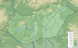
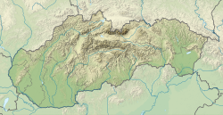
The Baradla Domica cave system is a large cave system in northern Hungary. As part of the Aggtelek Karst, it extends more than 25.5 km (25,500 m) and includes the 5.3 km (3.3 mi) Domica cave. A significant part of the cave has varied colors and shapes providing an unparalleled spectacle of decorative stalactites.
The cave system has been visited and researched for centuries because of its famous ornate speleothems. Natural entrances to the cave have been open from ancient times, and there are traces of Neolithic occupation.[1] However, the first written mention of the cave dates from 1549. The first survey was conducted in 1794 by Joseph Sartory. In 1825 it was only known to be 1.8 km (1.1 mi) in length. This section was surveyed in 1802 and the first map published. In 1825 the engineer, Imre Vass explored the cave a further 5 km (3.1 mi) along the main branch, producing an accurate map and a description. His work, published in Hungarian and German was published in 1831.[2] In order to facilitate cave visits, the first tourist walks were installed in 1806. In 1890 the Red Lake entrances were established and further exploration and extension was conducted between 1927 and 1928.
Description
[edit]The cave has a natural entrance at Aggtelek, at the foot of a high white cliff that overlooks the edge of the village. It has an articulated, meandering main channel 7 km (4.3 mi) long, with a rock tunnel, on average, 10 m (33 ft) wide and 7 to 8 m (23 to 26 ft) high with a few giant caverns (one of which is large enough to hold 1000 people at once.[3] The main branch has several short and long connecting side branches. Subterranean river waters run through the main branch at times of flood. The world's largest known stalagmite, at 37.2 m (122 ft) tall, is found within the Baradla-Domica cave system.[3]
Over 500 species of troglodytes (cave-dwelling animals), including 21 species of bats are found within the cave system.[3]
Tourism and Conservation
[edit]Because of its spectacular cave structures and rare testimony to both tropical and temperate effects on karst landscapes, Baradla and other caves of the Aggtelek Karst and Slovak Karst were declared as a UNESCO World Heritage Site in 1995.[4] The entire cave system and the catchment areas - with the nearby Domicával wetlands of international importance were subject to protection in 2001. The Aggtelek National Park is an appealing attraction all year round, popular with visitors, who can choose from several hiking trails.[5]

References
[edit]- ^ Molnár, Mihály; Dezsö, Zoltán; Futo, Istvan; Siklósy, Zoltan; Jull, A. J. Timothy; Koltai, Gabriella (2016). "Study of radiocarbon dynamics of Baradla Cave, Hungary". EGU General Assembly Conference Abstracts. 18. Adsabs harvard edu: EPSC2016-15278. Bibcode:2016EGUGA..1815278M.
- ^ ""Algal growth experiments in the Baradla Cave at Aggtelek (Biospeleolog" by Erzsebet Kol". Scholarcommons.usf.edu. Retrieved January 7, 2017.
- ^ a b c World Heritage Nomination - IUCN Summary: Caves of Aggtelek Karst and Slovak Karst (Report). IUCN. March 1995. Retrieved 29 April 2023.
- ^ "Caves of Aggtelek Karst and Slovak Karst". United Nations Educational, Scientific, and Cultural Organization. Retrieved 29 April 2023.
- ^ "Water chemistry analysis in the sediment of Baradla Cave, Hungary (PDF Download Available)". Retrieved January 7, 2017.


