Svalsta: Difference between revisions
Appearance
Content deleted Content added
No edit summary |
JOSIEwiki6 (talk | contribs) Updated population figures |
||
| (2 intermediate revisions by 2 users not shown) | |||
| Line 1: | Line 1: | ||
{{Infobox settlement |
{{Infobox settlement |
||
|official_name |
| official_name = Svalsta |
||
|image_skyline |
| image_skyline = |
||
|image_caption |
| image_caption = |
||
|pushpin_map |
| pushpin_map = Sweden Södermanland#Sweden |
||
|pushpin_label_position = |
| pushpin_label_position = |
||
|subdivision_type |
| subdivision_type = [[Country]] |
||
|subdivision_name |
| subdivision_name = [[Sweden]] |
||
|subdivision_type3 |
| subdivision_type3 = [[Municipalities of Sweden|Municipality]] |
||
|subdivision_name3 |
| subdivision_name3 = [[Nyköping Municipality]] |
||
|subdivision_type2 |
| subdivision_type2 = [[Counties of Sweden|County]] |
||
|subdivision_name2 |
| subdivision_name2 = [[Södermanland County]] |
||
|subdivision_type1 |
| subdivision_type1 = [[Provinces of Sweden|Province]] |
||
|subdivision_name1 |
| subdivision_name1 = [[Södermanland]] |
||
|area_footnotes |
| area_footnotes = <ref name=scb>{{cite web |url=http://www.scb.se/Statistik/MI/MI0810/2010A01/Tatorternami0810tab1_4.xls |title=Tätorternas landareal, folkmängd och invånare per km<sup>2</sup> 2005 och 2010 |date=14 December 2011 |publisher=[[Statistics Sweden]] |language=Swedish |archiveurl=https://web.archive.org/web/20120127055525/http://www.scb.se/Statistik/MI/MI0810/2010A01/Tatorternami0810tab1_4.xls |archivedate=27 January 2012 |url-status=live |accessdate=10 January 2012 }}</ref> |
||
|area_total_km2 |
| area_total_km2 = 0.77 |
||
|population_as_of |
| population_as_of = 31 December 2020 |
||
| population_footnotes = <ref name="scb_urban_area_population_area_population_density">{{cite web | title=Statistiska tätorter 2020, befolkning, landareal, befolkningstäthet| publisher=[[Statistics Sweden]] | url=https://www.scb.se/MI0810 |date=31 December 2020 | access-date=3 June 2024}}</ref> |
|||
|population_footnotes = <ref name=scb /> |
|||
|population_total |
| population_total = 1,111 <!-- This is the official figure from Statistics Sweden (Statistiska centralbyrån). --> |
||
|population_density_km2 = |
| population_density_km2 = auto |
||
|timezone |
| timezone = [[Central European Time|CET]] |
||
|utc_offset |
| utc_offset = +1 |
||
|timezone_DST |
| timezone_DST = [[Central European Summer Time|CEST]] |
||
|utc_offset_DST |
| utc_offset_DST = +2 |
||
|coordinates |
| coordinates = {{coord|58|44|N|16|52|E|region:SE|display=inline,title}} |
||
|blank_name |
| blank_name = [[Köppen climate classification|Climate]] |
||
|blank_info |
| blank_info = [[Oceanic climate|Cfb]] |
||
|website |
| website = |
||
}} |
}} |
||
'''Svalsta''' (local pronunciation ''Sválsta'') is a [[Urban areas in Sweden|locality]] situated in [[Nyköping Municipality]], [[Södermanland County]], [[Sweden]] with 1,078 inhabitants in 2010.<ref name=scb /> |
'''Svalsta''' (local pronunciation ''Sválsta'') is a [[Urban areas in Sweden|locality]] situated in [[Nyköping Municipality]], [[Södermanland County]], [[Sweden]] with 1,078 inhabitants in 2010.<ref name=scb /> |
||
| Line 34: | Line 34: | ||
{{Localities in Nyköping Municipality}} |
{{Localities in Nyköping Municipality}} |
||
{{authority control}} |
|||
[[Category:Populated places in Södermanland County]] |
[[Category:Populated places in Södermanland County]] |
||
Latest revision as of 11:33, 3 June 2024
Svalsta | |
|---|---|
| Coordinates: 58°44′N 16°52′E / 58.733°N 16.867°E | |
| Country | Sweden |
| Province | Södermanland |
| County | Södermanland County |
| Municipality | Nyköping Municipality |
| Area | |
• Total | 0.77 km2 (0.30 sq mi) |
| Population (31 December 2020)[2] | |
• Total | 1,111 |
| • Density | 1,400/km2 (3,700/sq mi) |
| Time zone | UTC+1 (CET) |
| • Summer (DST) | UTC+2 (CEST) |
| Climate | Cfb |
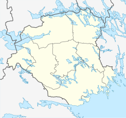
Svalsta (local pronunciation Sválsta) is a locality situated in Nyköping Municipality, Södermanland County, Sweden with 1,078 inhabitants in 2010.[1]
References
[edit]- ^ a b "Tätorternas landareal, folkmängd och invånare per km2 2005 och 2010" (in Swedish). Statistics Sweden. 14 December 2011. Archived from the original on 27 January 2012. Retrieved 10 January 2012.
- ^ "Statistiska tätorter 2020, befolkning, landareal, befolkningstäthet". Statistics Sweden. 31 December 2020. Retrieved 3 June 2024.


