Baracska: Difference between revisions
Appearance
Content deleted Content added
m r2.7.3) (Robot: Adding zh:鲍劳奇考 |
Ira Leviton (talk | contribs) Fixed the images in the infobox. Please see Category:Pages using infoboxes with thumbnail images. |
||
| (11 intermediate revisions by 10 users not shown) | |||
| Line 1: | Line 1: | ||
{{Infobox settlement <!--more fields are available for this Infobox--See Template:Infobox Settlement--> |
{{Infobox settlement <!--more fields are available for this Infobox--See Template:Infobox Settlement--> |
||
|coordinates_display = inline,title |
|||
|coordinates_region = HU |
|||
|subdivision_type = [[Countries of the world|Country]] |
|subdivision_type = [[Countries of the world|Country]] |
||
|subdivision_name = {{HUN}} |
|subdivision_name = {{HUN}} |
||
| Line 8: | Line 6: | ||
|timezone_DST=[[Central European Summer Time|CEST]] |
|timezone_DST=[[Central European Summer Time|CEST]] |
||
|utc_offset_DST=+2 |
|utc_offset_DST=+2 |
||
|image_shield =HUN Baracska címer.svg |
|||
|image_flag =Flag of Baracska.svg |
|||
|pushpin_map =Hungary |
|pushpin_map =Hungary |
||
|pushpin_label_position = <!-- the position of the pushpin label: left, right, top, bottom, none --> |
|pushpin_label_position = <!-- the position of the pushpin label: left, right, top, bottom, none --> |
||
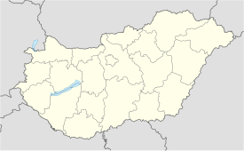
|pushpin_map_caption =Location of Baracska |
|pushpin_map_caption =Location of Baracska |
||
|pushpin_mapsize =| |
|pushpin_mapsize =275px| |
||
official_name=Baracska| |
official_name=Baracska| |
||
image_map=Image:FejérMegye.png| |
|||
mapsize=275px| |
|||
map_caption=Location of Fejér county in Hungary| |
|||
subdivision_type1=[[Counties of Hungary|County]]| |
subdivision_type1=[[Counties of Hungary|County]]| |
||
subdivision_name1=[[Fejér]]| |
subdivision_name1=[[Fejér]]| |
||
| Line 23: | Line 25: | ||
postal_code_type=[[Postal code]]| |
postal_code_type=[[Postal code]]| |
||
postal_code=2471| |
postal_code=2471| |
||
area_code=22 |
area_code=22 |
||
|coordinates = {{coord|47.287439|18.756995|region:HU|display=inline,title}} |
|||
latd=47.287439| |
|||
| blank_name = Motorways |
|||
longd=18.756995| |
|||
| blank_info = [[M7 motorway (Hungary)|M7]] |
|||
| blank2_name = Distance from Budapest |
|||
| blank2_info = {{convert|37.2|km|abbr=on}} Northeast |
|||
| |
|||
website={{URL|http://www.baracska.hu}} |
website={{URL|http://www.baracska.hu}} |
||
}} |
}} |
||
| Line 32: | Line 38: | ||
== External links == |
== External links == |
||
* [http://www.terkepcentrum.hu/index.asp?go=map&tid=8581 Street map] {{ |
* [https://web.archive.org/web/20071001091325/http://www.terkepcentrum.hu/index.asp?go=map&tid=8581 Street map] {{in lang|hu}} |
||
| ⚫ | |||
| ⚫ | |||
{{Fejér}} |
{{Fejér}} |
||
| ⚫ | |||
{{authority control}} |
|||
[[eo:Baracska]] |
|||
[[fr:Baracska]] |
|||
| ⚫ | |||
[[it:Baracska]] |
|||
| ⚫ | |||
[[hu:Baracska]] |
|||
[[nl:Baracska]] |
|||
[[sk:Baracska]] |
|||
| ⚫ | |||
[[sl:Baracska]] |
|||
[[vi:Baracska]] |
|||
[[zh:鲍劳奇考]] |
|||
Latest revision as of 10:44, 11 July 2024
Baracska | |
|---|---|
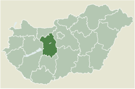
 Location of Fejér county in Hungary | |
| Coordinates: 47°17′15″N 18°45′25″E / 47.287439°N 18.756995°E | |
| Country | |
| County | Fejér |
| Area | |
• Total | 39.68 km2 (15.32 sq mi) |
| Population (2004) | |
• Total | 2,729 |
| • Density | 68.77/km2 (178.1/sq mi) |
| Time zone | UTC+1 (CET) |
| • Summer (DST) | UTC+2 (CEST) |
| Postal code | 2471 |
| Area code | 22 |
| Motorways | M7 |
| Distance from Budapest | 37.2 km (23.1 mi) Northeast |
| Website | www |
Baracska is a village in Fejér county, Hungary.
External links
[edit]- Street map (in Hungarian)


