Kisberény: Difference between revisions
Appearance
Content deleted Content added
del vandalism |
KylieTastic (talk | contribs) -thumb (see WP:INFOBOXIMAGE) |
||
| (34 intermediate revisions by 19 users not shown) | |||
| Line 1: | Line 1: | ||
{{Infobox |
{{Infobox settlement <!--more fields are available for this Infobox--See Template:Infobox Settlement--> |
||
| ⚫ | |||
| ⚫ | |||
| |
| settlement_type = Village |
||
| image_shield = HUN Kisberény COA.svg |
|||
|timezone=[[Central European Time|CET]] |
| timezone = [[Central European Time|CET]] |
||
|utc_offset=+1 |
| utc_offset = +1 |
||
|timezone_DST=[[Central European Summer Time|CEST]] |
| timezone_DST = [[Central European Summer Time|CEST]] |
||
|utc_offset_DST=+2 |
| utc_offset_DST = +2 |
||
| ⚫ | |||
| image_map = SomogyMegye.png |
|||
map=[[Image:SomogyMegye.png|center|thumb|275px|Location of Somogy county in Hungary]]| |
|||
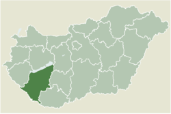
| map_caption = Location of Somogy county in Hungary |
|||
| ⚫ | |||
| ⚫ | |||
| ⚫ | |||
| subdivision_name = {{HUN}} |
|||
| ⚫ | |||
| subdivision_type1 = [[List of regions of Hungary|Region]] |
|||
population_total=206| |
|||
| ⚫ | |||
| ⚫ | |||
| ⚫ | |||
| ⚫ | |||
| subdivision_name2 = [[Somogy County|Somogy]] |
|||
| ⚫ | |||
| subdivision_type3 = [[Districts of Hungary|District]] |
|||
| ⚫ | |||
| subdivision_name3 = [[Fonyód District|Fonyód]] |
|||
area_code=85| |
|||
| subdivision_type4 = [[List of Catholic dioceses in Hungary|RC Diocese]] |
|||
| subdivision_name4 = [[Roman Catholic Diocese of Kaposvár|Kaposvár]] |
|||
| ⚫ | |||
| ⚫ | |||
| ⚫ | |||
| population_total = 178<ref>[http://www.ksh.hu/apps/hntr.telepules?p_lang=EN&p_id=30827 Kisberény, KSH]</ref> |
|||
| ⚫ | |||
| ⚫ | |||
latd=46.63979| |
|||
| ⚫ | |||
longd=17.65935 |
|||
| population_demonym = kisberényi |
|||
| ⚫ | |||
| ⚫ | |||
| area_code = (+36) 85 |
|||
| blank4_name_sec1 = [[NUTS statistical regions of Hungary|NUTS 3 code]] |
|||
| blank4_info_sec1 = HU232 |
|||
| blank5_name_sec2 = [[List of members of the National Assembly of Hungary (2018–22)|MP]] |
|||
| blank5_info_sec2 = [[József Attila Móring]] ([[KDNP]]) |
|||
| pushpin_map = Hungary |
|||
| ⚫ | |||
| ⚫ | |||
| ⚫ | |||
| coordinates = {{coord|46.63979|17.65935|region:HU|display=inline,title}} |
|||
| blank_name = [[Patron Saint]] |
|||
| blank_info = [[Catherine of Alexandria]] |
|||
}} |
}} |
||
'''Kisberény''' is a village in [[Somogy County|Somogy]] county, [[Hungary]]. It was the only settlement in the 18th and 19th century in the [[Somogy County (former)|Somogy County]] with a [[Serbian people|Serbian]] majority.<ref>[http://nyelvor.c3.hu/period/1403/140303.pdf Szabó József: A dél-dunántúli délszláv bevándorlások]</ref><ref>[https://library.hungaricana.hu/en/view/SOMM_SomAlm_052/?pg=0&layout=s&query=szerb László Szita : SOMOGY MEGYEI NEMZETISÉGEK TELEPÜLÉSTÖRTÉNETE A XVIII-XIX. SZÁZADBAN]</ref> |
|||
'''Kisberény''' is a village in [[Somogy]] county, [[Hungary]]. |
|||
== External links == |
== External links == |
||
* [http://www.terkepcentrum.hu/index.asp?go=map&tid=30827 Street map] {{ |
* [http://www.terkepcentrum.hu/index.asp?go=map&tid=30827 Street map] {{in lang|hu}} |
||
== References == |
|||
| ⚫ | |||
{{reflist}} |
|||
{{Fonyód District}} |
|||
{{Somogy}} |
|||
{{authority control}} |
|||
{{DEFAULTSORT:Kisbereny}} |
{{DEFAULTSORT:Kisbereny}} |
||
[[Category: |
[[Category:Populated places in Somogy County]] |
||
[[eo:Kisberény]] |
|||
| ⚫ | |||
[[it:Kisberény]] |
|||
[[hu:Kisberény]] |
|||
[[nl:Kisberény]] |
|||
[[sk:Kisberény]] |
|||
Latest revision as of 14:21, 14 July 2024
Kisberény | |
|---|---|
Village | |
 Location of Somogy county in Hungary | |
| Coordinates: 46°38′23″N 17°39′34″E / 46.63979°N 17.65935°E | |
| Country | |
| Region | Southern Transdanubia |
| County | Somogy |
| District | Fonyód |
| RC Diocese | Kaposvár |
| Area | |
• Total | 7.46 km2 (2.88 sq mi) |
| Population (2017) | |
• Total | 178[1] |
| Demonym | kisberényi |
| Time zone | UTC+1 (CET) |
| • Summer (DST) | UTC+2 (CEST) |
| Postal code | 8693 |
| Area code | (+36) 85 |
| Patron Saint | Catherine of Alexandria |
| NUTS 3 code | HU232 |
| MP | József Attila Móring (KDNP) |
Kisberény is a village in Somogy county, Hungary. It was the only settlement in the 18th and 19th century in the Somogy County with a Serbian majority.[2][3]
External links
[edit]- Street map (in Hungarian)
References
[edit]


