Serles: Difference between revisions
Appearance
Content deleted Content added
m WP:CHECKWIKI error fixes using AWB (11915) |
m Moving Category:Mountains of Tyrol (state) to Category:Mountains of Tyrol (federal state) per Wikipedia:Categories for discussion/Speedy |
||
| (7 intermediate revisions by 7 users not shown) | |||
| Line 1: | Line 1: | ||
{{short description|Mountain in Tyrol, Austria}} |
|||
{{Infobox mountain |
{{Infobox mountain |
||
| name = Serles |
| name = Serles |
||
| photo = Serles- |
| photo = Serles -BT- 02.jpg |
||
| photo_caption = Serles |
| photo_caption = Serles, view direction SW |
||
| elevation_m = 2718 |
| elevation_m = 2718 |
||
| elevation_ref = |
| elevation_ref = |
||
| Line 10: | Line 11: | ||
| location = [[Tyrol (state)|Tyrol, Austria]] |
| location = [[Tyrol (state)|Tyrol, Austria]] |
||
| range = [[Stubai Alps]] |
| range = [[Stubai Alps]] |
||
| coordinates = {{coord|47|07|25|N|11|22|54|E|type:mountain_scale:100000|format=dms|display=inline,title}} |
|||
| lat_d = 47 | lat_m = 07 | lat_s = 25 | lat_NS = N |
|||
| long_d = 11 | long_m = 22 | long_s = 54 | long_EW = E |
|||
| map = Austria |
| map = Austria |
||
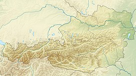
| map_caption = Location of Serles in Austria |
| map_caption = Location of Serles in Austria |
||
| Line 21: | Line 21: | ||
}} |
}} |
||
'''Serles''' (2,718 m) is a mountain of the [[Stubai Alps]] in the [[Austria]]n state of [[Tyrol (state)|Tyrol, Austria]], between the [[Stubaital|Stubai Valley]] and [[Wipptal]], near the Italian border. Its nickname is ''Altar von Tirol'', literally the ''Altar of Tyrol''. |
'''Serles''' (2,718 m) is a mountain of the [[Stubai Alps]] in the [[Austria]]n state of [[Tyrol (state)|Tyrol, Austria]], between the [[Stubaital|Stubai Valley]] and [[Wipptal]], near the Italian border. Its nickname is ''Altar von Tirol'', literally the ''Altar of Tyrol''. It has several lower peaks, including Sonnenstein ({{Cvt|2476|m||abbr=}}) to the north.<ref>{{Cite book|url=https://books.google.com/books?id=BHc9AQAAIAAJ&dq=Serles+sonnenstein&q=%222476+m%22|title=Berg- und Gipfelkreuze in Tirol|last=Eppacher|first=Wilhelm|date=1957|publisher=Wagner|language=de}}</ref> |
||
Located on the edge of long ridge traversing east from [[Habicht]], it is a popular [[scrambling]] peak and can get very crowded in the summer. The summit provides excellent view of the Stubai Alps and [[Zillertal Alps]].<ref name="summitpost">{{cite web|url=http://www.summitpost.org/serles/150747|title=Serles - Summitpost|publisher=summitpost.org|accessdate=20 February 2016}}</ref> |
Located on the edge of long ridge traversing east from [[Habicht]], it is a popular [[scrambling]] peak and can get very crowded in the summer. The summit provides excellent view of the Stubai Alps and [[Zillertal Alps]].<ref name="summitpost">{{cite web|url=http://www.summitpost.org/serles/150747|title=Serles - Summitpost|publisher=summitpost.org|accessdate=20 February 2016}}</ref> |
||
It is accessible via the Serlesjöchl: |
It is accessible via the Serlesjöchl: |
||
* from [[Matrei am Brenner]] in Wipptal via Maria Waldrast (the easiest route)<ref name="summitpost"/> |
* from [[Matrei am Brenner]] in Wipptal via Maria Waldrast (the easiest route),<ref name="summitpost"/> |
||
* from [[Fulpmes]] and [[Neustift im Stubaital|Kampl]] in Stubaital via Wildeben |
* from [[Fulpmes]] and [[Neustift im Stubaital|Kampl]] in Stubaital via Wildeben (which is just as easy, if it was not for the extra altitude to climb). |
||
==References== |
==References== |
||
| Line 34: | Line 34: | ||
{{Authority control}} |
{{Authority control}} |
||
[[Category:Mountains of Tyrol (state)]] |
[[Category:Mountains of Tyrol (federal state)]] |
||
[[Category:Mountains of the Alps]] |
[[Category:Mountains of the Alps]] |
||
[[Category:Stubai Alps]] |
[[Category:Stubai Alps]] |
||
Latest revision as of 16:23, 14 July 2024
| Serles | |
|---|---|
 Serles, view direction SW | |
| Highest point | |
| Elevation | 2,718 m (8,917 ft) |
| Prominence | 333 m (1,093 ft) |
| Listing | Alpine mountains 2500-2999 m |
| Coordinates | 47°07′25″N 11°22′54″E / 47.12361°N 11.38167°E |
| Geography | |
| Location | Tyrol, Austria |
| Parent range | Stubai Alps |
| Climbing | |
| First ascent | ca. 1579 |
| Easiest route | From Matrei am Brenner |
Serles (2,718 m) is a mountain of the Stubai Alps in the Austrian state of Tyrol, Austria, between the Stubai Valley and Wipptal, near the Italian border. Its nickname is Altar von Tirol, literally the Altar of Tyrol. It has several lower peaks, including Sonnenstein (2,476 m (8,123 ft)) to the north.[1]
Located on the edge of long ridge traversing east from Habicht, it is a popular scrambling peak and can get very crowded in the summer. The summit provides excellent view of the Stubai Alps and Zillertal Alps.[2]
It is accessible via the Serlesjöchl:
- from Matrei am Brenner in Wipptal via Maria Waldrast (the easiest route),[2]
- from Fulpmes and Kampl in Stubaital via Wildeben (which is just as easy, if it was not for the extra altitude to climb).
References
[edit]- ^ Eppacher, Wilhelm (1957). Berg- und Gipfelkreuze in Tirol (in German). Wagner.
- ^ a b "Serles - Summitpost". summitpost.org. Retrieved 20 February 2016.

