Mauga Afi: Difference between revisions
Appearance
Content deleted Content added
Teinesavaii (talk | contribs) m remove coordinates in body of article |
Entranced98 (talk | contribs) Importing Wikidata short description: "Mountain in Samoa" |
||
| (18 intermediate revisions by 16 users not shown) | |||
| Line 1: | Line 1: | ||
{{Short description|Mountain in Samoa}} |
|||
'''Maunga Afi''' is a volcanic mountain on the island of [[Savai'i]] in [[Samoa]].<ref name=''test''>[http://74.125.155.132/search?q=cache:LfKWhxh8N_sJ:https://scholarspace.manoa.hawaii.edu/bitstream/10125/1423/1/v32n1-79-94.pdf+Mata+o+le+Afi+crater&cd=5&hl=en&ct=clnk&gl=nz], Vegetation of the Montane Region of Savai'i, Western Samoa1 by W. ARTHUR WHISTLER, p.1 - Pacific Science (1978), vol. 32, no. 1</ref> |
|||
{{Infobox mountain |
|||
| name = Mauga Afi |
|||
| photo = |
|||
| photo_caption = |
|||
| elevation_m = 1847 |
|||
| elevation_ref = <ref name=peakery>{{cite web |url=https://peakery.com/mauga-afi-samoa/ |title=Mauga Afi |publisher=Peakery |date= |access-date=29 July 2021}}</ref> |
|||
| prominence_m = |
|||
| map = Samoa |
|||
| map_caption = Map of Samoa |
|||
| label_position = |
|||
| listing = |
|||
| location = [[Gagaʻifomauga]], [[Samoa]] |
|||
| range = |
|||
| ⚫ | |||
| range_coordinates = |
|||
| coordinates_ref = |
|||
| topo = |
|||
| type = |
|||
| age = |
|||
| first_ascent = |
|||
| easiest_route = |
|||
}} |
|||
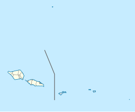
'''Mauga Afi''' ("Burning Mountain" or "Mountain of Fire") is a volcanic mountain in the [[Gagaʻifomauga]] district on the island of [[Savai'i]] in [[Samoa]]. It has an elevation of 1847m.<ref name=peakery/> |
|||
The most recent eruption of Mauga Afi was around 1768 and was observed by [[Louis Antoine de Bougainville]] when sailing past Savai'i.<ref>{{cite web |url=https://new-hls.s3.amazonaws.com/hls/data/56/website/resource/files/a-visitors-field-guide-to-savaii.pdf |title=A Visitor's Field Guide to Savai’i: Touring Savai'i with a Geologist |author=Warren Jopling |page=14 |access-date=29 July 2021 |quote=The Mauga Afi eruption was recorded by the French navigator Anton Bougainville when sailing by Savai'i's north coast in 1768}}</ref> Lava from this eruption sequence covered vast areas of the north coast of Savai'i.<ref>{{cite web |url=https://mro.massey.ac.nz/bitstream/handle/10179/556/strcn.pdf |last1=Cronin |first1=Shane |last2=Bonte-Grapentin |first2=Michael |last3=Nemeth |first3=Karoly |title=SAMOA TECHNICAL REPORT – REVIEW OF VOLCANIC HAZARD MAPS FOR SAVAI’I AND UPOLU |publisher=SOUTH PACIFIC APPLIED GEOSCIENCE COMMISSION |date=2006 |access-date=29 July 2021}}</ref>{{rp|7}} |
|||
The most recent eruption of Mauga Afi was around 1725 (plus or minus 40-years). |
|||
| ⚫ | |||
Maunga Afi (translated from the Samoan language) means ''Burning Mountain'' or ''Mountain of Fire''. The word 'mauga' in the Samoan language means 'mountain' and 'afi' means 'fire.' |
|||
{{reflist}} |
|||
| ⚫ | |||
The island of Savai'i consists of a massive [[shield volcano]] and is still volcanically active. |
|||
| ⚫ | |||
| ⚫ | |||
Other volcanoes on Savai'i include [[Silisili|Mt Silisili]], the highest mountain in Samoa and [[Mt Matavanu]]. The eruption of Mt Matavanu (1905-1911) destroyed villages on the central north coast of Savai'i which can be seen by the lava fields in [[Saleaula]] village. |
|||
| ⚫ | |||
| ⚫ | |||
In [[Samoan mythology]] the god of earthquakes is [[Mafui'e]]. Another mythical figure [[Ti'iti'i (Samoan mythology)|Ti'iti'i]] tricked the earthquake god so that Samoans could have fire to cook their food. |
|||
| ⚫ | |||
<references/> |
|||
| ⚫ | |||
| ⚫ | |||
{{Samoa-geo-stub}} |
{{Samoa-geo-stub}} |
||
| ⚫ | |||
| ⚫ | |||
| ⚫ | |||
| ⚫ | |||
Latest revision as of 22:43, 17 July 2024
| Mauga Afi | |
|---|---|
| Highest point | |
| Elevation | 1,847 m (6,060 ft)[1] |
| Coordinates | 13°34′S 172°29′W / 13.567°S 172.483°W |
| Geography | |
| Location | Gagaʻifomauga, Samoa |
Mauga Afi ("Burning Mountain" or "Mountain of Fire") is a volcanic mountain in the Gagaʻifomauga district on the island of Savai'i in Samoa. It has an elevation of 1847m.[1]
The most recent eruption of Mauga Afi was around 1768 and was observed by Louis Antoine de Bougainville when sailing past Savai'i.[2] Lava from this eruption sequence covered vast areas of the north coast of Savai'i.[3]: 7
References
[edit]- ^ a b "Mauga Afi". Peakery. Retrieved 29 July 2021.
- ^ Warren Jopling. "A Visitor's Field Guide to Savai'i: Touring Savai'i with a Geologist" (PDF). p. 14. Retrieved 29 July 2021.
The Mauga Afi eruption was recorded by the French navigator Anton Bougainville when sailing by Savai'i's north coast in 1768
- ^ Cronin, Shane; Bonte-Grapentin, Michael; Nemeth, Karoly (2006). "SAMOA TECHNICAL REPORT – REVIEW OF VOLCANIC HAZARD MAPS FOR SAVAI'I AND UPOLU" (PDF). SOUTH PACIFIC APPLIED GEOSCIENCE COMMISSION. Retrieved 29 July 2021.
External links
[edit]

