Pinhal Novo: Difference between revisions
m sp, date & link fixes, replaced: town → town, October 2004 → October 2004, Portugal → Portugal, Setubal → Setúbal (2) using AWB |
RodRabelo7 (talk | contribs) m deprecated |
||
| (36 intermediate revisions by 29 users not shown) | |||
| Line 1: | Line 1: | ||
{{Short description|Civil parish in Lisbon Region, Portugal}} |
|||
{{unreferenced|date=December 2007}} |
|||
{{Infobox Portuguese subdivision |
|||
|type = parish |
|||
|official_name = Pinhal Novo |
|||
|image_skyline = Pinhal Novo Coreto.jpg |
|||
|image_caption = Sunset in Pinhal Novo |
|||
|image_flag = |
|||
|image_shield = Novobrasaologo.jpg |
|||
|image_location = |
|||
|region = [[Lisboa Region|Lisbon]] |
|||
|metro = [[Lisbon metropolitan area|Lisbon]] |
|||
|district = [[Setúbal District|Setúbal]] |
|||
|municipality = [[Palmela]] |
|||
|coordinates = {{coord|38.631|-8.914|type:adm1st_region:PT_dim:50000|display=inline,title}} |
|||
|elevation = |
|||
|area_total = 54.44 |
|||
|population_as_of = 2011 |
|||
|population_total = 25000 |
|||
|patron = |
|||
|area_code = |
|||
|postal_code = |
|||
|website = |
|||
}} |
|||
'''Pinhal Novo''' ({{IPA|pt|piˈɲal ˈnovu}}) is a town in Portugal situated in the [[Península de Setúbal|Setúbal Peninsula]] halfway between [[Lisbon]] and [[Setúbal]]. It is a [[freguesia (Portugal)|civil parish]] of the [[Palmela]] Municipality. The population in 2011 was 25,000,<ref name=ine>[http://www.ine.pt/ngt_server/attachfileu.jsp?look_parentBoui=165404348&att_display=n&att_download=y Instituto Nacional de Estatística (INE)], Census 2011 results according to the 2013 administrative division of Portugal</ref> in an area of 54.44 km<sup>2</sup>.<ref name=dgt>{{Cite web |url=http://www.dgterritorio.pt/cartografia_e_geodesia/cartografia/carta_administrativa_oficial_de_portugal_caop_/caop__download_/carta_administrativa_oficial_de_portugal___versao_2017__em_vigor_/ |title=Áreas das freguesias, concelhos, distritos e país |access-date=2018-11-05 |archive-url=https://web.archive.org/web/20181105172426/http://www.dgterritorio.pt/cartografia_e_geodesia/cartografia/carta_administrativa_oficial_de_portugal_caop_/caop__download_/carta_administrativa_oficial_de_portugal___versao_2017__em_vigor_/ |archive-date=2018-11-05 |url-status=dead }}</ref> It is served by two highways connecting Lisbon to the South and by its new train station that has enabled residents to connect directly to Lisbon's subway network in 38 minutes since October 2004. It is located near the [[Arrabida Natural Park]] and many of facilities, such as [[shopping centre]]s including Forum Montijo, the Alcochete Freeport, Pinô Shopping Centre and Mochos, two of the most popular Portuguese shopping companies. |
|||
| ⚫ | The city is experiencing continuous growth and has expanded from a little village a few years ago to a planned 40, 000 resident city. It benefits from new [[infrastructure]], and urbanisation plans do not allow large buildings, which contributes to a certain [[quality of life]]. {{citation needed|date=March 2015}} |
||
'''Pinhal Novo''' ({{IPA-pt|pɨˈɲaɫ ˈnovu}}) is a town in Portugal with 26,000 inhabitants situated in the [[Península de Setúbal|Setúbal Peninsula]] halfway between [[Lisbon]] and [[Setúbal]]. It is served by two highways connecting Lisbon to the South and by its new train station that has enabled residents to connect directly to Lisbon's subway network in 30 minutes since October 2004. It is located near the [[Arrabida National Park]] and many of facilities, such as [[shopping center]]s including Forum Montijo and the Alcochete Freeport. |
|||
==References== |
|||
| ⚫ | The city is experiencing continuous growth and has expanded from a little village a few years ago to a planned |
||
{{Reflist}} |
|||
Various modifications to improve dislocation in the village have been made true in this decade. The overhead passage between the "two sides" (dois lados) of the village, divided by the train track, was turned into a subterranean tunnel, although it is not very used due to the passage being unprotected, and being a target of various ''graffitis''. |
|||
{{authority control}} |
|||
{{coord|38|38|N|8|55|W|region:PT_type:city|display=title}} |
|||
[[Category:Towns in Portugal]] |
[[Category:Towns in Portugal]] |
||
[[Category:Freguesias of Palmela]] |
|||
{{ |
{{Setúbal-geo-stub}} |
||
[[de:Pinhal Novo]] |
|||
[[es:Pinhal Novo]] |
|||
[[pt:Pinhal Novo]] |
|||
[[ru:Пиньял-Нову]] |
|||
Latest revision as of 02:34, 9 August 2024
Pinhal Novo | |
|---|---|
 Sunset in Pinhal Novo | |
| Coordinates: 38°37′52″N 8°54′50″W / 38.631°N 8.914°W | |
| Country | |
| Region | Lisbon |
| Metropolitan area | Lisbon |
| District | Setúbal |
| Municipality | Palmela |
| Area | |
• Total | 54.44 km2 (21.02 sq mi) |
| Population (2011) | |
• Total | 25,000 |
| • Density | 460/km2 (1,200/sq mi) |
| Time zone | UTC+00:00 (WET) |
| • Summer (DST) | UTC+01:00 (WEST) |
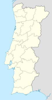
Pinhal Novo (Portuguese pronunciation: [piˈɲal ˈnovu]) is a town in Portugal situated in the Setúbal Peninsula halfway between Lisbon and Setúbal. It is a civil parish of the Palmela Municipality. The population in 2011 was 25,000,[1] in an area of 54.44 km2.[2] It is served by two highways connecting Lisbon to the South and by its new train station that has enabled residents to connect directly to Lisbon's subway network in 38 minutes since October 2004. It is located near the Arrabida Natural Park and many of facilities, such as shopping centres including Forum Montijo, the Alcochete Freeport, Pinô Shopping Centre and Mochos, two of the most popular Portuguese shopping companies.
The city is experiencing continuous growth and has expanded from a little village a few years ago to a planned 40, 000 resident city. It benefits from new infrastructure, and urbanisation plans do not allow large buildings, which contributes to a certain quality of life. [citation needed]
References
[edit]- ^ Instituto Nacional de Estatística (INE), Census 2011 results according to the 2013 administrative division of Portugal
- ^ "Áreas das freguesias, concelhos, distritos e país". Archived from the original on 2018-11-05. Retrieved 2018-11-05.


