Kotorr, Kosovo: Difference between revisions
m v2.04b - Bot T23 CW#558 - Fix errors for CW project (Duplicated reference) |
Mitrovica02 (talk | contribs) |
||
| (8 intermediate revisions by 6 users not shown) | |||
| Line 10: | Line 10: | ||
| leader_title = Mayor |
| leader_title = Mayor |
||
| subdivision_type = Location |
| subdivision_type = Location |
||
| subdivision_name = {{flag|Kosovo |
| subdivision_name = {{flag|Kosovo}} |
||
| subdivision_type1 = [[Districts of Kosovo|District]] |
| subdivision_type1 = [[Districts of Kosovo|District]] |
||
| subdivision_name1 = [[District of Mitrovica|Mitrovicë]] |
| subdivision_name1 = [[District of Mitrovica|Mitrovicë]] |
||
| Line 18: | Line 18: | ||
| elevation_m = |
| elevation_m = |
||
| population_total = 279 |
| population_total = 279 |
||
| population_footnotes = <ref> |
| population_footnotes = <ref>{{Cite web|url=http://pop-stat.mashke.org/kosovo-ethnic-loc2011.htm|title=Ethnic composition of Kosovo 2011|website=pop-stat.mashke.org}}</ref> |
||
| population_as_of = 2011 |
| population_as_of = 2011 |
||
| postal code = |
| postal code = |
||
| Line 34: | Line 34: | ||
}} |
}} |
||
'''Kotorr''' (in [[Albanian language|Albanian]]) is a village in [[Kosovo]] |
'''Kotorr''' (in [[Albanian language|Albanian]]) is a village in [[Kosovo]] located in the town-municipality of [[Skenderaj]] and in the [[District of Mitrovica]]. According to the 2011 census, it had 279 inhabitants, all of whom were [[Albanians|Albanian]]. |
||
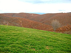
[[File:Kotorr, Skenderaj 1.jpg|thumb|Kotorr]] |
[[File:Kotorr, Skenderaj 1.jpg|thumb|Kotorr]] |
||
== Geography == |
== Geography == |
||
The village is located on the north side of the |
The village is located on the north side of the [[Peja]]-[[Mitrovica, Kosovo|Mitrovica]] road, some 8 kilometres north-west of [[Skenderaj]].<ref name="Лидов2007">{{cite book|author=Алексей Лидов|title=Косово: Ортходокс херитаже анд контемпорары катастрофе|url=https://books.google.com/books?id=54ppAAAAMAAJ|year=2007|publisher=Индрик|page=289|isbn=9785857593943 }}</ref> |
||
== History == |
== History == |
||
The village has been inhabited since late antiquity. In the south western part of the village the archeological locality of Kotorr Fortress ([[Albanian language|Albanian]] Gradina e Kotorrit) is situated, which based on the archeological findings, it goes back to 4th-5th century AD.<ref name="HARTA ARKEOLOGJIKE E KOSOVES II">{{cite book |last1=Hoxhaj |first1=Vesel |title=HARTA ARKEOLOGJIKE E KOSOVES II |date=2013 |publisher=Instituti Arkeologjik i Kosovës |location=Prishtinë |pages=108/109 |edition=2 |url=https://www.academia.edu/5230204/HARTA_ARKEOLOGJIKE_E_KOSOVES_II |access-date=10 January 2024}}</ref> |
|||
| ⚫ | |||
| ⚫ | Kotorr was mentioned in the 1455 Ottoman ''[[defter]]'' (tax registry) of the conquered lands of [[Scanderbeg|Gjergj Kastrioti Skenderbeu]].<ref name="Лидов2007"/> The village had an old church, of which only micro-toponyms exist today: "Church" ( Kisha), and "Church Valley" (Lugu i Kishës).<ref name="Лидов2007"/><ref name="Subotić1997">{{cite book|author=Gojko Subotić|title=Terra Sacra: L'Arte Del Cossovo|url=https://books.google.com/books?id=mg7qAAAAMAAJ|year=1997|publisher=Jaca Book|isbn=978-88-16-60198-7}}</ref> |
||
After the [[Kosovo War]], during the presence of the NATO-led peacekeeping [[Kosovo Force]], two houses belonging to Serbs were burnt down and one house was illegally occupied.<ref name="AndjelkovićTolerance2000">{{cite book|author1=Zoran Andjelković|author2=Center for Peace and Tolerance|title=Days of terror: in the presence of the international forces|url=https://books.google.com/books?id=YZYMAQAAMAAJ|year=2000|publisher=Center for peace and tolerance|pages=105, 154|quote=Kotore, Srbica}}</ref> |
After the [[Kosovo War]], during the presence of the NATO-led peacekeeping [[Kosovo Force]], two houses belonging to Serbs were burnt down and one house was illegally occupied.<ref name="AndjelkovićTolerance2000">{{cite book|author1=Zoran Andjelković|author2=Center for Peace and Tolerance|title=Days of terror: in the presence of the international forces|url=https://books.google.com/books?id=YZYMAQAAMAAJ|year=2000|publisher=Center for peace and tolerance|pages=105, 154|quote=Kotore, Srbica}}</ref> |
||
| Line 56: | Line 58: | ||
|1991=516 |
|1991=516 |
||
|2011=279 |
|2011=279 |
||
|source=<ref>{{cite web|title=Evolution of the population 1948-2011|url=http://pop-stat.mashke.org/kosovo-census-ks.htm|website= |
|source=<ref>{{cite web|title=Evolution of the population 1948-2011|url=http://pop-stat.mashke.org/kosovo-census-ks.htm|website=pop-stat.mashke.org/kosovo-census-ks.htm|accessdate=14 September 2014}}</ref> |
||
}} |
}} |
||
| Line 70: | Line 72: | ||
}} |
}} |
||
}} |
}} |
||
==Notes== |
|||
{{notelist}} |
|||
==References== |
==References== |
||
{{Reflist}} |
{{Reflist}} |
||
{{Skenderaj}} |
|||
[[Category:Villages in Skenderaj]] |
[[Category:Villages in Skenderaj]] |
||
[[Category:Medieval Serbian sites in Kosovo]] |
[[Category:Medieval Serbian sites in Kosovo]] |
||
[[Category:Drenica]] |
[[Category:Drenica]] |
||
{{Kosovo-geo-stub}} |
{{Kosovo-geo-stub}} |
||
Latest revision as of 12:13, 14 August 2024
Kotorr
Kotorr Kosovë | |
|---|---|
Village | |
 | |
| Coordinates: 42°48′04″N 20°44′35″E / 42.80111°N 20.74306°E | |
| Location | |
| District | Mitrovicë |
| Municipality | Skënderaj |
| Population (2011)[1] | |
• Total | 279 |
| Time zone | UTC+1 (CET) |
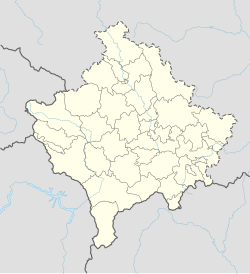
Kotorr (in Albanian) is a village in Kosovo located in the town-municipality of Skenderaj and in the District of Mitrovica. According to the 2011 census, it had 279 inhabitants, all of whom were Albanian.

Geography
[edit]The village is located on the north side of the Peja-Mitrovica road, some 8 kilometres north-west of Skenderaj.[2]
History
[edit]The village has been inhabited since late antiquity. In the south western part of the village the archeological locality of Kotorr Fortress (Albanian Gradina e Kotorrit) is situated, which based on the archeological findings, it goes back to 4th-5th century AD.[3]
Kotorr was mentioned in the 1455 Ottoman defter (tax registry) of the conquered lands of Gjergj Kastrioti Skenderbeu.[2] The village had an old church, of which only micro-toponyms exist today: "Church" ( Kisha), and "Church Valley" (Lugu i Kishës).[2][4]
After the Kosovo War, during the presence of the NATO-led peacekeeping Kosovo Force, two houses belonging to Serbs were burnt down and one house was illegally occupied.[5]
Demographics
[edit]| Year | 1948 | 1953 | 1961 | 1971 | 1981 | 1991 | 2011 |
|---|---|---|---|---|---|---|---|
| Population | 401 | 422 | 422 | 430 | 494 | 516 | 279 |
Graphs are unavailable due to technical issues. There is more info on Phabricator and on MediaWiki.org. |
References
[edit]- ^ "Ethnic composition of Kosovo 2011". pop-stat.mashke.org.
- ^ a b c Алексей Лидов (2007). Косово: Ортходокс херитаже анд контемпорары катастрофе. Индрик. p. 289. ISBN 9785857593943.
- ^ Hoxhaj, Vesel (2013). HARTA ARKEOLOGJIKE E KOSOVES II (2 ed.). Prishtinë: Instituti Arkeologjik i Kosovës. pp. 108/109. Retrieved 10 January 2024.
- ^ Gojko Subotić (1997). Terra Sacra: L'Arte Del Cossovo. Jaca Book. ISBN 978-88-16-60198-7.
- ^ Zoran Andjelković; Center for Peace and Tolerance (2000). Days of terror: in the presence of the international forces. Center for peace and tolerance. pp. 105, 154.
Kotore, Srbica
- ^ "Evolution of the population 1948-2011". pop-stat.mashke.org/kosovo-census-ks.htm. Retrieved 14 September 2014.

