Alpartir: Difference between revisions
Appearance
Content deleted Content added
No edit summary |
No edit summary |
||
| (4 intermediate revisions by 3 users not shown) | |||
| Line 5: | Line 5: | ||
| nickname = |
| nickname = |
||
| image_flag = Bandera de Alpartir.svg |
| image_flag = Bandera de Alpartir.svg |
||
| |
| image_shield = Escudo de Alpartir.svg |
||
| image_skyline = Peirón de la Virgen de los Desamparados.JPG |
| image_skyline = Peirón de la Virgen de los Desamparados.JPG |
||
| map_caption = |
| map_caption = |
||
| Line 38: | Line 38: | ||
'''Alpartir''' is a municipality located in the [[Zaragoza (province)|province of Zaragoza]], [[Aragon]], [[Spain]]. According to the 2004 [[census]] ([[Instituto Nacional de Estadística (Spain)|INE]]), the municipality has a population of 603 inhabitants. |
'''Alpartir''' is a municipality located in the [[Zaragoza (province)|province of Zaragoza]], [[Aragon]], [[Spain]]. According to the 2004 [[census]] ([[Instituto Nacional de Estadística (Spain)|INE]]), the municipality has a population of 603 inhabitants. |
||
== References == |
|||
| ⚫ | |||
{{reflist}} |
|||
| ⚫ | |||
{{authority control}} |
|||
[[Category:Municipalities in the Province of Zaragoza]] |
[[Category:Municipalities in the Province of Zaragoza]] |
||
| ⚫ | |||
[[Category:Populated places in the Province of Zaragoza]] |
|||
| ⚫ | |||
Latest revision as of 17:47, 21 August 2024
Alpartir | |
|---|---|
 | |
| Coordinates: 41°25′N 1°23′W / 41.417°N 1.383°W | |
| Country | |
| Autonomous community | |
| Province | Zaragoza |
| Area | |
• Total | 26 km2 (10 sq mi) |
| Elevation | 490 m (1,610 ft) |
| Population (2018)[1] | |
• Total | 579 |
| • Density | 22/km2 (58/sq mi) |
| Time zone | UTC+1 (CET) |
| • Summer (DST) | UTC+2 (CEST) |
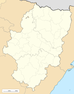
Alpartir is a municipality located in the province of Zaragoza, Aragon, Spain. According to the 2004 census (INE), the municipality has a population of 603 inhabitants.
References
[edit]- ^ Municipal Register of Spain 2018. National Statistics Institute.


