Češnjica pri Kropi: Difference between revisions
Appearance
Content deleted Content added
m Bot: Migrating 3 interwiki links, now provided by Wikidata on d:q3432350 |
Tom.Reding (talk | contribs) |
||
| (11 intermediate revisions by 4 users not shown) | |||
| Line 1: | Line 1: | ||
{{Infobox settlement |
{{Infobox settlement |
||
|official_name = Češnjica |
|official_name = Češnjica pri Kropi |
||
|other_name = |
|other_name = |
||
|native_name = <!-- for cities whose native name is not in English --> |
|native_name = <!-- for cities whose native name is not in English --> |
||
| Line 6: | Line 6: | ||
|settlement_type = <!--For Town or Village (Leave blank for the default City)--> |
|settlement_type = <!--For Town or Village (Leave blank for the default City)--> |
||
|motto = |
|motto = |
||
|image_skyline = |
|image_skyline = Cesnjica pri Kropi.jpg |
||
|imagesize = |
|imagesize = |
||
|image_caption = |
|image_caption = |
||
|image_flag = |
|image_flag = |
||
| Line 31: | Line 31: | ||
|pushpin_label_position =bottom |
|pushpin_label_position =bottom |
||
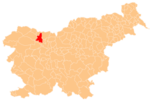
|pushpin_map_caption =Location in Slovenia |
|pushpin_map_caption =Location in Slovenia |
||
|coordinates_display = inline,title |
|||
|coordinates_region = SI |
|||
|subdivision_type = Country |
|subdivision_type = Country |
||
|subdivision_name = [[Image:Flag of Slovenia.svg|25px]] [[Slovenia]] |
|subdivision_name = [[Image:Flag of Slovenia.svg|25px]] [[Slovenia]] |
||
| Line 38: | Line 36: | ||
|subdivision_name1 = [[Upper Carniola]] |
|subdivision_name1 = [[Upper Carniola]] |
||
|subdivision_type2 = [[Statistical regions of Slovenia|Statistical region]] |
|subdivision_type2 = [[Statistical regions of Slovenia|Statistical region]] |
||
|subdivision_name2 = [[ |
|subdivision_name2 = [[Upper Carniola Statistical Region|Upper Carniola]] |
||
|subdivision_type3 = [[Municipalities of Slovenia|Municipality]] |
|subdivision_type3 = [[Municipalities of Slovenia|Municipality]] |
||
|subdivision_name3 = [[Municipality of Radovljica|Radovljica]] |
|subdivision_name3 = [[Municipality of Radovljica|Radovljica]] |
||
| Line 96: | Line 94: | ||
|timezone_DST = |
|timezone_DST = |
||
|utc_offset_DST = |
|utc_offset_DST = |
||
|coordinates = {{coord|46|17|15.91|N|14|13|41.48|E|region:SI|display=inline,title}} |
|||
|latd= 46|latm= 17|lats=15.91 |latNS=N |
|||
|longd=14|longm=13|longs=41.48 |longEW=E |
|||
|elevation_footnotes = |
|elevation_footnotes = |
||
|elevation_m = 486.7 |
|elevation_m = 486.7 |
||
| Line 111: | Line 108: | ||
|footnotes = <ref>[http://www.stat.si/eng/index.asp Statistical Office of the Republic of Slovenia]</ref> |
|footnotes = <ref>[http://www.stat.si/eng/index.asp Statistical Office of the Republic of Slovenia]</ref> |
||
}} |
}} |
||
'''Češnjica''' is a village near [[Kropa, Radovljica|Kropa]] in the [[Municipality of Radovljica]] in the [[Upper Carniola]] region of [[Slovenia]]. |
'''Češnjica pri Kropi''' ({{IPA|sl|ˈtʃeːʃnjitsa pɾi ˈkɾoːpi|pron}}) is a village near [[Kropa, Radovljica|Kropa]] in the [[Municipality of Radovljica]] in the [[Upper Carniola]] region of [[Slovenia]]. |
||
==Name== |
==Name== |
||
The name of the settlement was changed from ''Češnjica'' to ''Češnjica pri Kropi'' in 1952.<ref>''Spremembe naselij 1948–95''. 1996. Database. Ljubljana: Geografski inštitut ZRC SAZU, DZS.</ref> |
The name of the settlement was changed from ''Češnjica'' to ''Češnjica pri Kropi'' in 1952.<ref>''Spremembe naselij 1948–95''. 1996. Database. Ljubljana: Geografski inštitut ZRC SAZU, DZS.</ref> |
||
==Church== |
|||
[[File:Cesnjica pri Kropi - church.jpg|thumb|left|180px|Saint Thomas's Church]] |
|||
The church in Češnjica pri Kropi is dedicated to [[Thomas the Apostle|Saint Thomas]]. It was built in 1696 and renovated in 1763 and 1814. The church is decorated in a simple Baroque style.<ref>''Krajevni leksikon Dravske Banovine''. 1937. Ljubljana: Zveza za tujski promet za Slovenijo, p. 543.</ref> |
|||
==References== |
==References== |
||
| Line 120: | Line 121: | ||
==External links== |
==External links== |
||
*[ |
*[https://www.geopedia.world/#T12_L362_F2473:22_x1583128.063876305_y5826652.767302858_s15_b2345 Češnjica pri Kropi on Geopedia] |
||
{{Radovljica}} |
{{Radovljica}} |
||
Latest revision as of 19:16, 21 August 2024
Češnjica pri Kropi | |
|---|---|
 | |
| Coordinates: 46°17′15.91″N 14°13′41.48″E / 46.2877528°N 14.2281889°E | |
| Country | |
| Traditional region | Upper Carniola |
| Statistical region | Upper Carniola |
| Municipality | Radovljica |
| Elevation | 486.7 m (1,596.8 ft) |
| Population (2002) | |
• Total | 118 |
| [1] | |
Češnjica pri Kropi (pronounced [ˈtʃeːʃnjitsa pɾi ˈkɾoːpi]) is a village near Kropa in the Municipality of Radovljica in the Upper Carniola region of Slovenia.
Name
[edit]The name of the settlement was changed from Češnjica to Češnjica pri Kropi in 1952.[2]
Church
[edit]
The church in Češnjica pri Kropi is dedicated to Saint Thomas. It was built in 1696 and renovated in 1763 and 1814. The church is decorated in a simple Baroque style.[3]
References
[edit]- ^ Statistical Office of the Republic of Slovenia
- ^ Spremembe naselij 1948–95. 1996. Database. Ljubljana: Geografski inštitut ZRC SAZU, DZS.
- ^ Krajevni leksikon Dravske Banovine. 1937. Ljubljana: Zveza za tujski promet za Slovenijo, p. 543.
External links
[edit]


