Spodnje Laže: Difference between revisions
Appearance
Content deleted Content added
image |
Tom.Reding (talk | contribs) |
||
| (2 intermediate revisions by one other user not shown) | |||
| Line 38: | Line 38: | ||
|subdivision_name2 = [[Savinja Statistical Region|Savinja]] |
|subdivision_name2 = [[Savinja Statistical Region|Savinja]] |
||
|subdivision_type3 = [[Municipalities of Slovenia|Municipality]] |
|subdivision_type3 = [[Municipalities of Slovenia|Municipality]] |
||
|subdivision_name3 = [[Slovenske Konjice]] |
|subdivision_name3 = [[Municipality of Slovenske Konjice|Slovenske Konjice]] |
||
|subdivision_type4 = |
|subdivision_type4 = |
||
|subdivision_name4 = |
|subdivision_name4 = |
||
| Line 110: | Line 110: | ||
}} |
}} |
||
'''Spodnje Laže''' ({{IPA |
'''Spodnje Laže''' ({{IPA|sl|ˈspoːdnjɛ ˈlaːʒɛ|pron}}) is a settlement in the [[Municipality of Slovenske Konjice]] in eastern [[Slovenia]]. It lies on the left bank of the [[Dravinja|Dravinja River]]. The [[railway line]] from [[Celje]] to [[Pragersko]] runs through the settlement. The area is part of the traditional region of [[Lower Styria|Styria]]. The municipality is now included in the [[Savinja Statistical Region]].<ref>[http://www.slovenskekonjice.si Slovenske Konjice municipal site]</ref> |
||
==References== |
==References== |
||
| Line 117: | Line 117: | ||
==External links== |
==External links== |
||
*{{commons category-inline|Spodnje Laže}} |
*{{commons category-inline|Spodnje Laže}} |
||
*[ |
*[https://www.geopedia.world/#T12_L362_F2473:1862_x1730189.7321540674_y5829164.8646002_s15_b2345 Spodnje Laže on Geopedia] |
||
{{Slovenske Konjice}} |
{{Slovenske Konjice}} |
||
Latest revision as of 15:36, 23 August 2024
Spodnje Laže | |
|---|---|
 | |
| Coordinates: 46°18′11.42″N 15°32′36.33″E / 46.3031722°N 15.5434250°E | |
| Country | |
| Traditional region | Styria |
| Statistical region | Savinja |
| Municipality | Slovenske Konjice |
| Area | |
• Total | 1.13 km2 (0.44 sq mi) |
| Elevation | 267.8 m (878.6 ft) |
| Population (2002) | |
• Total | 138 |
| [1] | |
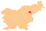
Spodnje Laže (pronounced [ˈspoːdnjɛ ˈlaːʒɛ]) is a settlement in the Municipality of Slovenske Konjice in eastern Slovenia. It lies on the left bank of the Dravinja River. The railway line from Celje to Pragersko runs through the settlement. The area is part of the traditional region of Styria. The municipality is now included in the Savinja Statistical Region.[2]
References
[edit]External links
[edit] Media related to Spodnje Laže at Wikimedia Commons
- Spodnje Laže on Geopedia


